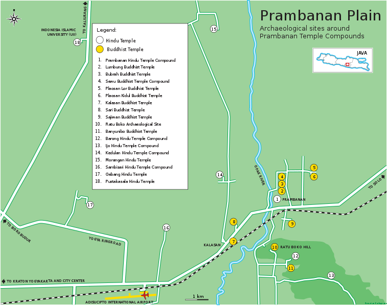
File:Prambanan Plain Map en.svg
Appearance

Size of this PNG preview of this SVG file: 757 × 599 pixels. Other resolutions: 303 × 240 pixels | 606 × 480 pixels | 970 × 768 pixels | 1,280 × 1,013 pixels | 2,560 × 2,027 pixels | 1,085 × 859 pixels.
Original file (SVG file, nominally 1,085 × 859 pixels, file size: 1.77 MB)
File history
Click on a date/time to view the file as it appeared at that time.
| Date/Time | Thumbnail | Dimensions | User | Comment | |
|---|---|---|---|---|---|
| current | 17:38, 28 September 2010 |  | 1,085 × 859 (1.77 MB) | Gunkarta | Minor text edit |
| 17:10, 28 September 2010 |  | 1,085 × 857 (1.77 MB) | Gunkarta | minor text layout edit | |
| 17:08, 28 September 2010 |  | 1,085 × 857 (1.77 MB) | Gunkarta | {{Information |Description={{en|1=The map of Prambanan Plain, the archaeological sites around Prambanan Temple Compound. Prambanan plain are filled with archaeological sites, mainly Hindu or Buddhist temples scattered in around short distance between one |
File usage
The following page uses this file:
Global file usage
The following other wikis use this file:
- Usage on cs.wikipedia.org
- Usage on en.wikipedia.org
- Usage on fr.wikipedia.org
- Usage on id.wikipedia.org
- Usage on ja.wikipedia.org
- Usage on ru.wikivoyage.org


