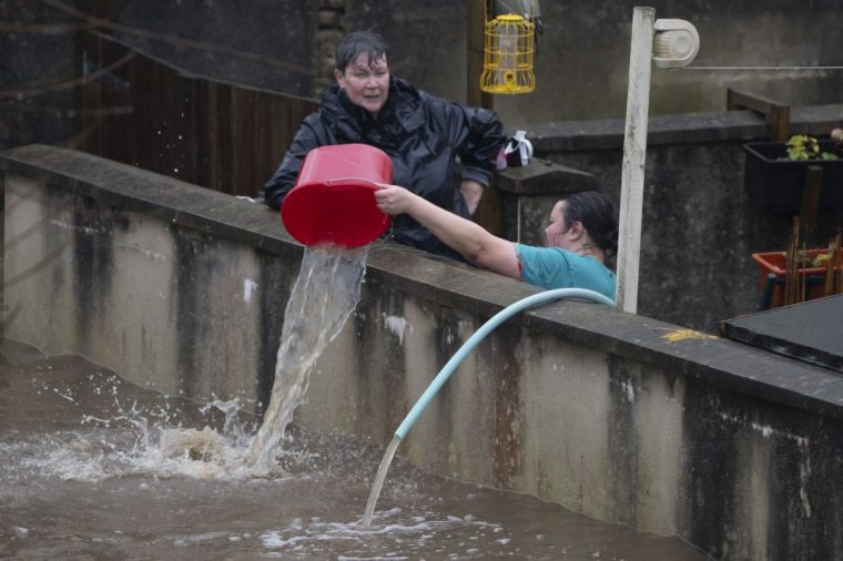
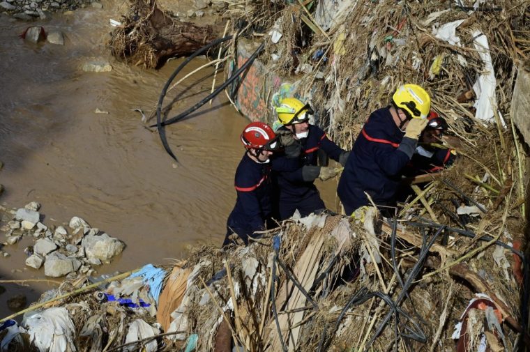
Last week Storm Bert brought mass devastation to parts of the UK. Hundreds of properties flooded and at least five people died.
As the flood waters recede, questions are being asked about how prepared the UK was for these floods.
Residents said they did not receive flood alerts until water was a foot deep in the streets, and many have criticised the Met Office for only issuing a yellow weather warning.
Experts say lessons must be learned from the storm and warn the UK is not prepared for a more extreme flooding event, like recently experienced in Spain.
Did the Met Office forecast Storm Bert incorrectly?
The Met Office issued yellow weather warnings ahead of Storm Bert, which is the least severe of the three warnings – yellow, amber and red – that it issues. An amber warning was issued for snow and ice in Scotland.
Many have questioned why more severe warnings were not issued, especially in Wales where the impacts of Storm Bert were most felt.
“I think a lot of this has come from the misinterpretation or misunderstanding of what that yellow means,” said Hannah Cloke, professor of hydrology at the University of Reading.
Professor Cloke explained a yellow warning can have multiple meanings, including “that something bad is going to happen, but it’s very uncertain” or “we’re pretty sure this is going to happen, but it’s going to have less impact”.

Storm Bert sat in the former category, meaning the Met Office said there was a chance there could be a bad storm, but the forecast was uncertain.
“The reason it was yellow was because there was uncertainty about where exactly those impacts would be and how bad they would be in the lead up to the event,” added Dr Linda Speight, a hydrometeorologist at the University of Oxford.
Dr Speight said it was a problem that the public doesn’t fully understand the Met Office warning system.
“This event will certainly show that we need to think about how we communicate those aspects and how we help people to realise that if this does happen, the impacts are going to be pretty bad,” she said.
Why did the flood warnings come late during Storm Bert?
The Environment Agency and its counterparts in Wales, Scotland and Northern Ireland are responsible for issuing alerts when a river is at risk of bursting its banks and flooding properties.
Over 170 flood warnings were issued during Storm Bert, as well as two severe flood warnings in Wales and one in Northamptonshire.
But some residents in Wales said the warnings came too late for them to act. The leader of Rhondda Cynon Taf Council said water was already one foot deep in Pontypridd, one of the worst affected areas, when warnings were issued.
David Letellier, head of south Wales central operations at Natural Resources Wales, said the agency “issued two severe flood warnings, 66 flood warnings and 65 flood alerts across Wales which went to over 46,000 properties” during Storm Bert.
He said the “limited” period between warnings being issued and the impact being experienced on the ground was due to the “rapid” response of the River Taff to “intense rainfall”.

“Our warnings are issued when flooding is expected to make sure people have advanced warning and are prepared, but we also have to strike a careful balance between issuing warnings and giving communities false alarms,” he said.
While experts agreed that the UK has some of the most advanced forecasting technology in the world, they said Storm Bert demonstrated how our warning system must still be improved.
Dr Speight explained that the rivers that flooded in Wales are examples of “quite rapidly rising rivers”, for which it is hard to determine the correct trigger point at when to issue a warning. She said a balance has to be struck between issuing warnings too late and issuing too many warnings that people become complacent.
Dr John Curtin, former CEO of the Environment Agency, said “one of the fundamental challenges with a rapidly changing climate and flood forecasting is our reliance on what happened in the past to guide our forecasting decisions in the future”.
He added: “We need to change to a situation where we don’t just rely on being better at forecasting what we’ve just experienced but really consider how climate and land use changes have and will continue to change how catchments respond.”
Is the UK prepared for an event like Valencia?
Experts agreed that one of the biggest challenges when it comes to flood preparedness is a lack of public awareness over what to do during an extreme weather event.
“It’s that imagination that something very bad can come along that I think we struggle with,” Professor Cloke said. “We’re used to it being a bit rainy and windy, but when something comes that could be catastrophic we just don’t seem to be able to imagine it”
Professor Cloke and others said the recent flooding in Spain brought home how unprepared Britons are for a similar event. Many of the 230 people who died did so while trying to move their cars to safe locations, which experts warn against doing.
“The images of so many people being in cars was really shocking to me. I was thinking: Why were those people in those cars? What went wrong? Why weren’t they warned in advance? It brings home the challenges of doing this,” Dr Speight said.
“I suspect if we’d seen that rainfall in Spain in the UK, then we’d have had similar shocking scenes that we weren’t really prepared to deal with.”
Professor Dapeng Yu, a river dynamics specialist at Loughborough University, said the UK is likely to a flood event on the scale of Valencia at some point as a result of climate change.
“It’s not a matter of whether, it is when,” he said,
He said the government will issue an alert in such a scenario. “The weakest point is the response, so whether people would take that seriously,” he said.


