Weather warnings for snow and ice have been issued across northern parts of the UK next week, as the first cold spell of the season arrives.
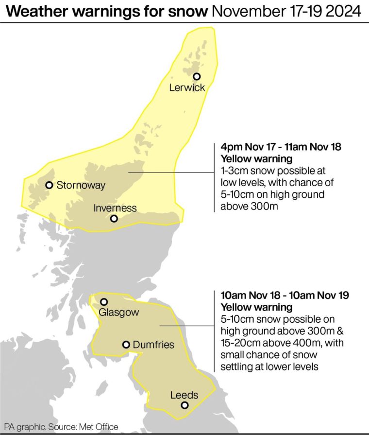
Up to 20cm (8in) of snow could fall on higher ground in parts of northern England and southern Scotland, where a yellow warning is in place on Monday and Tuesday, the Met Office said.
There is a small chance of up to 10cm (4in) of snow settling at lower levels, which could prove disruptive, the forecaster added.
The warning, in force for 24 hours from 10am on Monday, covers much of southern Scotland and north-east England, parts of Yorkshire, and some areas of the North West, including Lancashire and Cumbria.
A separate warning is in place in northern Scotland from 4pm on Sunday until 11am on Monday, where up to 10cm of snow could fall on higher ground.

The cold front comes after weeks of mild, above-average temperatures and is likely to reach all areas of the UK by the middle of next week.
Met Office spokesperson Grahame Madge said: “It’s going to get colder over the coming days – it’s still pretty mild in the south but there is a cold front that will be sinking south across northern parts of the UK.
“There’s going to be some wintriness in the hills, for example, tonight and into tomorrow.
“That’s all at quite high levels – Scottish mountains and the Lake District maybe. Then we get into our warning period for snow and ice.”
The weather could cause issues on the roads and railways, with longer journey times by road, bus and train services.
The Met Office has also warned of the possibility of icy patches on some untreated roads, pavements and cycle paths.
Mr Madge said the cold spell would still be “largely sunny”, with “clear sunny spells”.
“Technically and meteorologically, we are not in winter yet,” he added. “It’s still late autumn as for meteorologists winter begins in December – but this is the first really cold spell of the season so far.”
Forecasters say the change in the weather is a result of low pressure moving in.
Met Office deputy chief meteorologist Rebekah Hicks said: “Temperatures will drop as a northerly airflow develops, bringing in colder Arctic air.
“This introduces the possibility of snow, initially over high ground in the north from Sunday, with gusty winds also a potential hazard.”


I'm a cafe owner - this is why the £5 coffee is inevitable