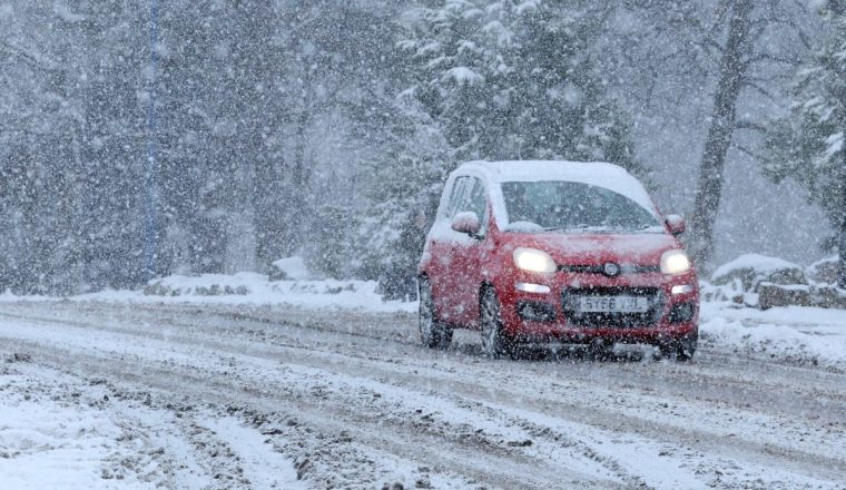
Storm Bert is heading to the UK bringing a heady mix of heavy rain, strong winds and snow for the weekend.
A deep area of low pressure will hit large parts of the country on Saturday and Sunday with weather warnings in place for snow, ice, wind and rain.
It comes after heavy snowfall have already disrupted parts of the North, the Midlands, Wales and the South West this week leading to travel chaos and school closures.
The Met Office said Storm Bert is forecast to bring “heavy rain, strong winds and disruptive snow to parts of the UK through the weekend”, with power cuts and travel disruption likely.
Dan Holley, Met Office deputy chief meteorologist, said: “Heavy snowfall is expected across parts of northern England and Scotland for a time on Saturday, especially over higher ground, and warnings are in place.”
“Heavy rain through Saturday and Sunday, especially in southern and western parts of the UK, will also bring impacts for some with a number of warnings in place.
“We expect 50-75 mm of rainfall quite widely within the warning areas, but in excess of 100 mm is possible over high ground in parts of Wales and south-west England.”
“In addition, rapid melting of lying snow over the weekend and periods of strong winds are likely to exacerbate impacts and bring the potential for travel disruption, as well as flooding for some.”

What is Storm Bert’s path?
Storm Bert is arriving from the the West, coming in from the Atlantic.
It will hit Wales, the south-west of England early on Saturday, then crossing over Northern Ireland and the north-west of England.
During the course of Saturday, it will push eastwards covering most of the UK before sweeping out into the North Sea on Sunday.
Heavy areas of rain will linger along in the south west of England throughout Sunday.
Where are weather warnings in place?
Storm Bert brings with is a slew of weather warnings for both Saturday and Sunday across the UK.
The Met Office has seven warnings in force for Saturday.
There are two yellow warning for strong winds of up to 70mph from 5am to 7pm across most of in Scotland, Northern Ireland, the North of England and North Wales.
An amber weather warning is in place for snow and ice from 7am to 5pm, with heavy snow expected to spread northeastwards on Saturday morning in Central, Tayside, Fife, Grampian, the Highlands and Western Isles and Strathclyde regions of Scotland.
There is potential for up to 40cm of snow on higher ground.
Two yellow weather warnings are in place for snow and ice, one from 4am Saturday to 9am Sunday for Scotland, the North, the Midlands, and the other covering Northern Ireland from midnight Friday to Saturday until 11am.
And there are two yellow weather warning for rain, one covering Wales and the West Midlands from 6am Saturday to 6am Sunday and the other covering London, the South East and South West and Herefordshire from 6am to just before midnight on Sunday.
On Sunday, three yellow weather warnings remain in place.
One for rain and snow covers Scotland and the North, continuing from Saturday into Sunday until around 9am. Forecasters say heavy snow on Saturday, followed by a rapid thaw and subsequent rain on Saturday night, may cause some disruption.
The two yellow weather warnings for rain from Saturday will carry into Sunday.

How long will Storm Bert last?
Storm Bert is expected to have have weakened as a system by Monday but it will still cause wet and windy conditions in the northern half of the country.
Stephen Dixon, a Met Office spokesman, told i: “The most impacts are expected on Saturday, with some heavy rain and strong winds.
“The strength of the system gradually diminishes through the weekend as it crosses northern parts of the UK, but it still retains some influence on our weather into Monday (though less significant!).”
The unsettled weather is likely to continue into the start of next week, with strong winds and some showers for many parts.
Temperatures will be around average for most places by the start of the week but strong winds mean it will feel rather cold.
And forecasters have warned that looking further ahead there are indications we could see a brief return to colder conditions with wintry showers for a time, especially in the North, before it becomes unsettled and milder again at then end of next week.

