Exactly where snow will fall on New Year's Eve as Met Office issues yellow warning
For parts of the UK, this year will see a white New Year's Eve, but the North of the country may be getting more than they bargained for, with significant disruption and danger expected
The Met Office have issued a 'danger to life' warning ahead of snow set to fall on New Year's Eve.
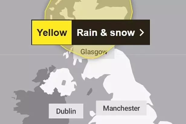
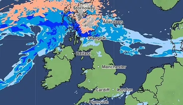
The North of the UK will see a blanket of snow just in time for a White Christmas, but it comes at a cost. A yellow weather warning has been issued for heavy rain and snow in the north-west of Scotland.
A large area covering the Highlands down to Glasgow may experience "significant disruption", including flooding, damage to buildings, and power cuts. The yellow weather warning is in place from midnight on Monday 30th January, to midnight on Wednesday 1.
READ MORE: Plane carrying 181 explodes in airport fireball as all bar two presumed dead after smashing into wallREAD MORE: Prince Harry backed mental health firm slammed by workers as 'toxic train wreck’The Met Office 's Chief Forecaster, Neil Armstrong, said: "From Sunday we will start to see some heavy rain affecting North-western parts of Scotland.
"After a brief respite, further rain and strong winds will be in place on Monday and Tuesday across Scotland, as another area of low-pressure approaches.
"This may be accompanied by some heavy snowfall in the mountains and perhaps to lower elevations." Deputy Chief Meteorologist Tony Wisson also added: “Later in the week, wintry showers are likely to be a feature of the forecast as a cold northerly flow becomes established.”
The rest of the UK may also be hit with disruptive weather, as there's a chance rain and snow could move south. Wind is also hitting parts of the nation, with a yellow warning in place for a blustery Newcastle upon Tyne.
Allendale, Alston, Stanhope, Barnard Castle, Kirkby Stephen, Hawes, Leyburn and Pateley Bridge are all expected to be affected on Monday. Strong gusts could reach between 50 and 60mph on higher ground.
According to the Beaufort Wind Scale, winds at this speed can see: "Whole trees in motion; inconvenience felt when walking against the wind. Foam blown in streaks across the sea."
The Chief Forecaster has urged the British public to stay on top of the turbulent weather, commenting : “with such varied and potentially fast-moving weather conditions it is important for people to keep up to date with the forecast.”
For the latest breaking news and stories from across the globe from the Daily Star, sign up for our newsletters


