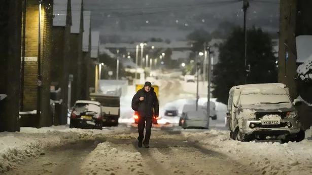
More snow warnings have been issued across six more areas of the UK, as the Met Office shared concerns it could cause icy roads.
Significant snowfall has already disrupted today as commuters head back to the office and schools return following Christmas and New Year break. A number of train services being hit with delays and cancellations , and a slew of A-roads confirmed as closed due to snow, flooding, or crashes.
Weather warnings are in place in 12 specific areas of the UK. These are East England, Southwest England, North West England, London and the Southeast, the West Midlands, and Wales, Grampian Highlands & Eilean Siar, Orkney & Shetland, Lothian Borders and Northern Ireland.
Met Office deputy chief forecaster Mike Silverstone, said: “The low pressure that brought the snow and heavy rain in the south will move out to the east by Monday. This will allow a cold northerly flow to become established again for much of next week.
“This will bring further sleet, snow and hail showers to northern Scotland in particular, but possibly to some other areas, especially near western coasts, with a fair amount of dry and bright weather elsewhere. Temperatures will remain below average, with widespread frost and the threat of ice at times.
“Some areas, especially in the north, may struggle to get above freezing for several days.
"There is also the potential for some snow in southern and maybe central parts of England and Wales around the middle of the week, as a system brushes the south, bumping into the cold air.
“This is however still uncertain, and we’ll continue to assess this over the coming days. Further weather warnings could be issued through next week, so do stay up to date with the forecast.”
The weather warnings are set to continue Tuesday as new snow and ice warnings have been issued - starting today at 3pm - in Northern Ireland, Scotland, Wales and south-western England. Wednesday also promises to be problematic for those living in the south where as much as 10cm could fall. People have been told power cuts may happen and drivers should prepare for breakdowns.
The latest warning for tomorrow reads: “Snow showers will continue for the rest of Monday and into Tuesday morning bringing further accumulations of 2 to 5 cm in places, and 5 to 10 cm above 200 metres across northern Scotland. Showers will initially fall as rain or sleet at lower levels this evening, and across the Northern Isles at times throughout, leading to a risk of icy stretches.”
