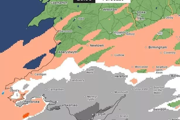
Wales is set to see more snow over the coming days, with the possibility that one day next week will see more snowfall than what we’ve just witnessed on Saturday night and Sunday morning, Met Office maps suggest.
There are three weather warnings in force as of Sunday morning, all issued by the Met Office. A yellow warning for snow and ice has been in place for most of Wales between 12pm on Saturday which lasts until midnight on Sunday.
An amber warning for snow and ice has also been in force since 6pm on Saturday and will remain in place until midday on Sunday. There is also a yellow warning for rain currently in force until 9pm on Sunday. For the latest Welsh news delivered to your inbox sign up to our newsletter.


Most of the snow that fell on Saturday evening and overnight into Sunday will be washed away throughout the day, but according to the Met Office maps, more is on the way. Looking at the precipitation maps that the forecaster publishes, rain is expected to fall across most of Wales throughout Sunday. You can see the best snow pictures from around Wales here.
The maps for Monday show sporadic snowfall in parts of Wales including Merthyr Tydfil and north Carmarthenshire and south Ceredigion. It will become more widespread as the afternoon progresses, with snow expected in the Newtown area and in the north of the country. Monday night and into Tuesday morning are predicted to see more snow, before things become calmer for most later on Tuesday. Update Monday, Jan 6: The Met Office has now significantly updated its forecast.


However, according to the maps, most of south Wales could see heavy snow by Wednesday afternoon. The area covered on the map includes Pembrokeshire, Carmarthenshire, Swansea, Cardiff and the vast majority of the south of the country. This snow is shown continuing throughout Wednesday afternoon and into Wednesday evening, eventually clearing in the west of the country but continuing to fall in the east.
Keep up to date with the latest weather where you live:


