
File:Marseille land cover location map.jpg

Size of this preview: 606 × 599 pixels. Other resolutions: 243 × 240 pixels | 621 × 614 pixels.
Original file (621 × 614 pixels, file size: 233 KB, MIME type: image/jpeg)
Captions
Captions
Add a one-line explanation of what this file represents
Summary
[edit]
| Description |
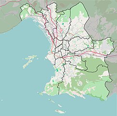
Français : Carte de la ville de Marseille. Coordonnées des bords de carte :
|
| Date | |
| Source | Own work from OpenStreetMap © les contributeurs d’OpenStreetMap |
| Author | Superbenjamin |
Licensing
[edit]
I, the copyright holder of this work, hereby publish it under the following license:
This file is licensed under the Creative Commons Attribution-Share Alike 4.0 International license.
- You are free:
- to share – to copy, distribute and transmit the work
- to remix – to adapt the work
- Under the following conditions:
- attribution – You must give appropriate credit, provide a link to the license, and indicate if changes were made. You may do so in any reasonable manner, but not in any way that suggests the licensor endorses you or your use.
- share alike – If you remix, transform, or build upon the material, you must distribute your contributions under the same or compatible license as the original.
File history
Click on a date/time to view the file as it appeared at that time.
| Date/Time | Thumbnail | Dimensions | User | Comment | |
|---|---|---|---|---|---|
| current | 18:30, 15 February 2016 | | 621 × 614 (233 KB) | Superbenjamin (talk | contribs) | User created page with UploadWizard |
You cannot overwrite this file.
File usage on Commons
There are no pages that use this file.
File usage on other wikis
The following other wikis use this file:
- Usage on es.wikipedia.org
- Usage on fr.wikipedia.org
- École supérieure d'ingénieurs de Luminy
- Calanque de Sugiton
- Cap Croisette
- Îles du Frioul
- Île de Planier
- Hôpital Saint-Joseph (Marseille)
- Les Catalans
- Château de la Buzine
- Château d'If
- Ratonneau
- Place Castellane
- Sainte-Marguerite (Marseille)
- Sainte-Anne (Marseille)
- Saint-Charles (Marseille)
- Opéra (quartier de Marseille)
- Le Pharo
- Hôpital d'instruction des armées Laveran
- Lycée Périer
- Les Accates
- Belsunce (Marseille)
- Noailles (Marseille)
- Les Goudes
- Chapitre (Marseille)
- Place Jean-Jaurès (Marseille)
- Place de Lenche
- Cours Saint-Louis
- Couvent des Bernardines de Marseille
- L'Estaque
- Boulevard Françoise-Duparc
- Canebière
- Boulevard Édouard-Herriot
- Conservatoire Pierre-Barbizet de Marseille
- Cours Belsunce
- Cours Jean-Ballard
- La Joliette
- Belle de Mai
- Teste de More
- Château Pastré
- Île Jarre
- Cours Joseph-Thierry
- Boulevard des Dames
- Le Rouet
- Rue de la République (Marseille)
- La Treille
- Château Borély
- Endoume
- Église Notre-Dame-des-Accoules de Marseille
- Boulevard Latil
- Assassinat d'Alexandre Ier de Yougoslavie
View more global usage of this file.