A cold weather alert issued by the UK Health Security Agency (UKHSA) is to last all week as almost 250 flood warnings still remain in place across England and Wales.
The UK Health Security Agency (UKHSA) has issued a ‘yellow’ warning to due forecasts of a prolonged period of freezing temperatures starting from Saturday.
The mercury dipped as low as -4°C in some places overnight and the Met Office said “settled” conditions will mean the cold snap will continue for several days.
The UKHSA warning says it expects “an increase in mortality across the population, particularly in the 65+ age group or those with certain underlying health conditions” as well as increased demand for remote health care.
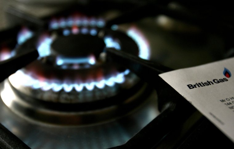
With energy bills set to increase by 5 per cent from January, the UKSHA added that “maintaining indoor temperatures at the recommended 18 degrees may become challenging for some, leading to increased risk of vulnerable people.”

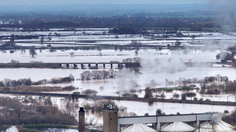
Although there will be less heavy rainfall than of late, water levels remain high and the Environment Agency had 244 flood warnings, where flooding is expected, in place across England on Saturday – down from more than 300 on Friday morning.
Natural Resources Wales has warnings in place on the River Wye at Monmouth and the River Ritec at Tenby.
There were a further 262 flood alerts, where flooding is possible, in place across England and nine in Wales.
Data from the Environment Agency showed almost every river in England has reached exceptionally high levels with some reaching record levels.
Heavy rain in Cambridgeshire meant rail replacement buses, in use due to flooding on the line, were unable to reach St Neots and Huntingdon railway stations for a spell overnight.
Network Rail said it was working to repair damage caused by a landslip near Arlesey in Bedfordshire on Thursday, along with planned engineering works. They estimate affected lines will reopen by the start of Monday with a bus replacement service in place until then.
Great Western Railway said it had suffered “significant disruption” to its services after flooding near Chipping Sodbury and the line between Swindon and Bristol Parkway is expected to remain closed through the weekend.
The line between Theale and Taunton is likely to remain closed on Saturday with services continuing on alternative routes.
South Western Railway, which saw much of its network affected on Friday including a landslip in Crewkerne, Somerset, said there was a “good service” on Saturday.
Roads have been closed in and around Gloucester due to flooding and Gloucestershire police said a taxi driver had been reported for traffic offences on Friday night when he needed rescuing after becoming stuck when he attempted to drive through floodwater.
The Environment Agency said the River Severn was expected to have reached its peak at Gloucester Docks, and further upstream in Worcester, on Friday evening.
A slip road onto the A419 near Cirencester was closed on Saturday morning due to flooding, according to National Highways.

In Sheffield, firefighters were called to rescue a man who fell into the swollen River Don.
The Environment Agency said “significant river flooding impacts” were expected on Saturday across parts of the Midlands on the River Trent and in Gloucester.
It said areas of the South West on the River Avon would also be affected, adding that impacts are likely across much of England over the next five days because the ground is “completely saturated”.
Caroline Douglass, the agency’s flood director, said the Trent has been at “some of the highest levels we’ve seen in 24 years”. Nottinghamshire County Council declared a major incident on Thursday due to the rising levels.
The Met Office predicted Saturday would bring a dry day to most areas with some sunny spells, although with a few showers along the coast and feeling cold with frost and fog patches overnight.
It said temperatures will drop to -4°C in parts of rural south-west England on Saturday night and -6°C in rural areas along the Welsh border in Shropshire and north Herefordshire on Sunday night.
Sunday is forecast to remain largely dry, except for the occasional shower in southeast England early in the day, with the cold weather continuing for much of the next week.
The UKHSA has issued a yellow cold weather alert for the vulnerable and elderly from 9am on Saturday until noon on January 12 with temperatures likely to be a few degrees below average across much of the UK, especially overnight, with ice an issue on wet ground.
Met Office chief forecaster Jason Kelly said: “As the prevailing weather conditions will be characterised by high pressure, a good deal of settled weather is likely.
“Clearer skies and a marked reduction in precipitation are expected, although any showers that do occur are likely to be wintry in nature.”
Prime Minister Rishi Sunak insisted people should be “reassured” by the response to flooding, but Labour accused the Government of being “asleep at the wheel” over flood warnings with leader Sir Keir Starmer vowing to make flood defences “fit for purpose”, writing on social media that “people’s lives shouldn’t be upended by extreme rain”.
Liberal Democrat spokeswoman for housing and communities Helen Morgan called on Mr Sunak to visit affected areas, saying: “The Prime Minister should see for himself the devastation caused by these floods.”


