Last Updated on November 18, 2024 by Admin
Site surveys are essential to the success of any construction project. They provide precise, reliable data about a location, which forms the foundation for planning, designing, and executing projects. Whether you’re laying the groundwork for a skyscraper, a road, or a residential property, a thorough site survey ensures that your project starts on solid ground.
This comprehensive guide delves into the tools, techniques, and best practices for conducting effective site surveys. With detailed insights and actionable steps, this blog is a valuable resource for students, engineers, and construction and real estate professionals.
Table of Contents
What is a Site Survey?
A site survey involves systematically collecting data about a location’s topography, soil conditions, existing infrastructure, and environmental factors. This information is used to:
- Assess the site’s suitability for a project.
- Ensure legal compliance with zoning laws and building codes.
- Prevent costly mistakes during construction.
Site surveys typically include measurements, observations, and analyses of physical and environmental conditions, giving architects, engineers, and contractors the data needed to design projects confidently.
Why Are Site Surveys Important?
1. Accurate Planning
Accurate site surveys provide essential data for creating precise blueprints and designs, minimizing errors during construction.
2. Regulatory Compliance
Many local and national regulations require detailed site surveys to ensure safety and environmental standards adherence.
3. Cost Savings
By identifying potential challenges early—such as poor soil conditions or underground utilities—site surveys help avoid costly delays and design changes.
4. Enhanced Safety
Comprehensive surveys identify hazards such as unstable ground or flood zones, reducing risks for construction teams and future occupants.
Types of Site Surveys
Site surveys vary depending on the project’s nature and requirements. Below are the most common types:
1. Topographic Surveys
- Purpose: Measure land elevations and contours.
- Applications: Road construction, landscaping, and site grading.
- Tools Used: Total stations, GPS devices, drones.
2. Boundary Surveys
- Purpose: Define legal property lines.
- Applications: Property sales, legal disputes, and compliance with zoning laws.
- Tools Used: Theodolites, measuring tape, GPS.
3. Geotechnical Surveys
- Purpose: Assess soil and rock conditions to determine load-bearing capacity.
- Applications: Foundation design, excavation planning.
- Tools Used: Soil sampling equipment, borehole drills.
4. Environmental Surveys
- Purpose: Identify environmental constraints, such as wetlands or endangered species.
- Applications: Compliance with environmental regulations.
- Tools Used: GIS software, drones, sensors.
5. Utility Surveys
- Purpose: Map underground utilities like water pipes, gas lines, and electrical conduits.
- Applications: Urban development, road construction.
- Tools Used: Ground-penetrating radar (GPR), electromagnetic locators.
6. Structural Surveys
- Purpose: Evaluate the condition of existing buildings or infrastructure.
- Applications: Renovations, retrofitting, and demolition.
- Tools Used: Laser scanners, infrared cameras.
Key Tools for Site Surveys
Traditional Tools
- Measuring Tape
- Best for small-scale, quick measurements.
2. Theodolites
- Measure horizontal and vertical angles with precision.
3. Plumb Bobs
- Ensure vertical alignment.
Modern Equipment
- Total Stations
- Combine electronic distance measurement (EDM) with angle measurement.
- Global Positioning System (GPS) Devices
- Provide accurate geographic coordinates for large-scale projects.
- Drones
- Capture high-resolution aerial data efficiently.
- Laser Scanners
- Generate precise 3D models of the site.
Software Tools
1. AutoCAD Civil 3D
- For topographic mapping and site design.
2. Geographic Information Systems (GIS)
- Analyzes spatial data for environmental and topographic insights.
3. Building Information Modeling (BIM) Software
- Integrates survey data into a unified construction model.
Illustration: Advanced Site Survey Equipment
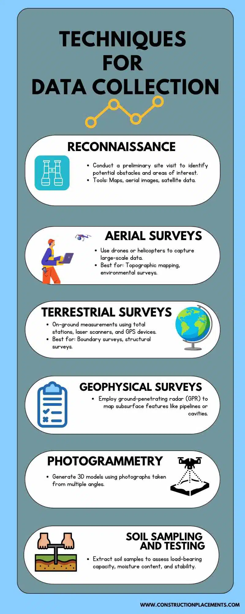
Techniques for Data Collection
Effective data collection ensures the accuracy and reliability of survey results. Below are the primary techniques used:
1. Reconnaissance
- Conduct a preliminary site visit to identify potential obstacles and areas of interest.
- Tools: Maps, aerial images, satellite data.
2. Aerial Surveys
- Use drones or helicopters to capture large-scale data.
- Best for: Topographic mapping and environmental surveys.
3. Terrestrial Surveys
- On-ground measurements using total stations, laser scanners, and GPS devices.
- Best for boundary surveys and structural surveys.
4. Geophysical Surveys
- Employ ground-penetrating radar (GPR) to map subsurface features like pipelines or cavities.
5. Photogrammetry
- Generate 3D models using photographs taken from multiple angles.
6. Soil Sampling and Testing
- Extract soil samples to assess load-bearing capacity, moisture content, and stability.

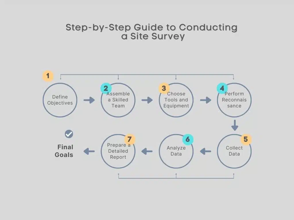
Step-by-Step Guide to Conducting a Site Survey
Step 1: Define Objectives
- Clearly outline the purpose of the survey (e.g., boundary mapping, environmental assessment).
Step 2: Assemble a Skilled Team
- Include surveyors, engineers, environmental scientists, and technicians.
Step 3: Choose Tools and Equipment
- Select tools appropriate for the type and scale of the survey.
Step 4: Perform Reconnaissance
- Identify potential hazards, access points, and key areas for data collection.
Step 5: Collect Data
- To gather comprehensive data, utilize tools like total stations, drones, and GPR.
Step 6: Analyze Data
- Software such as AutoCAD Civil 3D or GIS can be used for accurate data processing.
Step 7: Prepare a Detailed Report
- Include maps, 3D models, environmental assessments, and key recommendations.
Illustration: Workflow of a Site Survey

Best Practices for Site Surveys
1. Thorough Preparation
- Review historical data, maps, and previous surveys before beginning.
2. Safety Measures
- Use personal protective equipment (PPE) and adhere to safety protocols.
3. Cross-Verification
- Validate data using multiple tools and techniques.
4. Detailed Documentation
- Record all observations, measurements, and metadata during the survey.
5. Stakeholder Collaboration
- Communicate findings with architects, engineers, and regulatory authorities.
Common Challenges and Solutions
1. Inaccessible Terrain
- Solution: Deploy drones or remote sensing technologies.
2. Weather Constraints
- Solution: Schedule surveys during favorable weather and use weather-resistant equipment.
3. Equipment Malfunctions
- Solution: Regularly maintain and calibrate tools, and keep backup equipment on hand.
4. Data Overload
- Solution: Utilize advanced software to process and filter relevant data.
Advanced Trends in Site Surveys
The construction industry continues to innovate with advanced technologies that enhance survey accuracy and efficiency. Key trends include:
1. Integration with BIM
- Building Information Modeling (BIM) combines survey data with project models for seamless collaboration.
2. AI and Machine Learning
- Algorithms analyze survey data to identify patterns and predict challenges.
3. LiDAR Technology
- Light Detection and Ranging (LiDAR) provides highly accurate 3D mapping.
4. Cloud-Based Collaboration
- Real-time data sharing via cloud platforms improves coordination across teams.
Final Thoughts
Site surveys are the backbone of successful construction and real estate projects. Professionals can ensure precise data collection and analysis by leveraging the right tools, techniques, and best practices. Whether you’re a novice or an expert, following the insights in this guide will empower you to conduct site surveys confidently and efficiently. For further guidance and resources on construction technologies and techniques, explore the Technical Resources section.
For further insights into advanced surveying technologies, explore resources like National Society of Professional Surveyors for industry standards, American Surveyor Magazine for the latest trends, and Trimble for modern surveying equipment. To understand geotechnical aspects, visit Geoengineer.org, while the Esri GIS Blog provides valuable insights into geographic information systems in surveying.
Related Posts:


