|
|


|
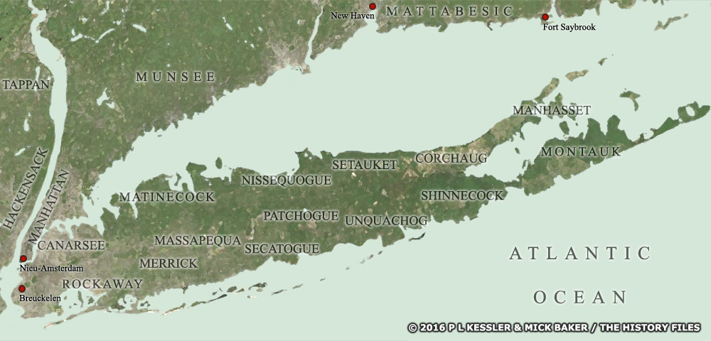
Map of Long Island c.AD 1600 |
|
A map showing the approximate location of each of the Metoac tribes which inhabited Long Island when the Europeans arrived, by which time they acknowledged a single sachem of the Montauk. A clickable version of this map is available for desktop displays. To select a tribe for further information, click on its name.
Map navigation: |
|
Original text and maps copyright © P L Kessler, Mick Baker, and the History Files. An original feature for the History Files. Go back or return home. |