|
|


|
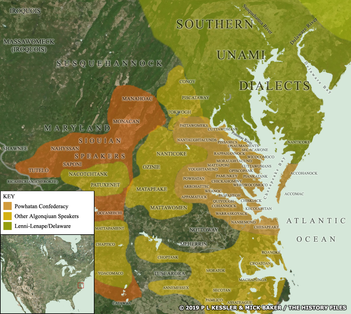
Map of the Powhatan confederacy AD 1600-1700 |
|
The Powhatan confederacy was formed towards the end of the sixteenth century, and under its second paramount chief it rapidly expanded to cover territory which is now divided between the states of Delaware (to the east of the peninsula) and Maryland (to its west). Note: The whereabouts of many of these tribes and sub-tribes was extremely fluid, as they migrated, forged new alliances and/or were assimilated into new groupings with alarming frequency. Shown here is a snapshot of a period - probably at the beginning of the 1600s, but there may be certain placements more in keeping with the early 1700s. A clickable version of this map is available for desktop displays. To select a tribe for further information, click on its name.
Map navigation: |
|
Original text and maps copyright © P L Kessler, Mick Baker, and the History Files. An original feature for the History Files. Go back or return home. |