Summer may have finally arrived in parts of the UK this weekend with some warm, dry and sunny weather heading this way.
Temperatures are set to soar as a spell of settled weather arrives, pushing the mercury up to 27°C in places by Sunday and bringing the potential for heatwave conditions later in the week.
Parts of London, the South East and East Anglia will enjoy dry and fine weather on Saturday, reaching 24°C in some areas, but there will be showers for southern Scotland, Northern Ireland, Wales and north-east England.
Met Office forecaster Alex Deakin said: “Sunday is a cracking day if you like it dry, warm and sunny. We haven’t had too many days like that so far throughout this summer.”
However, Saturday is expected to see some showers across the country with the possibility of them turning thundery in places.
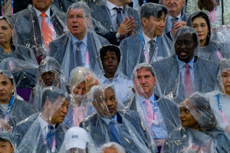
After the downpour at the Olympic opening ceremony across the Channel in Paris on Friday night, rain is also set to mar the start of the weekend here.

Mr Deakin said: “Today there will be some sunshine but there will also be a fair few showers, starting off quite wet over parts of North West England and Southern Scotland.
“Through the day, we will see showers developing particularly over parts of Wales and North East England.
“Some heavy downpours are likely this morning, parts of the M6 will not be very pleasant with a lot of spray and surface water around.
“Some heavier showers developing through the morning especially over Wales and the Midlands.
“Not as many showers today, compared to yesterday, for Scotland and Northern Ireland, not many again for East Anglia and the South East. Most places here will stay dry and fine.
“Where we do see those showers, they could be heavy and could even turn into thunderstorms in places and it will bring a slightly cooler day as well.”
Temperatures for much of the country will hover around 19/20°C on Saturday, Scotland could reach 21°C and parts of East Anglia and the South East could get up to 23/24°C.
Then Sunday will bring the promise of “lots of sunshine” and a rise in temperatures, with temperatures in and around London area possibly reaching 26/27°C. It will be a little cooler on the coast.
UV and pollen levels are expect to be high on Sunday.
And looking ahead into next week, forecasters have warned there is the possibility of temperatures creeping into heatwave territory.
David Hayter, the Met Office’s deputy chief meteorologist, said: “As we go through the weekend, the jet stream will weaken to the west of the UK, generating an area of high pressure that will slowly move in across the UK.
“High pressure means the air is sinking from higher in the atmosphere and that brings drier, settled and sunnier weather.
“Temperatures will rise too, becoming widely above average.”
Forecasters say the hot weather is due to the fact that “days are longer at this time of year” and when it’s a sunny day “temperatures build because the land retains more heat than it loses by night”.
More humid air from France is also expected to arrive by around Wednesday.
“Temperatures will be above average”, said Met Office meteorologist Tom Morgan, “but if you do live in the South East we could see it turn hot and heatwave criteria could be met in some parts of the UK.”
UK heatwave criteria are met when a location records a period of at least three consecutive days with daily maximum temperatures meeting or exceeding the heatwave temperature threshold.
Conditions are looking to turn increasingly warm, or even hot, in central, southern and eastern areas early next week and it is possible some places may reach heatwave criteria.
But it is uncertain how long this warmer weather will last, with a possibility it could breakdown from mid-week.


