It hasn’t been long since the UK experienced the coldest night of the winter so far – but thankfully, temperatures are on the up.
Temperatures dropped to as low as -18°C overnight this weekend, following days of snowfall, icy conditions, and flooding caused by the rapid thaw.
We’ve faced several weather warnings from the Met Office, including a couple of more serious amber warnings, thanks to the ongoing snow and rain.
Schools have been forced to close amid the poor weather conditions, and the increased demand for heating has caused gas supplies to plummet.
But thankfully, temperatures are set to increase again in the next few days.
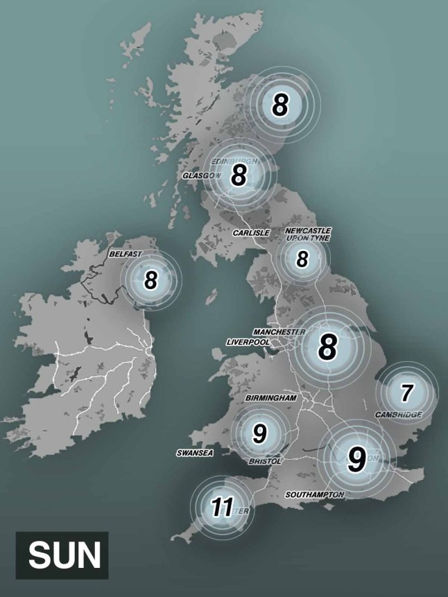
The Met Office’s long-range forecast for Sunday, January 19, is showing double figures in the south west of England, with 11°C predicted in Cornwall thanks to high pressure in the south.

The forecast, covering Thursday, January 16 until the 25th, says: ‘High pressure will lie close to the south of the UK initially, with generally settled conditions prevailing across the south.
More Trending
‘Cloud amounts will be variable but often large, with some fog developing under clearer spells, this slow to clear.
‘Frontal systems may affect the northwest of the UK at times, bringing some rain and windier conditions here.
‘High pressure and associated settled conditions may extend further north for a time, before low pressure seems likely to increasingly influence the UK weather late in the period, with some rain and windier conditions extending to most parts.
‘Temperatures are likely to be generally a little above average, especially in the north, though the south and east may have some rather cold starts under clearer skies and lighter winds.’
Get in touch with our news team by emailing us at webnews@metro.co.uk.
For more stories like this, check our news page.
MORE: Which football games have been called off due to extreme cold weather? FA Cup, League One and more
MORE: Parents warned of innocent mistake during cold snap that could cost child’s life


