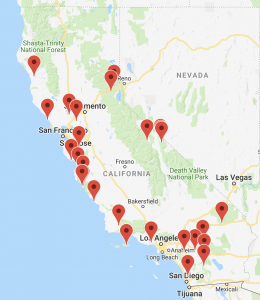
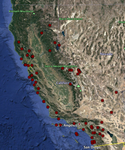
Latitude Longitude Information about each reserve
These point represent the location of the main facility on the reserve property.
| RESERVE NAME | Degree Minute Seconds | Weather Station | Topo |
| Angelo Coast Range Reserve | longitude -123.6444127989865 latitude 39.73065195908107 | 39.739167°, -123.630833° Elevation: 383.7 m | |
| Año Nuevo Island Reserve | longitude -122.3371298896907 latitude 37.10872232003363 | ||
| Blue Oak Ranch Reserve | longitude -121.7370767376033 latitude 37.38140578957226 | 37.381666°, -121.73638° Elevation: 574.5 m | |
| Bodega Marine Reserve | longitude -123.0714205586833 latitude 38.31817307290498 | 38.31388°, -123.0602° Elevation: 30.5 m | |
| Boyd Deep Canyon Desert Research Center | longitude -116.3751655710139 latitude 33.64764711145702 | 33.64805°, -116.37833° | |
| Box Springs Reserve* | longitude -117.2978199517237 latitude 33.96964520479203 | ||
| Burns Piñon Ridge Reserve | longitude -116.4531976482931 latitude 34.14891346851683 | 34.14805°, -116.4558° Elevation: 1243.9 m | |
| Carpinteria Salt Marsh Reserve | longitude -119.5340485710533 latitude 34.40050116514019 | ||
| Chickering American River Reserve* | longitude -120.324169817359 latitude 39.24752199522912 | 39.24583°, -120.36308° Elevation: 1807.5 m | |
| Coal Oil Point Natural Reserve | longitude -119.8784070986517 latitude 34.40812862771187 | ||
| Dawson Los Monos Canyon Reserve | longitude -117.2483318844264 latitude 33.14854357087403 | ||
| Elliott Chaparral Reserve | longitude -117.0951599208908 latitude 32.88899440061782 | 32.89166°, -117.09222° Elevation: 237.7 m | |
| Emerson Oaks Reserve | longitude -117.0416374844805 latitude 33.46620245496689 | ||
| Fort Ord Natural Reserve | longitude -121.7783877465855 latitude 36.67896697911283 | 36.666667°, -121.766667° Elevation: 30 m | |
| Hastings Natural History Reservation | longitude -121.5494863188234 latitude 36.38726368523841 | 36.38638°, -121.55027° Elevation: 546.2 m | |
| James San Jacinto Mountains Reserve | longitude -116.7742446002677 latitude 33.80898125267718 | 33.80944°, -116.7752° Elevation: 1649 m | |
| Oasis de los Osos (satellite site of James Reserve) | Latitude: 33.89088915458146 Longitude: -116.6960476484119 | ||
| Jepson Prairie Reserve | longitude -121.8232284178634 latitude 38.27433162017629 | 38.2679°, -121.8278° Elevation: 6.1 m | |
| Kendall-Frost Mission Bay Marsh Reserve | longitude -117.2286531694641 latitude 32.79349147093718 | ||
| Landels-Hill Big Creek Reserve | longitude -121.5950514628809 latitude 36.07330543088451 | 36.070833°, -121.598611° Elevation: 27.4 m 36.06611°, -121.5611° Elevation: 752.9 m 36.07222°, -121.5969° Elevation: 124.1 m | |
| Merced Vernal Pools | longitude -120.350993961017 latitude 37.40879089936578 | ||
| McLaughlin Natural Reserve | longitude -122.4155312278953 | ||
| Motte Rimrock Reserve | longitude -117.2595973667193 latitude 33.80390206528959 | 33.80472°, -117.2555° Elevation: 579.4 m | |
| Oasis de Los Osos Reserve | longitude -116.6960476484119 latitude 33.89088915458146 | ||
| Kenneth S. Norris Rancho Marino Reserve | longitude -121.0803620296637 latitude 35.53237062513189 | 35.53416°, -121.08333° Elevation: 18.3 m | |
| Hans Jenny Pygmy Forest Reserve | longitude -123.7637406202639 latitude 39.28616671958865 | ||
| Quail Ridge Reserve | longitude -122.1493573890673 latitude 38.48307731849088 | 38.483056°, -122.149522° Elevation: 310 m | |
| Sagehen Creek Field Station | longitude -120.241348 latitude 39.432056 | 39.4325°, -120.236944° Elevation: 1931.5 m | |
| San Joaquin Freshwater Marsh Reserve | longitude -117.8525563405328 latitude 33.65747393447313 | ||
| Santa Cruz Island Reserve | longitude -119.7137863515798 latitude 33.99480909994762 | 33.995943°, -119.716437° Elevation: 62.8 m | |
| Sedgwick Reserve | longitude -120.0405974905649 latitude 34.69259393264591 | 34.69388°, -120.0416° Elevation: 351.7 m | |
| Scripps Coastal Reserve | longitude -117.249148886714 latitude 32.87525321132196 | ||
| Steele/Burnand Anza-Borrego Desert Research Center | longitude -116.388844919326 latitude 33.24041102965545 | 33.2574°, -116.4073° Elevation: 249.9 m | |
| Stebbins Cold Canyon Reserve | longitude -122.1020050274035 latitude 38.49648404801051 | ||
| Stunt Ranch Santa Monica Mountains Reserve | longitude -118.6566183695037 latitude 34.09418148487285 | 34.09472°, -118.6566° Elevation: 397.8 m | |
| Sweeney Granite Mountains Desert Research Center | longitude -115.6533656363205 latitude 34.78097832871511 | 34.78222°, -115.653° Elevation: 1304.2 m | |
| Sacramento Mountains (satellite site of Sweeney Granite Mountains Reserve) | longitude: -114.750866 latitude: 34.775013 | ||
| Valentine Eastern Sierra Reserve / SNARL | longitude -118.8318145908631 latitude 37.6130030353029 | 37.61361°, -118.83305° Elevation: 2159.5 m | |
| Valentine Eastern Sierra Reserve / Valentine Camp | longitude -118.9953291176471 latitude 37.62977746126052 | ||
| White Mountain Research Center | longitude -118.3263447664719 latitude 37.3600979790518 | 37.58305°, -118.23722° Elevation: 3782.6 m 37.54305°, -118.20444° Elevation: 3094 m 37.63416°, -118.2533° Elevation: 4342.2 m | |
| Younger Lagoon Reserve | longitude -122.0662052492452 latitude 36.952953792901 | 36.948889°, -122.066389° Elevation: 10.7 m | |
| Yosemite Field Station (SNR Office) | longitude -119.6559819288639 latitude 37.53962281828129 | ||
| Associated Field Stations | |||
| Sequoia & Kings Canyon | longitude -118.6710886527553 | ||
| UCSC Campus Reserve | longitude -122.0673064999999 | ||
| UC Irvine Ecological Preserve | longitude -117.8404038168675 | ||
| Lassen Reserve |
|
| |
| Point Reyes Field Station | longitude -122.921906 |
| |
| Tejon Ranch |
|
| |
|  |
| |
Converting Latitude-Longitude Notations to Themselves
Some tables and internet sites return latitude and longitude in the notations below, and there might be a need to convert from one to the other, here’s how. There’re 60 minutes in a degree, and 60 seconds in a minute, therefore 60 is the mulipiler or divisor, to convert any notations.
Convert DD.DDDD to DD.MM.SS
A position in whole degrees and a fractional part of degrees, conversion of it to degrees, minutes and seconds
Example using a Latitude DD.DDDD=48.5020N
Multiply the FRACTIONAL part by 60 to get MINUTES and FRACTIONAL MINUTES: .5020 x 60=30.12
Next, multiply the FRACTIONAL MINUTES by 60 obtains the SECONDS: .12 x 60=7.2″
Therefore: 48.5020= 48 30′ 7.2″ DD MM SS
Do the same for a Longitude.
Convert DD.MM.SS to DD.DDD
A position in degrees, minutes, seconds, conversion of it to degrees and fractions of a degree.
Example using a Latitude DD MM SS=48 30′ 7.2″N
Divide the SECONDS by 60, to get DECIMAL SECONDS: 7.2 / 60=.12
Next, divide the WHOLE MINUTES and DECIMAL SECONDS by 60 obtains the fractional part of degrees: 30.12 / 60=0.5020
Therefore: 48 30′ 7.2″= 48.5020 DD.DDDD
Do the same for a Longitude.

