West, Ian M. 2016. The Fossil Forest Exposure, Part 1 - Introduction; Geology of the Wessex Coast, field guide. Internet site: wessexcoastgeology.soton.ac.uk/Fossil-Forest.htm. UK. Version: 4th December 2016
 .
.
This is:
THE FOSSIL FOREST: PART 1: THE GEOLOGY OF THE LEDGE.
For Purbeck Trees - go to:
THE FOSSIL FOREST: PART 2: PURBECK FOSSIL TREES.
by: Ian West
Romsey, Hampshire,
and Visiting Scientist at:
Faculty of Natural and Environmental Sciences
Southampton University
Website hosted by courtesy of iSolutions, Southampton University
Aerial photographs by courtesy of The Channel Coastal Observatory , Southampton.
Website archived at the
British Library
Click here for the full LIST OF WEBPAGES
..| Home and Contents
|Lulworth Cove Field Guide
| Geological Bibliography for Lulworth Cove
|Stair Hole, Lulworth
|Purbeck Evaporites|
|Purbeck Palaeoenvironments |
Purbeck Formation - Bibliography - General | Purbeck Fmt - Bibliography - Topics|
|Isle of Portland
|Durlston Bay - Peveril Point, Upper Purbeck Formation
|Durlston Bay, Middle Purbeck
Durlston Bay - Lower Purbeck
|Durlston Bay - Central Zigzag Part and Coast Erosion
|Durlston Head - Lower Purbeck Formation & Portland Stone
|Durlston Bay - Bibliography
|Paper on Purbeck Evaporites (1975 with some updating)
|..... For more webpages go to: List of Webpages
Selected external links:
Lulworth Cove Heritage Centre
Related Field Guides --- |Lulworth Cove
|Mupe Bay and Bacon Hole | Stair Hole| Dungy Head| Durdle Door| Worbarrow Bay|
|Paper - Evaporites and Associated Sediments of the Basal Purbeck Formation (Upper Jurassic) of Dorset, by Ian M. West, 1975.
(You can download this educational site to SurfOffline or similar software to keep an offline copy, but note that updating of the live version takes place periodically.)
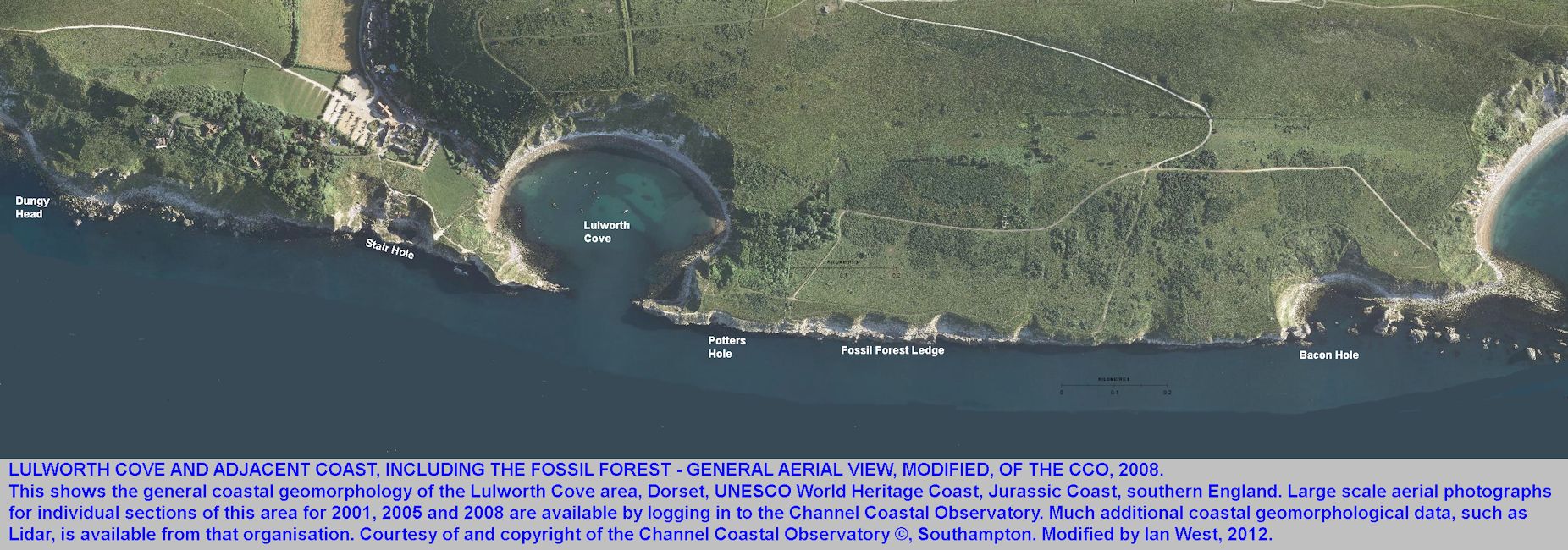
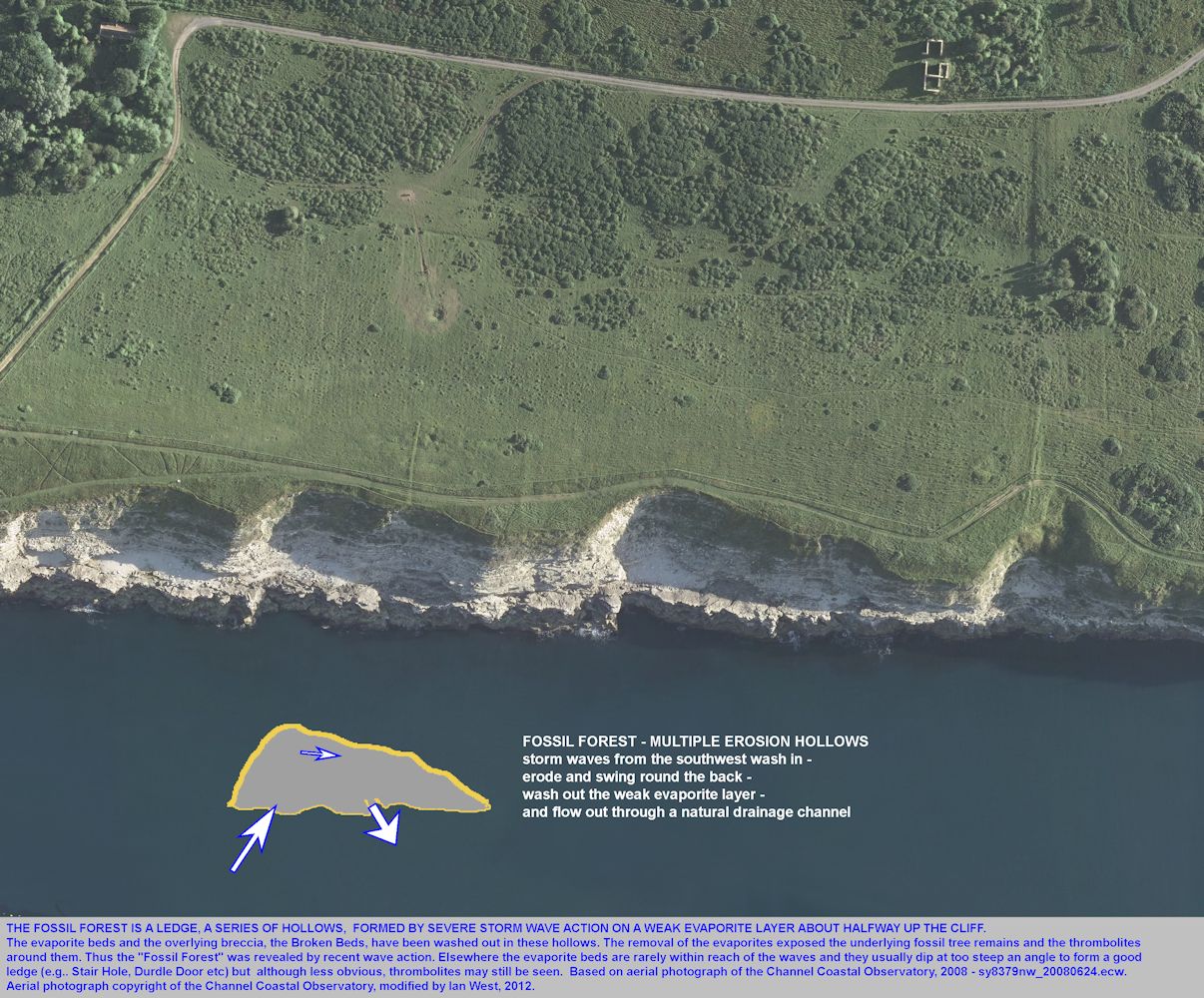
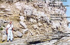

The Fossil Forest, west of Lulworth Cove, Dorset, southern England, is a classic geological locality. It consists of a series of small embayments about half way up the cliff where a weak bed of evaporites or replaced evaporites crops out. The evaporitic beds and and overlying tectonic-evaporite breccia, the Broken Beds are eroded away on rare occasions by the action of great storms washing seawater up the cliff. The water returns to the sea with some debris through small run off channels, one of which is present in each small embayment.
The washing away of the evaporites and breccia reveals the remains of Late Jurassic trees and thrombolite mounds surrounding them. The trees are maily of an an ancient Cypress type (Protocupressinoxylon). They are rooted in a calcareous palaeosol (ancient soil), the Great Dirt Bed. Above the trees is are microbial mounds of thrombolitic ("stromatolitic") limestone. Above this the unusual Broken Beds, a limestone breccia that was originally evaporitic (a cargneule). This is the thin margin of the Purbeck Anhydrite under much of southern and south-eastern England and well-known to the oil industry as a seismic reflector. This marginal facies of the Purbeck evaporites is well-seen at the Fossil Forest and the adjacent Potters Hole.
.

This is No.1 of two Fossil Forest Webpages.
For Purbeck fossil trees go to:
PURBECK FOSSIL TREES AT THE FOSSIL FOREST AND ON THE ISLE OF PORTLAND.

INTRODUCTION -
(with reference to Martian analogues)
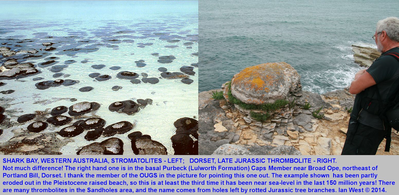
The Fossil Forest is a limestone ledge with a late Jurassic soil and remains of rooted trees. It provides information on an ancient environment in which late Jurassic dinosaurs lived. It is in the cliff east of Lulworth Cove in Dorset, UK. The remains of fossil trees, about 140 million years old, can be seen, most are empty moulds, but there is some preservation as silicified wood. There are also thrombolites (often referred to in older literature and parts of this webpage as "stromatolites", laminated microbial structures) which encrust the trees and interesting evaporite and tectonic features. The thrombolites are the result of precipitation of calcium carbonate around microbial growth in hypersaline water. They are known from Precambrian rocks to modern examples in Australian hypersaline lagoons.
Similar fossil thrombolites to those at the Jurassic Fossil Forest, Dorset, also seem to be present on the planet Mars. For photographic comparison of a Purbeck thrombolite and a Mars thrombolite go to:
the important Harry Rabb website:
Life on Mars.
Supporting the former occurrence of Purbeck-type sabkhas on Mars is the apparent occurrence of enterolithic gypsum veins of sabkha type, such as are common in Purbeck sabkha facies. See the Mars picture of a thrombolite - Sol 528 - scan two-thirds way down the website, looking on the far left, to find this easily, with a Purbeck example from the Fossil Forest, Dorset, shown alongside. They are very similar.
.

INTRODUCTION - THE ARMY RANGES
Range Access Information
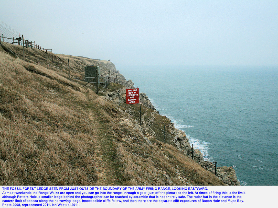
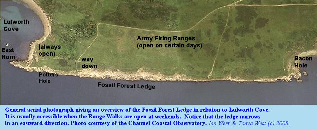
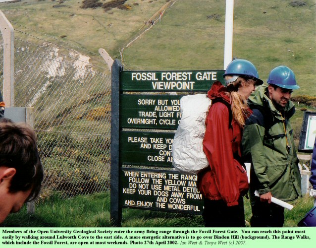
Note that the Fossil Forest Ledge is within the Lulworth Ranges of the Army. It is in the back, overshoot area beyond the targets of the tank firing ranges. It only accessible at most weekends and at these times the red flag is not flying. It is also open on a few occasions in addition the weekends. Before visiting please check the opening schedule:
Access Times at Defence Training Estate, Lulworth and Tynham Village, 2011 ( or 2012 etc.)
[
Ditto for 2012. etc]
or Google: "Lulworth Ranges"
.

GENERAL INTRODUCTION:
The Upper Fossil Forest
There are two horizons of fossil tree remains above palaeosols in the basal Purbeck Group of Dorset. The more widespread one is the Lower Fossil Forest which occurs above the Lower Dirt Bed (not the Basal Dirt Bed) from the Isle of Portland to Poxwell, Upwey and Portesham, north of Weymouth. The Upper Fossil Forest is known at the Fossil Forest locality, east of Lulworth Cove, and on the northern Isle of Portland. It is more limited in extent than the Lower Fossil Forest. Neither occur in the coastal exposures east of Lulworth Cove because these are of the thicker basinal facies. Thrombolites do extend as far east as Durlston Head but do not contain tree remains there.
Both fossil forest horizons have trees encrusted with thrombolites, which have developed beneath as well as above fallen tree trunks or branches. The tree are sometimes silicified and in some cases they have rotted away. In the Lower Fossil Forest, vertical thrombolite tree trunks have sometime fallen over (see Portesham). When they have fallen more thrombolite may encrust them on the upper side, as at Pulpit Rock, Portland (Lower Fossil Forest).

INTRODUCTION - THE LOCALITY:
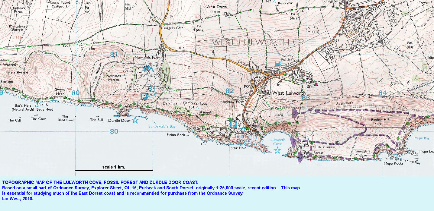
Topographic Maps

INTRODUCTION:
Geological Maps
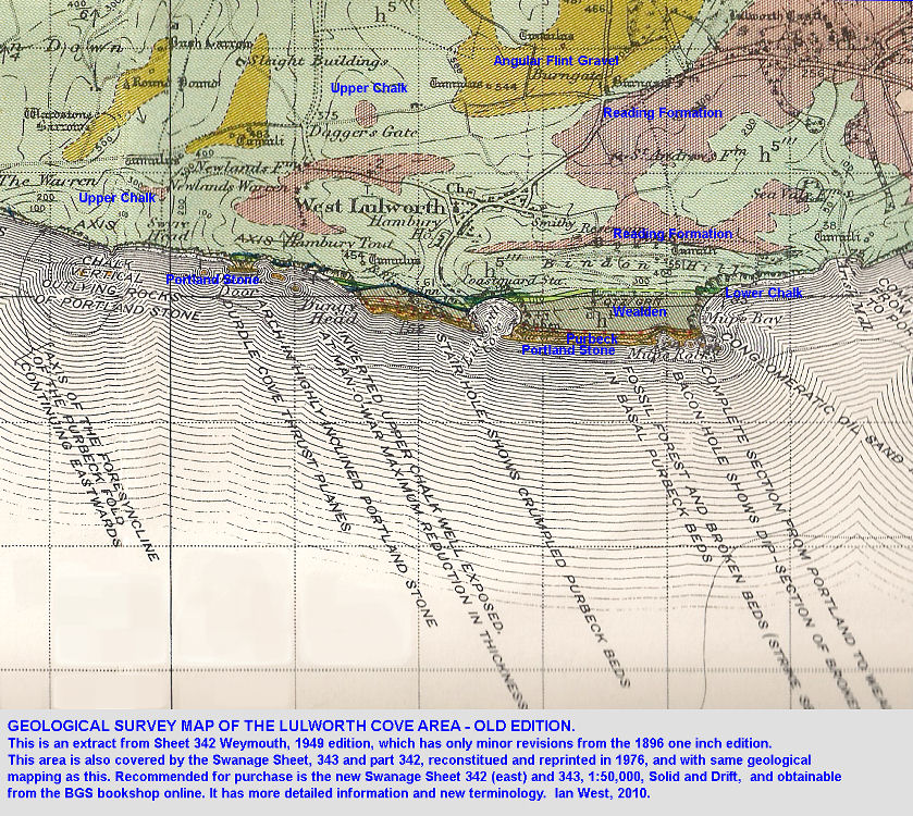
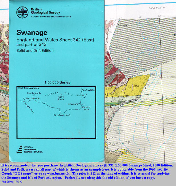
The British Geological Survey map, 1:50,000, Solid and Drift, 2000 Edition, Swanage Sheet, 343 and part of 342, is well worth purchasing. It can be obtained from the
British Geological Survey website and is very inexpensive, costing only 12 pounds sterling.

INTRODUCTION:
Safety and Risk Assessment
When visiting the Fossil Forest note that hammers are not allowed. Parties should wear safety helmets and beware of falling rock. This is not as much a hazard on this ledge as elsewhere though. The real risk is falling off the ledge and into the sea. In particular, children should be well-supervised.
[Sadly, there have been fatalies in the area, but this is over many years, and in an area visited by numerous people. There should be awareness of risks, though, even if they are not higher than at other geological localities in Dorset.
Accidents or incidents to geologists have been rare or absent at the Fossil Forest, compared to Lulworth Cove, but this is partly because accident frequency in geology is partially related to the number of geologists visiting a specific locality. Because the ranges are often closed and because access to the Fossil Forest requires a walk around the cove it has proportionally less visitors. There has been one death of a geologist from heart failure just above the Fossil Forest and two rock climbers have been drowned there many years ago.
Abide by the military safety instructions on notices and do not pick up or interfere with any suspicious metal objects. Unexploded shells are rarely found in the area nowadays, although I have long ago found one at Gad Cliff. Apart from the Fossil Forest ledge and Mupe Bay beach, stay on the marked paths.
The greatest risk is of falling into the sea or onto rocks while examining the section from the cliff edge. Where possible avoid the cliff edge and do not attempt to climb down to the Portland Stone below. Geologists working on the cliff edge should take care not to forget about it whilst making geological studies or taking photographs, and stepping back negligently. Be very careful in stormy conditions.
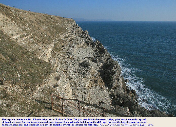
Do not try to climb on beyond the normal eastern limit of the Fossil Forest ledge; there is no safe exit to Bacon Hole. The far western margin, west of the steps, is an easy cliff-edge walk but it is unsuitable for parties or for children, and its use by the general public is not advised.
Adders (poisonous snakes) are common in the Lulworth Cove area, but have rarely caused any problem; just do not disturb them.
Addendum - In late 2016 problems arose with loose and hazardous rock at the steps down to the Fossil Forest. I am not aware of whether this problem has been solved yet. It will probably will be sooner or later. Note, though that at times there may be no steps access to the Fossil Forest ledge, because of loose rock. This could affect field parties, (although individual geologists might perhaps proceed by another route should it be known to them and only if it is safe at the time, and they do this at their own risk)
No liability for accidents at the Fossil Forest or other parts of the Lulworth Cove is accepted.

INTRODUCTION:
Location and Access
A simplified geological map of the Lulworth Cove area is given above. This shows the location of the Fossil Forest exposure to the east of Lulworth Cove.
Note the location of the Fossil Forest which is in the military firing ranges. These are open most but not all weekends (for enquiries please telephone the Army Range Control - 01929-462721, ext. 819). Hammers are not permitted and geological parties should wear safety helmets. Thrombolites with hollow moulds which once contained trees are also visible in the north face on the west side of the Durdle Door promontory but can only really be seen satisfactorily with binoculars. Fossil tree remains are common in the quarries of the Isle of Portland and are also present in old quarries in the Weymouth area.
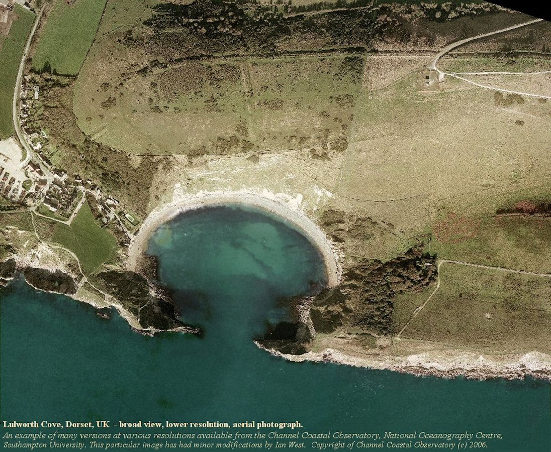
The entrance to this is mostly easily reached by walking eastwards round Lulworth Cove and taking a path east from the low slumped Wealden cliffs. If you wish to follow the steep path up the cliff at East Over to Pepler's Point then there is a gate nearby into the ranges and to the Fossil Forest.

INTRODUCTION:
Entering the Fossil Forest Ledge
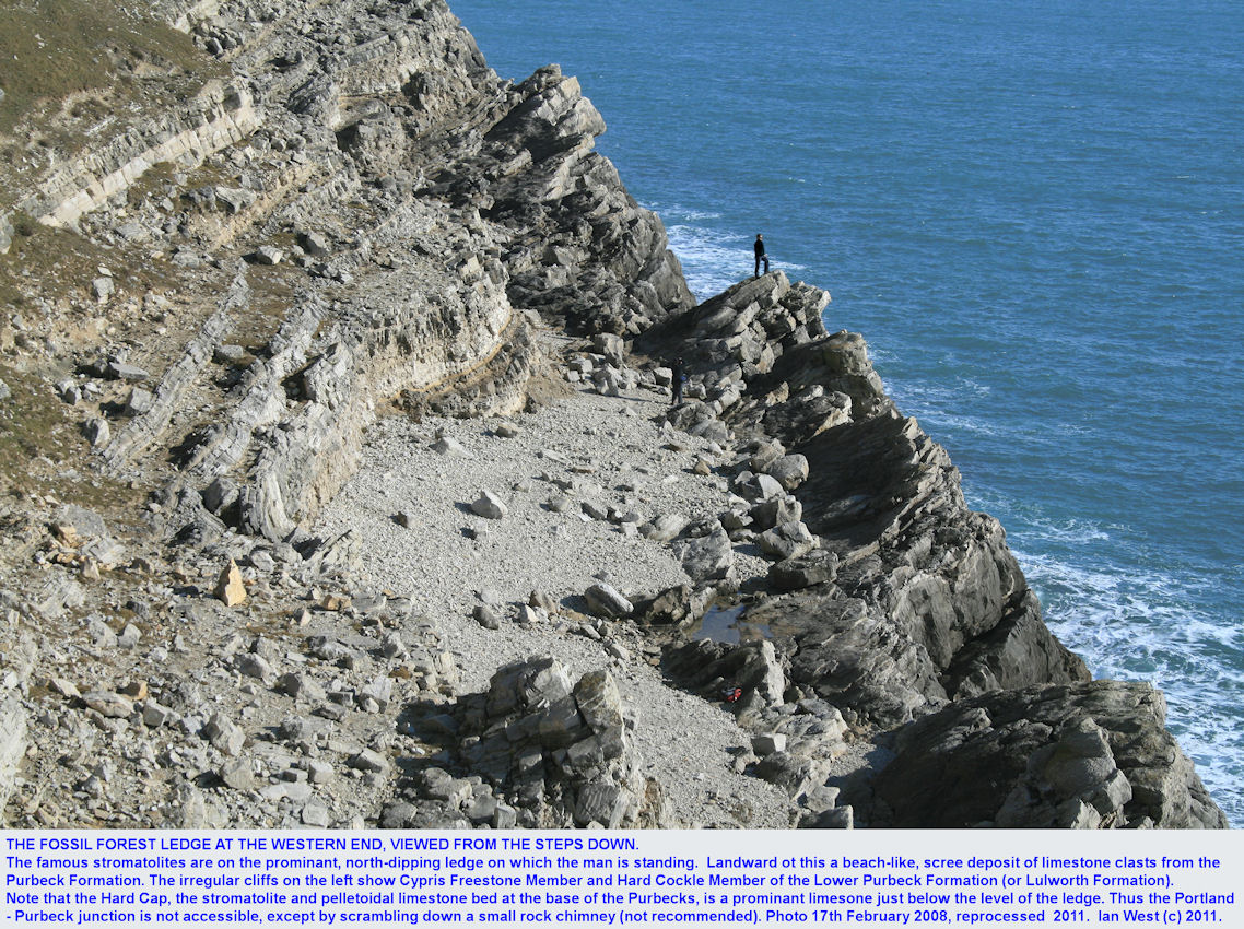
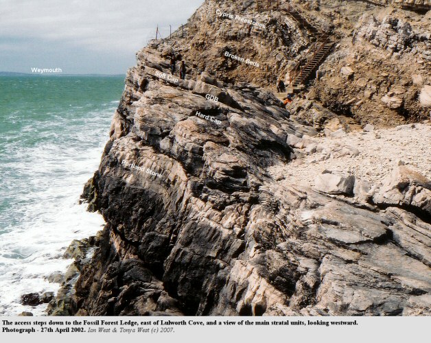

PURBECK FORMATION
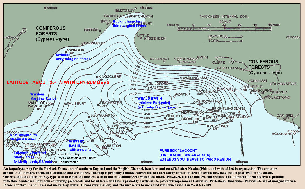
Introduction - Isopach Map

INTRODUCTION:
The Fossil Forest Ledge

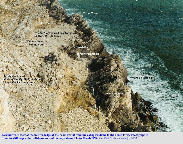
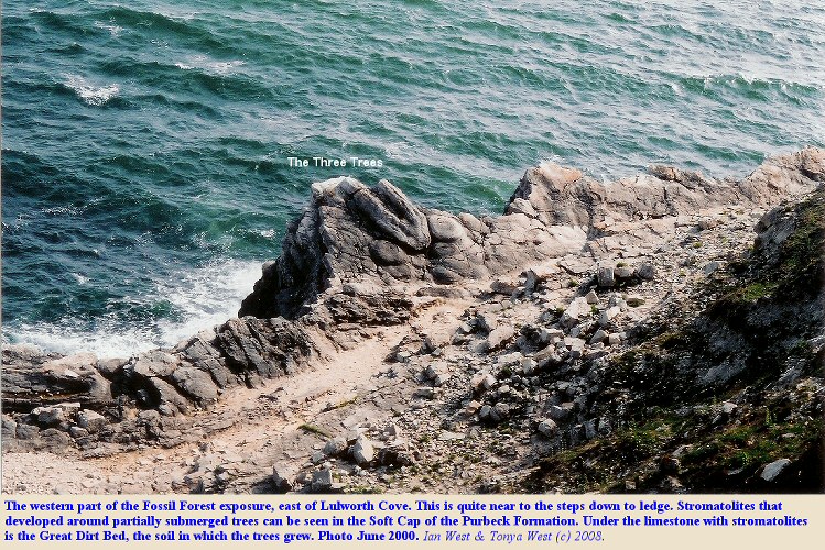
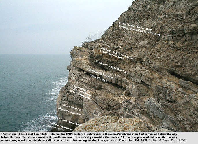
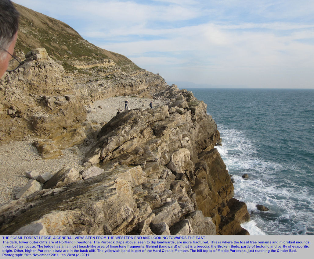
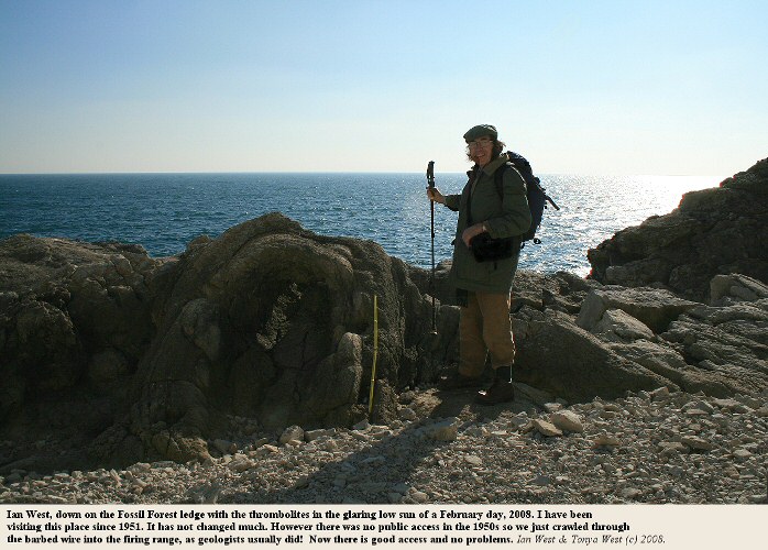
The steps down to the Fossil Forest ledge at its western end are shown above. Many of the features of the Fossil Forest can be seen in this first section. It ends eastwards with the Three Trees, which have been photographed and shown several times in various books (these three thrombolites can be seen in the lower of the two photographs above). The views towards the sea are southwards. You can continue eastward from the western ledge to the central ledge which has interesting fallen blocks of Cherty Freshwater Limestone with low salinity fossils and pseudomorphs after halite.
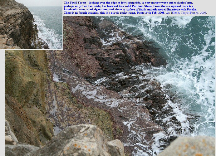
The seaward side of the ledge is a wall of Portland Stone with the basal Purbeck Hard Cap forming the uppermost part. The outer cliffs are almost vertical and end downwards in an usually narrow, rock platform, with deep water beyond. This shows the usual ecological zones of a rocky coast with a Laminaria zone, a red algae zone (Lithothamnion?) and a zone of smooth limestone with Patella (the limit).
The narrowness of the rock platform demonstrates that erosion has been very slow or the coast is very young (or both). Rising sea-level at a location where there was once, just offshore, an old cliff line of the Ipswichian raised beach (i.e. it was probably like Portland - See Prestwich).
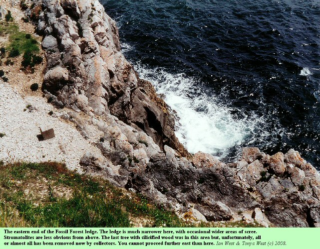
The Fossil Forest Ledge narrows eastward. The practical limit for walkers is just beyond the small embayment with a concrete block, shown in the photograph above. There used to be a good silicified tree in this area but, unfortunately, it has been destroyed by collectors.

INTRODUCTION:
History of the Fossil Forest Ledge
The Fossil Forest was originally known as the "Vairy Vances" or "Fairy Dances" (Loader and Loader, 1932). Presumably this is a reference to the rings made by the thrombolites, as seen in the photographs. The name was used in connection with smuggling activities. "A large and well concealed cave, which ultimately foundered, was situated half way down the face of an abrupt cliff near Fossil Forest (Vairy Vances or Fairy Dances) as it was then called. The men were lowered by ropes from the cliff top to the ledge, the boats brought close under, and the tubs hauled up in the same way. The ledge was higher on the sea side and sloped towards the land, making with the broken rock lying around, admirable cover. The spirit laid in this cart until an opportune time arrived to cart it inland." (Loader and Loader, 1932).

INTRODUCTION:
Potters Hole
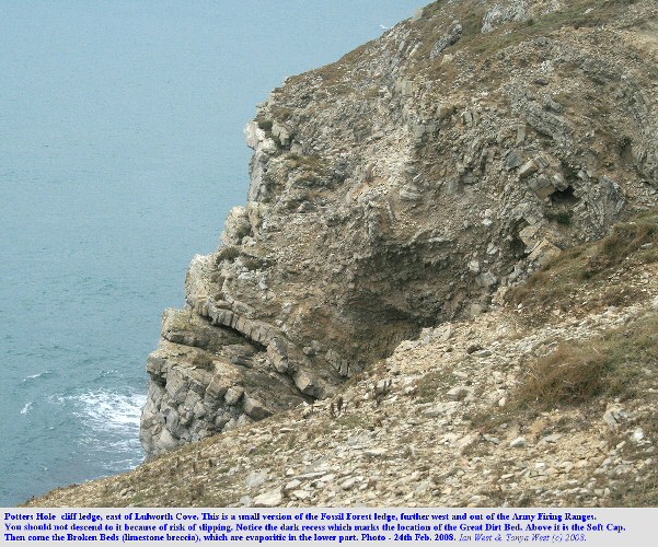
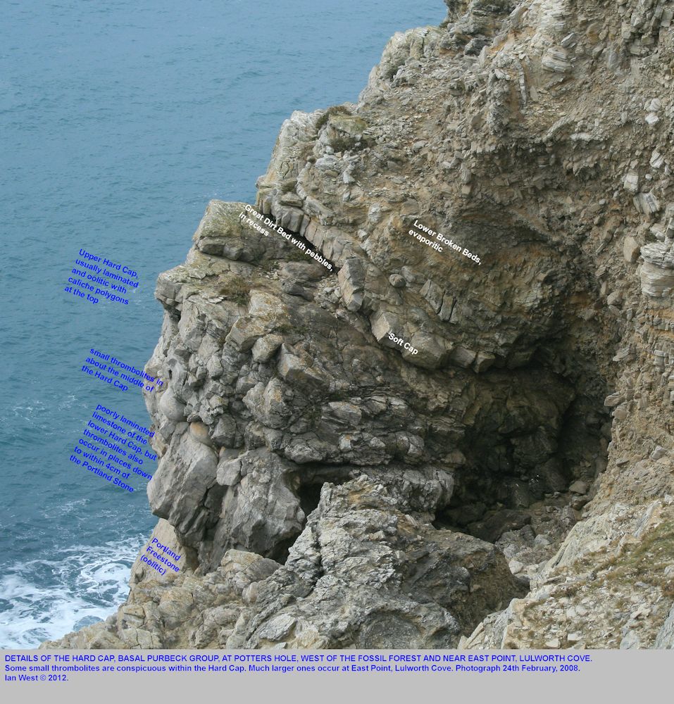
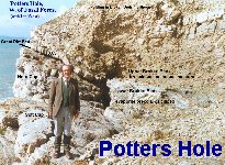
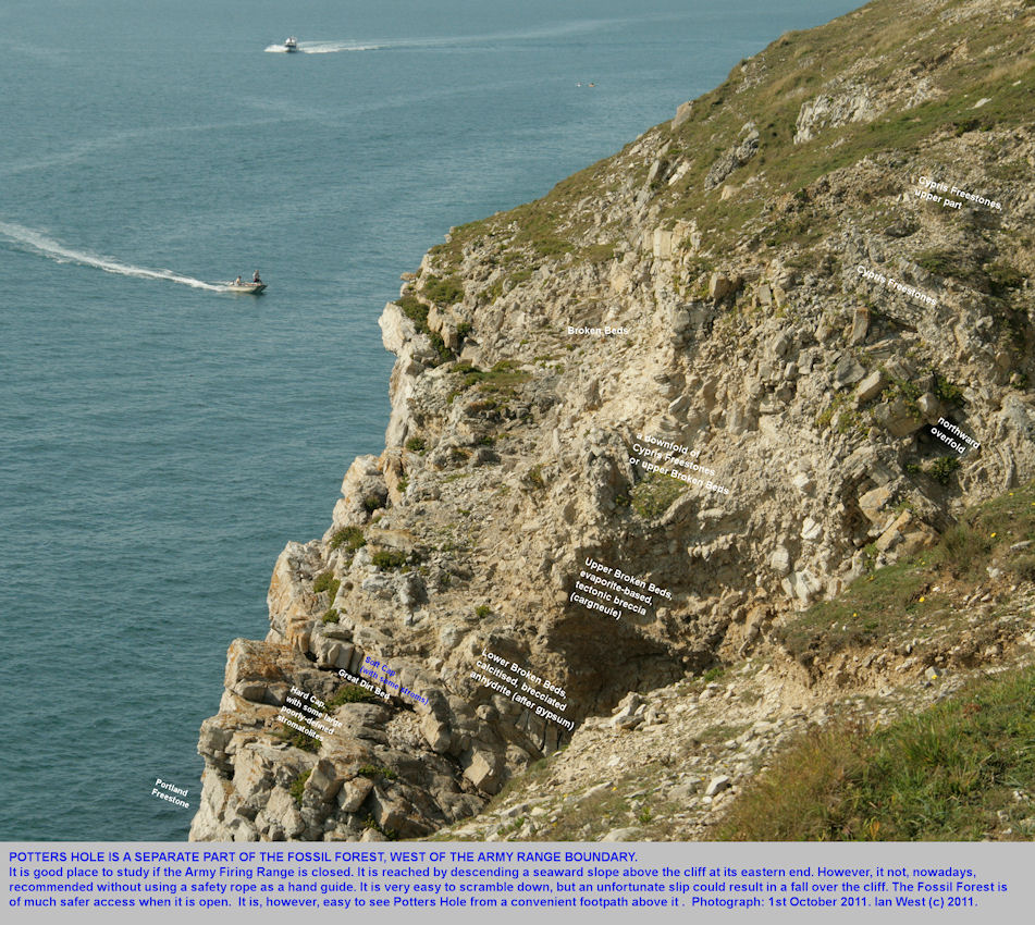
Outside of the army firing ranges at Lulworth Cove there is a westward and smaller version of the Fossil Forest ledge at Potters Hole. Here the Hard Cap, the Great Dirt Bed, the Soft Cap and the Broken Beds are well-exposed. The location is a short distance west of the Army Ranges fence. Take care on the cliff path here because it is now broken away in places.
Note that there is no path to Potters Hole and the only approach is via a dangerous steep and crumbly slope above a vertical rock cliff. Although commonly visited by parties in the past, it is not nowrecommended for use without a safety rope.
Access to the base of the Purbecks, the Lower Dirt Bed and the Hard Cap is available, with scrambling, at the western end. The Hard Cap of fine-grained, lagoonal oolitic and pelletal limestone contains large ovoid thrombolites. The Great Dirt Bed is well exposed and above this comes the Soft Cap with some thrombolitic limestone. Half of a thrombolite mound above a tree is visible.
Above the Soft Cap is the limestone breccia, known as the Broken Beds, long misunderstood but actually a carbonate-evaporite rauhwacke. The lower part of this consists of blocks of calcitised anhydrite (now porous white limestone with small euhedral quartz crystals and spherulites of lutecite chalcedony) in a rather brownish matrix of soft calcitised anhydrite, resembling a soft sandstone (there is no sand here, in fact). Brecciated chert replacing primary lenticular gypsum is brecciated at the top of this unit. Above it occurs a breccia of laminated pelletoidal and ostracodal limestone of Cypris Freestones facies. There is no significant matrix in this part. The true Cypris Freestones lie above.

STRATAL SUCCESSION AT THE FOSSIL FOREST:
Succession of Strata - General
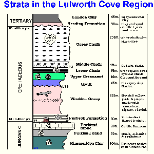
The simplified diagram above shows the succession of strata in the Lulworth Cove region, with various degrees of simplicification. Note the relative position of the Purbeck Formation discussed here, above the marine Portland Stone and below the fluvial Wealden Group. The silicified tree remains and moulds of tree trunks mostly occur near the base of the Purbeck. Foliage and some timber can occur at various levels in the formation but trees in place are not known at higher levels here. Black lignitic wood, much of which is of similar type, occurs in the Wealden strata above, usually as drifted logs. These are often found in old river channels in association with river pebbles and coarse sand.

STRATAL SUCCESSION continued:
Succession of Strata - Fossil Forest Section
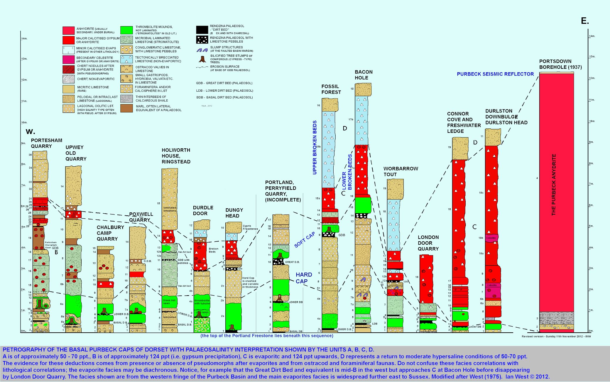
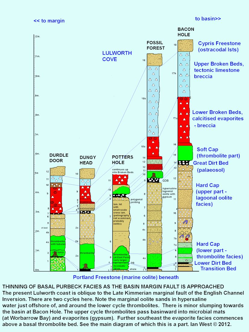
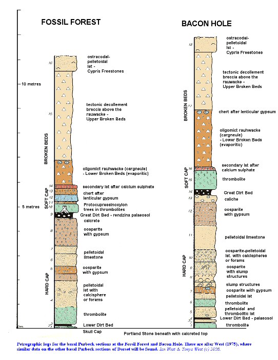
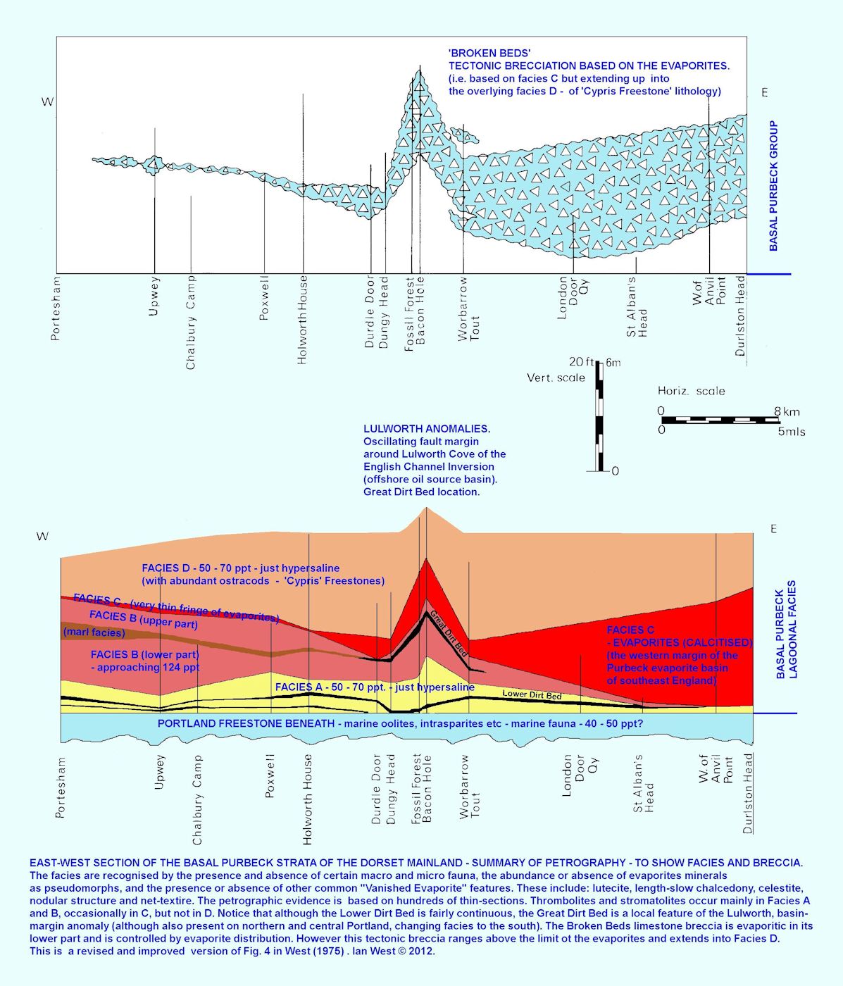
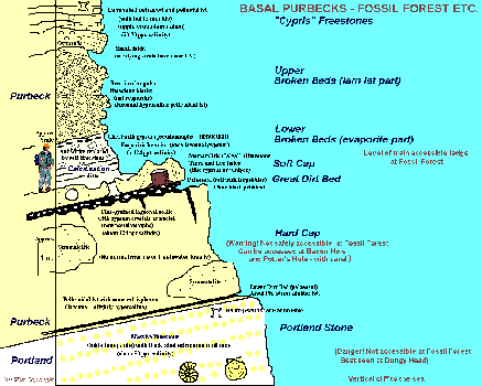
The Fossil Forest ledge is eroded in the cliffs just above the basal Purbeck Caps. It gives good access to the Great Dirt Bed, a palaeosol, the Soft Cap, a thrombolitic or stromatolitic limestone above it, to excellent exposures of calcitised evaporites, discussed more fully below, and to the Cypris Freestones above.
The diagrams above show the petrographic units of the basal Purbeck strata of Dorset, as determined by West (1975). Positions can be found quite easily. First observe the level of the main thrombolites (stromatolites) in the Soft Cap. These will be at your feet and cannot be missed. Look down into the recess under the limestone bed in which they occur and see the Great Dirt Bed. Having found his it should be quite easy to follow the graphic logs above. However, note that there are some thickness changes along the Fossil Forest ledge because of evaporite flowage and decollement folding in the upper Broken Beds.
Access to all units from the top of the Hard Cap (just under the Great Dirt Bed) upwards is easy (at least until the Hard Cockle Member is reached). Proceeding downwards from the top of the Hard Cap is less easy because the Hard Cap, Lower Dirt Bed and Skull Cap (Transition Bed) are exposed in a nearly vertical cliff directly above the sea. Beneath is vertical Portland Freestone. The Hard Cap is only accessible by scrambling down in a certain recess and this is not recommended without a safety rope. Note that there is significant lateral variation within the Hard Cap and the strombolites are very variable. The upper and lower divisions are fairly regular and distinctive, though.
This Fossil Forest section can now be considered in some detail, as shown in the diagrams above. The succession here records the results of a shallowing-up and progressive restriction of water from the marine Portland Stone Formation with giant ammonites (Titanites) and common thick-shelled marine molluscs such as Myophorella ( " Trigonia " ), Camptonectes lamellosus . The Portland Stone is a massive oolite forming the outer cliff which descends to the sea. It is not safely accessible and if study of it is needed it is recommended that Dungy Head , a short distance to the west be visited. Giant ammonites of the Portland can also be seen at Bacon Hole, to the east.
The thin (2.5 cm), pelloidal "Junction Bed " (or "Basal Cast Bed" - a familiar feature at many localities, but usually thicker than this) is overlain by the basal thrombolitic limestone. The Lower Dirt Bed, a palaeosol with fossil tree remains at some localities (such as Portland lies above. The Hard Cap is thick here and can subdivided (into the following (new terms): the Banded Hard Cap, at the base, the Hard Cap Sulphate Bed, the Lower Tubule Bed, and the Oolitic Hard Cap). The Oolitic Hard Cap is particularly interesting because of the common occurrence of lenticular gypsum crystals as nuclei to the small, lagoonal ooids.

SUCCESSION:
THE SKULL CAP OR TRANSITION BED (Beds 1 and 2)
The Skull Cap or Transition Bed consists of a few centimetres of thrombolitic limestone directly on top of the uppermost oolite of the Portland Freestone. This uppermost oolite is calcreted because of penecontemporaneous exposure.

THE LOWER DIRT BED
The Lower Dirt Bed is a thin Purbeck palaeosol without limestone pebbles (present in the Great Dirt Bed). It is very similar the to LDB on the Isle of Portland. It is only accessible at one or two places by climbing down the outer cliffs in a convenient recess.
See Matthewman et al. (2012) for information on the organic geochemistry of Purbeck palaeosols or "Dirt Beds"

THE HARD CAP (Beds 4,5,6,7 and 8)
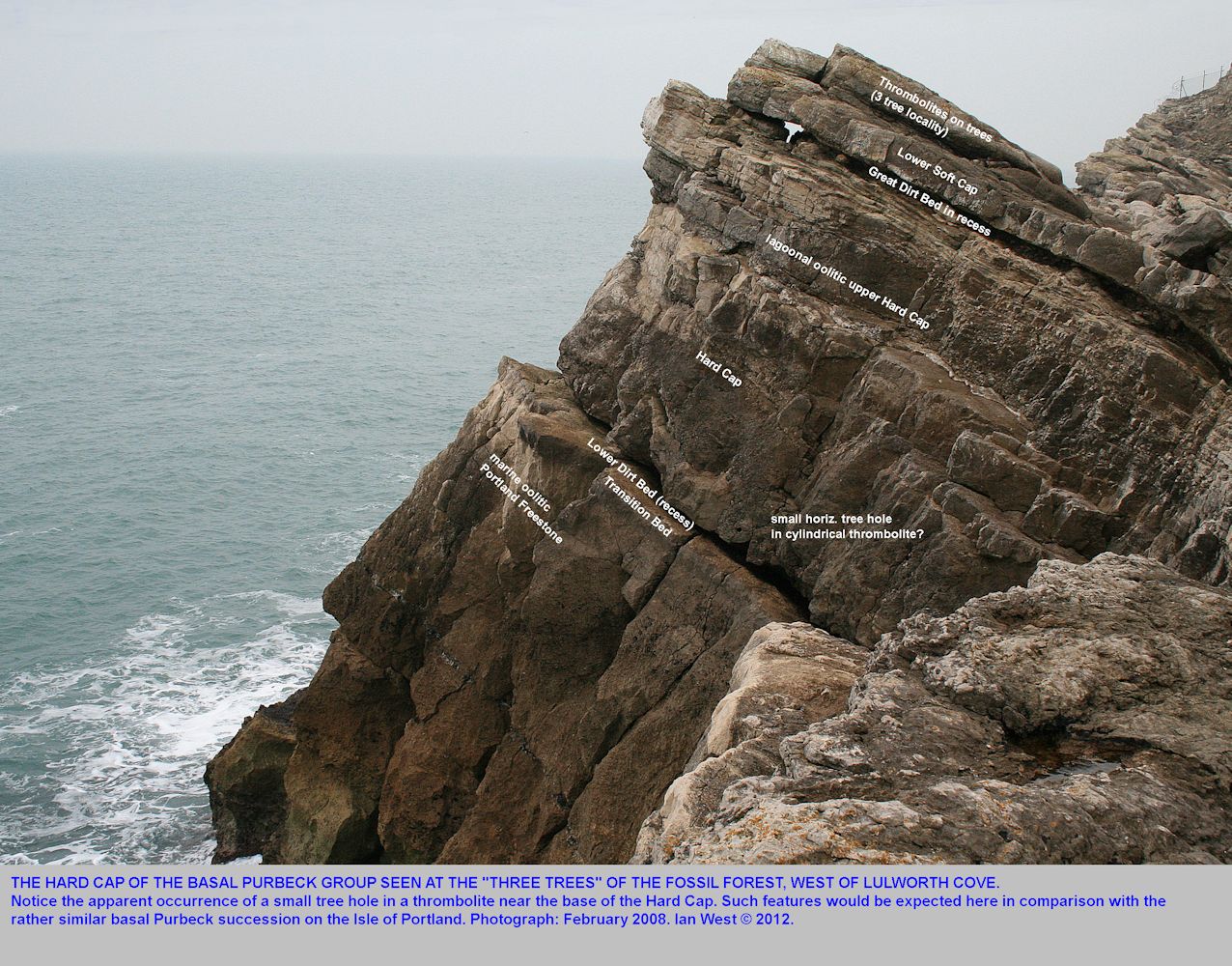
The Hard Cap is a well-known, lagoonal limestone unit of about 2 metres in thickness. It consists of six recognisable beds. Large thrombolites occur within it in a fairly irregular manner, so that the details are different from place to place. See the logs above or West (1975) for lithological details.
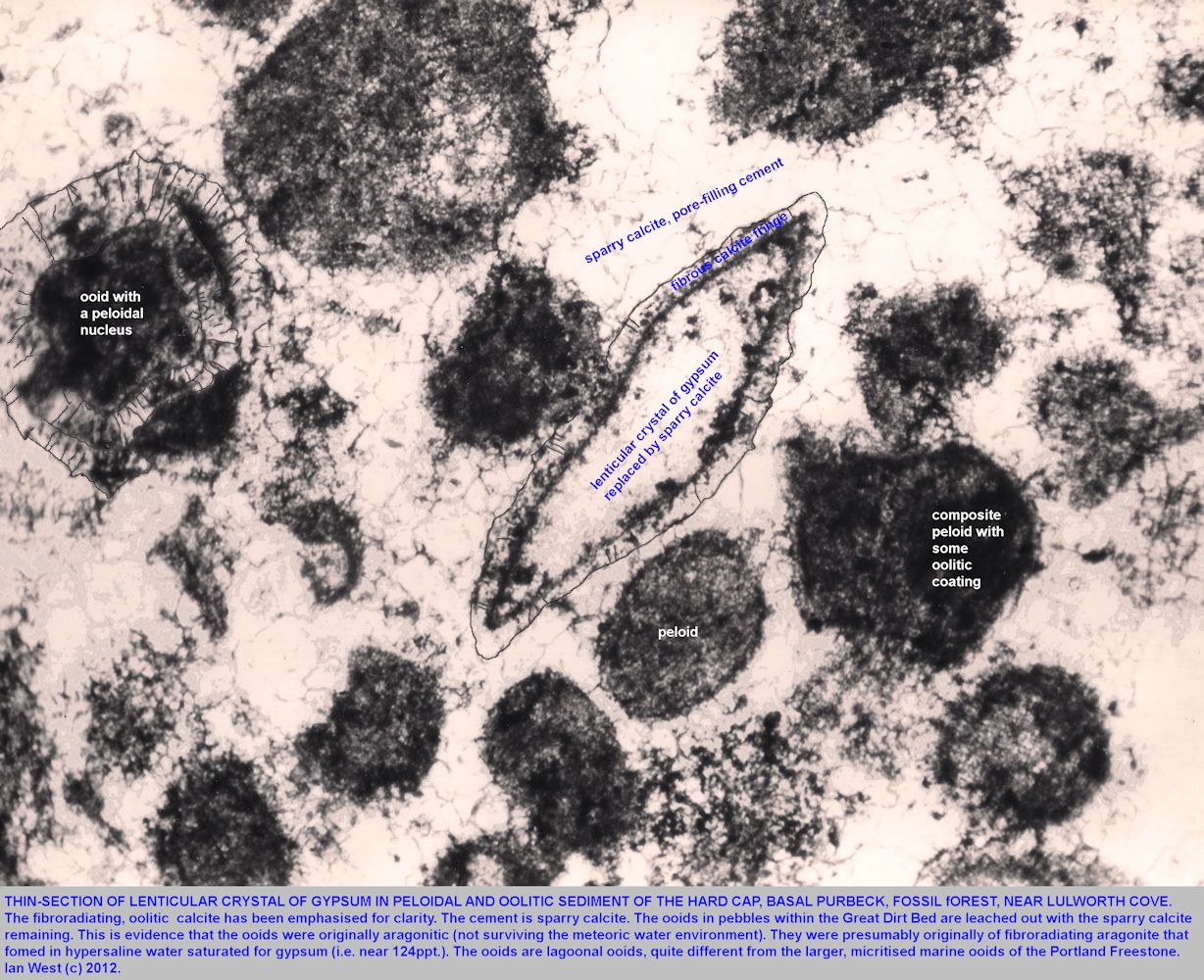
The lower part is mostly pelletoidal but it contains some calcispheres or foraminifera in places. Lagoonal, "quiet-water" oolites occur in the middle and particularly in the upper part. The oolites are transitional to evaporites and contain numerous calcite pseudomorphs after lenticular crystals of gypsum, as shown above . It is interesting to see these as nuclei to ooids. It shows that brine salinity was often approaching 124ppt.
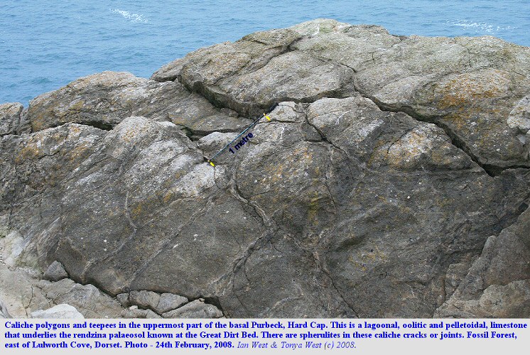
The top of the Hard Cap is notable for the polygonal structures first described by Pugh as algal. These are in fact caliche and teepee structures, similar to those seen in Quaternary carbonates in Kuwait and elsewhere.

THE GREAT DIRT BED
The Great Dirt Bed - Palaeosol
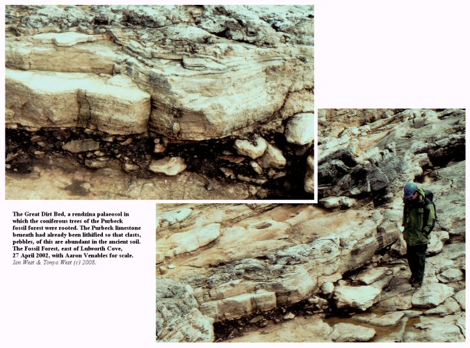
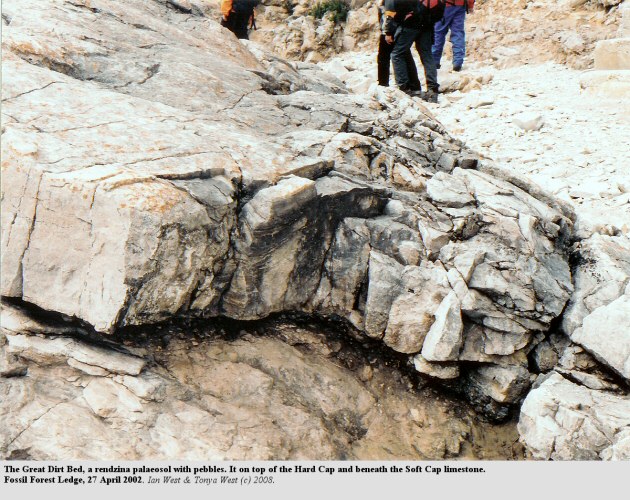
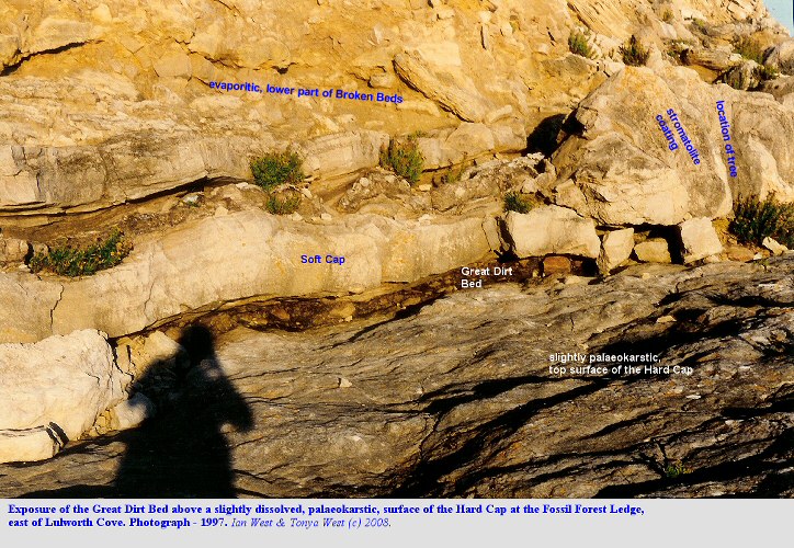
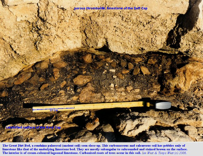
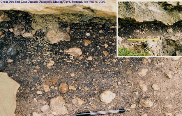
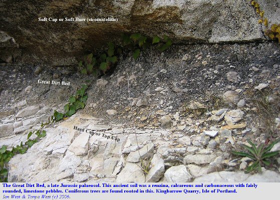
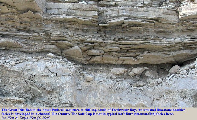
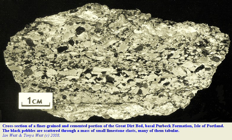
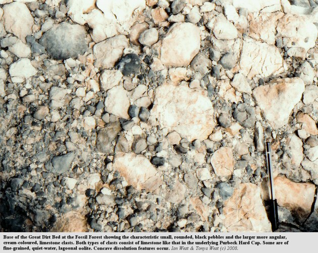
Photographs of the Great Dirt Bed at the Fossil Forest are given above, together with a selection of photographs of the same bed on the Isle of Portland, for comparison.
The Great Dirt Bed is a well-known, ancient carbonate-rich soil. It is one of the very first ancient soils to be recognised as such by geologists. It was initially recorded by Webster in 1826. However, the quarrymen of the Portland Stone clearly knew that it was soil long before the first geological study. They found two or three "dirts" or soils in the Caps limestones at the top of the Portland Stone which they were quarrying. The thickest and best developed of two or three dirt beds they called the Great Dirt Bed. It is the only palaeosol with abundant pebbles.
In terms of soil classification the Great Dirt Bed is a type of rendzina. The pebbles within it are of lagoonal limestone similar to the Hard Cap beneath. They do not, however, consist of Portland material as suggested by Webster .
A good discussion of the nature and origin of the Great Dirt has been provided by Francis (1986) . She described it as a well-developed palaeosol exhibiting a simple A/C rendzina profile, consisting of a dark, organic-rich horizon overlying limestone bedrock (which was already lithified). The main component of the matrix of the A-horizon is decomposed plant debris. There is little evidence of the activity of soil organisms and notable lack of the faecal pellet textures (pelletoid moder fabric) typical of modern rendzinas. Francis attributed the lack of soil organisms (earthworms, insects and other arthropods?) to the semi-arid climate.
There is no obvious field evidence of fire; however
there is actually abundant charcoal in the Purbeck palaeosols. See the work of Francis and a recent paper:
See Matthewman et al. (2012) provide information on the organic geochemistry of Purbeck palaeosols or "Dirt Beds" and also note that some of the palaeosol kerogen is fossil charcoal.
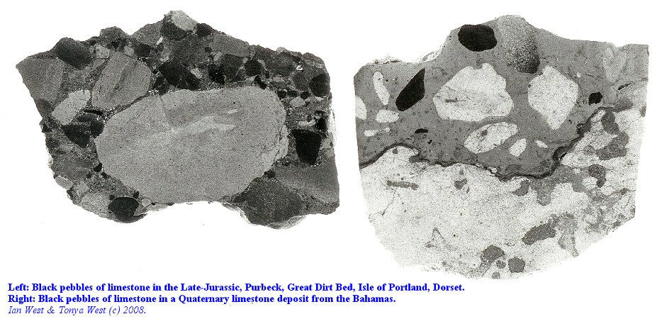
Black pebbles of blackened limestone - a common features of palaeosols in carbonate sequences, are major components of the Great Dirt Bed. These have been attributed to blackening at the margins of hypersaline lakes (Ward et al., 1970) or blackening within the soils (Strasser and Davaud, 1983). The pebbles often contain calcitised gypsum pseudomorphs like those in the Hard Cap beneath and calcrete coatings occur on some. The soil also contains fine-grained resinous material from the conifers (although I am not aware of any amber having been found) and some clay Francis (1986) . Foliage from the herbaceous level of the forest would have included material from ferns and lycopods. This probably contributed to the soil in addition to the coniferous tree debris.
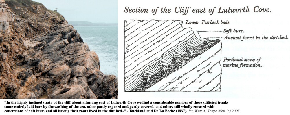
The trees of were rooted in the dirt bed and extend up into the Soft Cap above for short distances (about half a metre to a metre) . These trees are discussed separately below.
The lower part of the Soft Cap above consists of thrombolitic limestone formed in shallow hypersaline water. The trees were effectively " pickled " in this by a rise in water-level. Above come calcitised evaporites. Anhydrite, resulting from the alteration of primary gypsum, has been replaced by limestone (calcium sulphate to calcium carbonate).
The replacement has been incomplete so that the resulting rock is porous and rather crumbly (it has a sandy appearance - but there is no sand).
The lower part of the Broken Beds (see the section on this unit ) above consist of similar calcitised anhydrite. In thin-section, under the microscope, pseudomorphs after anhydrite can be found. This part of the breccia has a matrix of calcitised anhydrite. Chert near the top consists of pseudomorphs after primary lenticular gypsum (the replacement of gypsum by silica took place early, as did the silicification of the tree trunks). The upper part of the Broken Beds consists of brecciated, laminated, pelletoidal limestone with ostracods. It is similar to the Cypris Freestones above and has no matrix.
Above the Broken Beds come the Cypris " Freestones but the cliff continues up through the Hard Cockle Member with small euryhaline bivalves ( Protocardia purbeckensis )

THE FOSSIL TREES OF THE PURBECK FORMATION
Please go to separate webpage at:
PURBECK FOSSIL TREES AT THE FOSSIL FOREST AND ON THE ISLE OF PORTLAND.
(This webpage continues with discussion of the strata present at the Fossil Forest Ledge.)

THE LOWER SOFT CAP (THROMBOLITE BED):
(Limestone above the Great Dirt Bed of the Upper Fossil Forest)
Modern Analogues - General
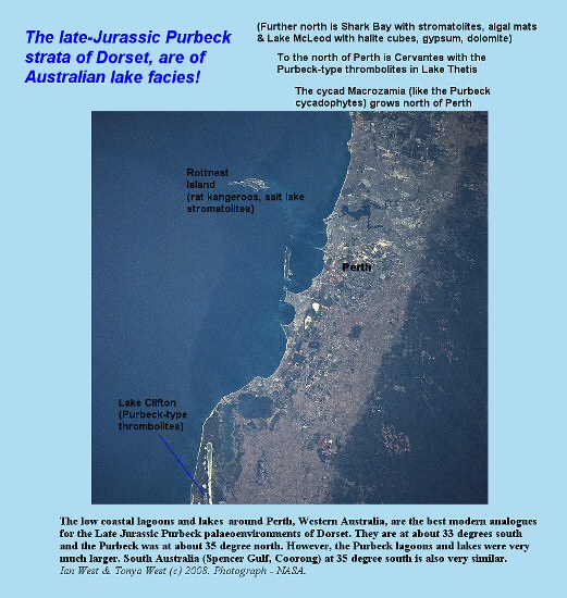
Present-day environments with much resemblance to those of the basal Purbeck occur mainly in Australia. There are major similarities with both the Mediterranean type environments of South Australia, and semi-arid environments of Western Australia near Perth.

THE LOWER SOFT CAP
Modern Analogue:
The Coorong Lagoon, South Australia
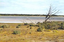
An environment with some similarities in terms of semi-arid climate, latitude (although in wrong hemisphere) and presence of evaporites to that of the Purbeck fossil forest environment is that of the coastal Coorong area of South Australia, shown here. Trees grow and die at the margins of hypersaline lakes in this region. These lakes may largely dry out after summer drought. The slightly pink colour results from halobacteria or algae.
This association of trees and hypersaline lakes is not a common one at the present day, mostly because human activities have destroyed the trees in such areas. The Purbeck climate (at about 37 degrees north and clearly very seasonal) was probably Mediterranean but the present Mediterranean area is particularly poor for trees because of deforestation and the grazing of goats. South Australia, with its Mediterranean climate, provides better analogues for various Purbeck features (charophyte lakes, chert, dolomite etc.). Differences should also be noted. The grass and angiosperm shrubs have replaced some low Purbeck vegetation (ferns, horsetails and cycadophytes?).
Note that the Coorong area of lagoons and lakes is separated from the sea by a long barrier beach. It is not suggested that the Purbeck environment was associated with a long barrier beach type. Such a beach has not been found and the whole Purbeck lagoonal area was not narrow and was very large (about 200 km across). Nevertheless, the Coorong and other South Australia areas are useful guides to the Purbeck palaeoenvironments.
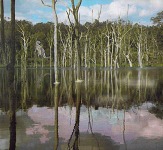
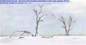
Reconstructions -
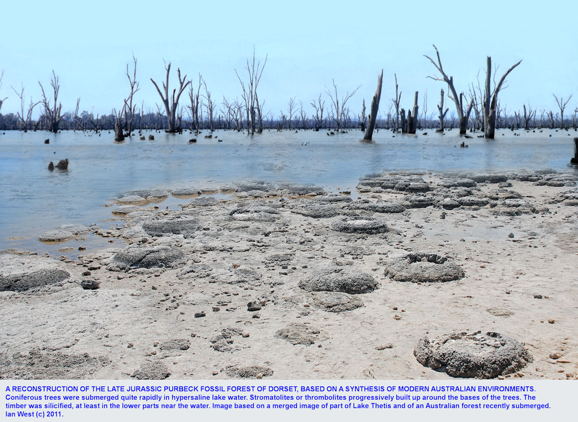
Left: The very early stage of submergence of the Purbeck trees in saline lagoon water is shown here. In the summer this brine became sufficiently hypersaline at times to precipitate a little gypsum and, with time, thrombolites developed around the tree stumps. Notice that there is a pinkish colour to the water because of the presence of halobacteria and algae. The real topography would have been more subdued than this and the surrounding environments were probably forested rather than bushy. Local swells or low ridges did exist in Dorset, however, and the area over the Wytch Farm oilfield was one of these (raised in the Late Kimmerian Movements).
Right: At times the water of the shallow lagoon will have almost certainly dried up and the trees would have been encrusted in salt. The form of the thrombolites shows that the water depth was often less than a metre so this was very likely from time to time in summer. Salt has not been preserved at this level but evidence of calcium sulphate is common. Halite is so soluble that it may be ephemeral and in this semi-arid environment it would have been readily lost in the winter rains. The gypsum and probably halite-saturated conditions of the trees accounts not only for their general preservation but also for the great rarity of holes made by boring organisms within them (one example has been seen in a cycadophyte but they are normally absent in the cypress-type wood).
The low vegetation would have been of ferns and horsetails and not grass which had not evolved at this time. In reality many more trees would probably have been visible in the distance, including scattered cycadophytes.
Notice from this reconstruction just how thrombolitic carbonate could accumulate beneath as well as above a near horizontal trunk. The fallen section on the left is lying above the floor of the lagoon. If the saline water was to rise and microbial ('algal') growth take place it could grow beneath and above this particular trunk. This type of growth has clearly happened in the basal Purbeck environment, and it also explains the "tree-holes", nearly horizontal holes left by tree branches, and found in the caps on the Isle of Portland.

THE LOWER SOFT CAP (THROMBOLITE BED):
Thrombolites and Stromatolites of the Soft Cap - Introduction
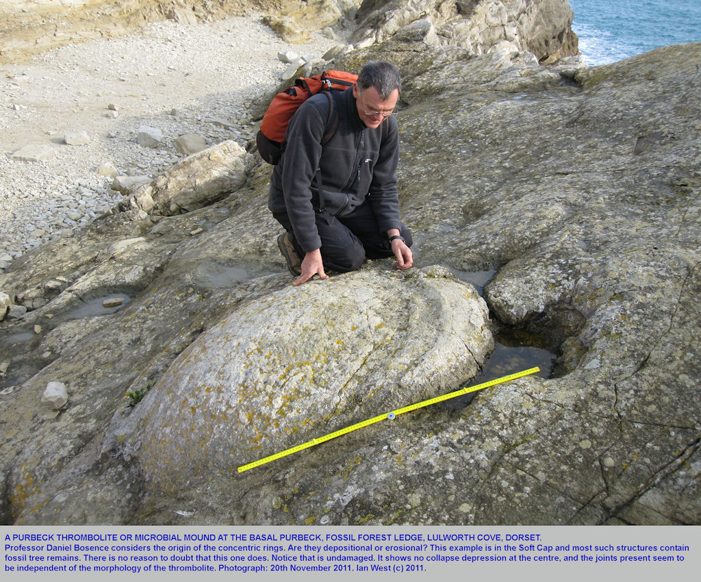
Both thrombolites and stromatolites are carbonate development that form in shallow hypersaline water. Stromatolites are clearly laminated, microbial ("algal") mats. Throbolites are lumpy developments of carbonate of microbial origin in hypersaline saline water. They occur at the present day and in fossil condition in ancient salt lake deposits. [Incidently similar fossil thrombolites seem, from photographs, to be present on the planet Mars, although the circular features seen, might perhaps be of some inorganic origin, and thus the matter is not confirmed]. Thrombolites are well developed around late Jurassic, fossil tree remains on the Isle of Portland and at the Fossil Forest on the Isle of Purbeck.
.
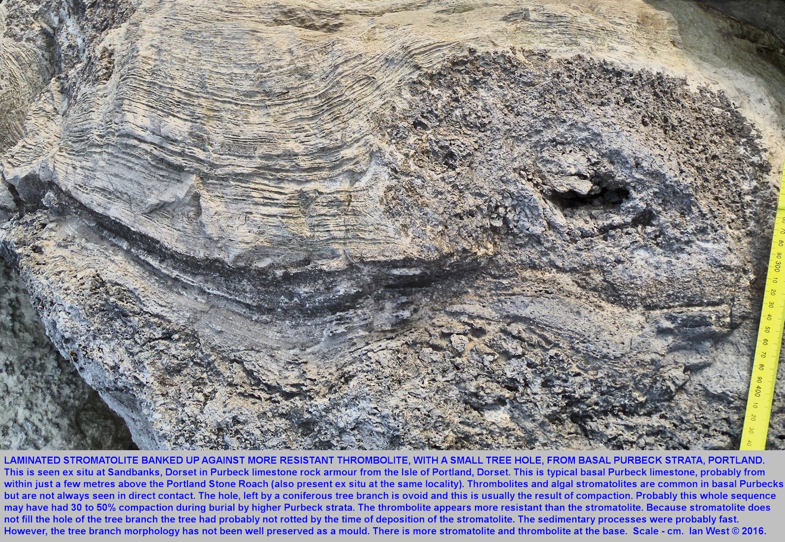
.
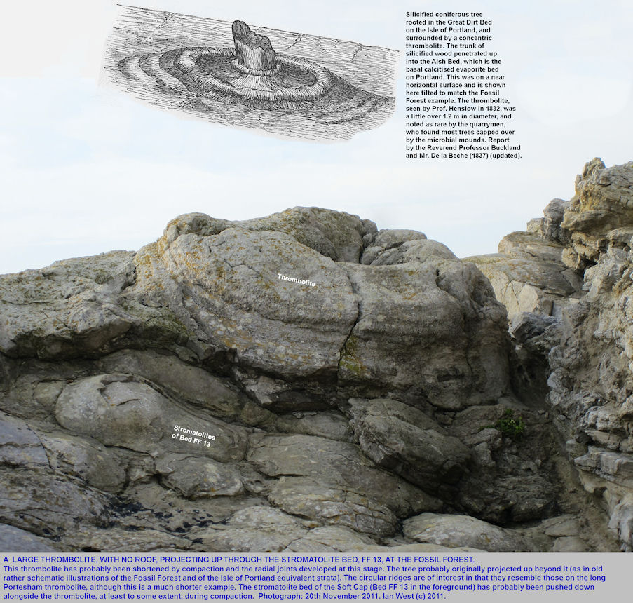
The well-known microbial mounds at the Fossil Forest or on the Isle of Portland are often casually referred to as "stromatolites", and sometimes accidently here, but actually they are not well-laminated, and thus strictly are thrombolites. True stromatolites do occur at the Fossil Forest; they are well-laminated and mostly occur in about the middle of the Soft Cap.
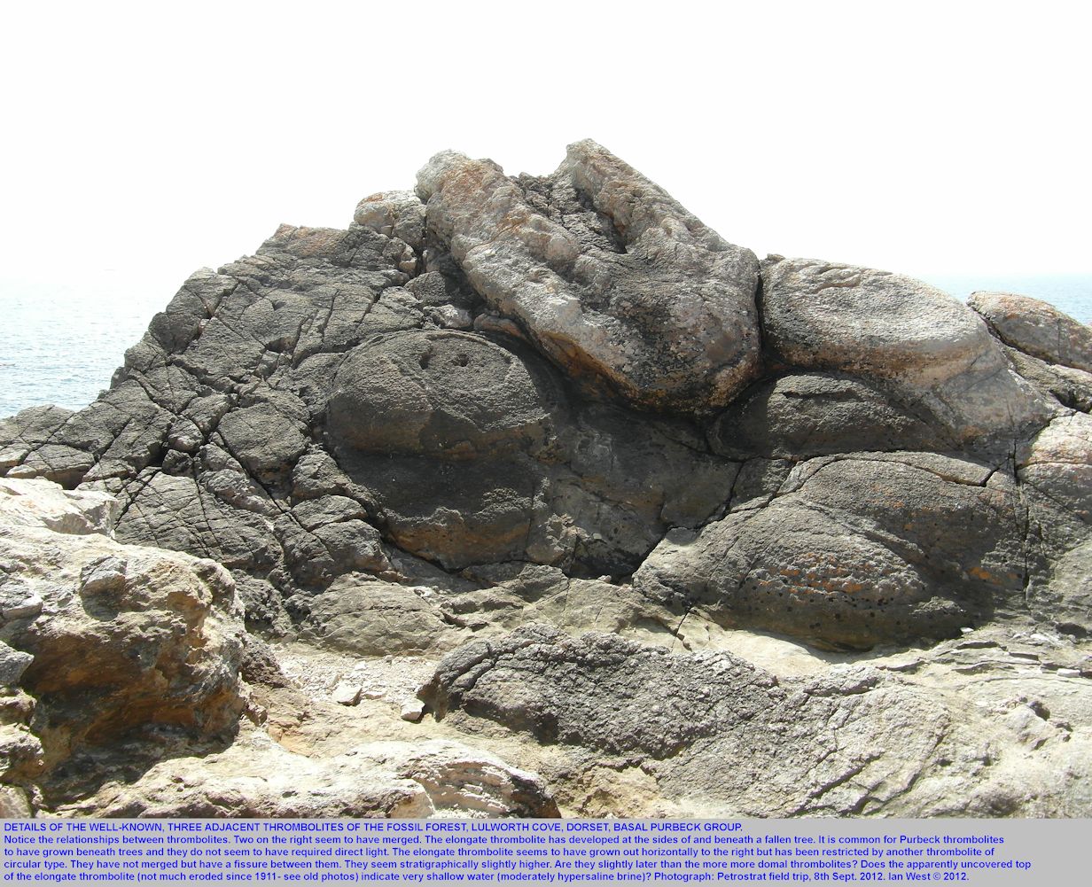
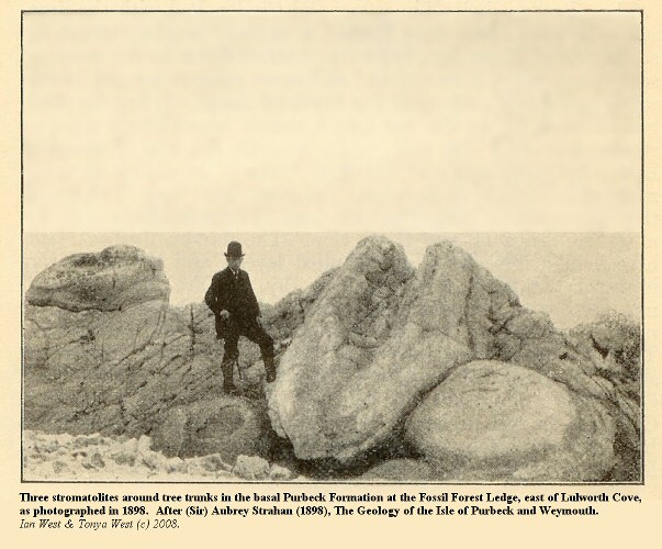
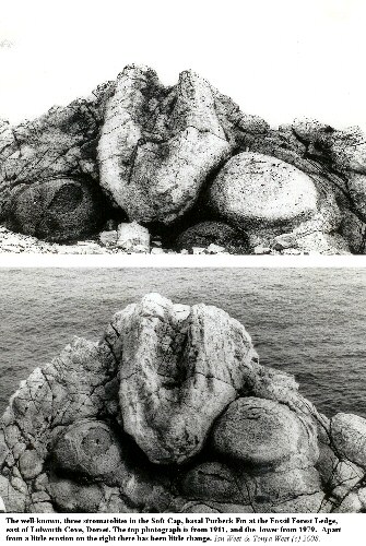
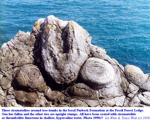
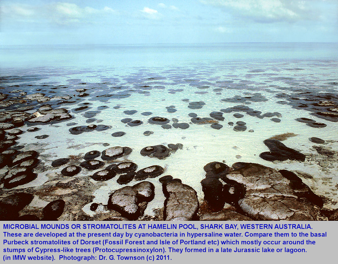
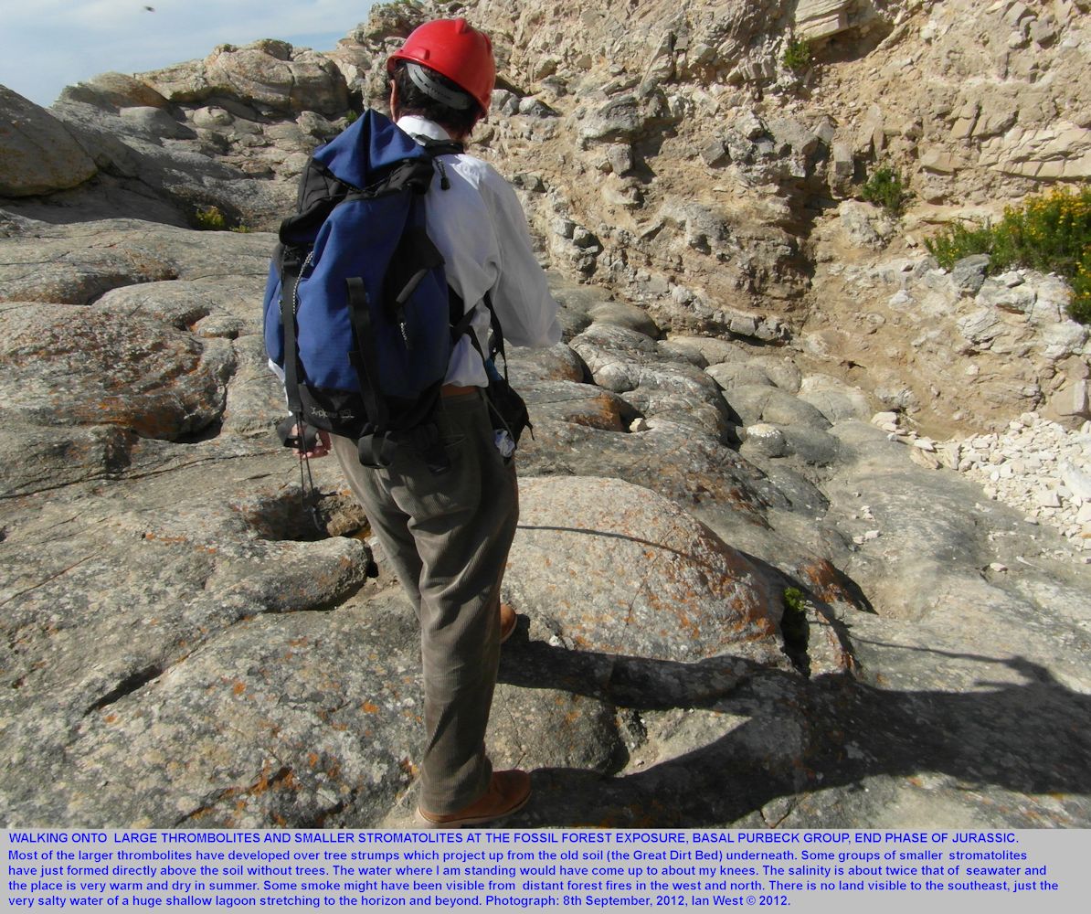
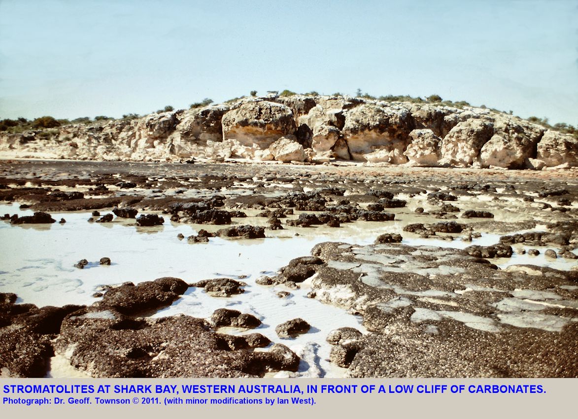
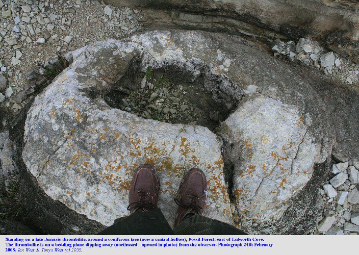
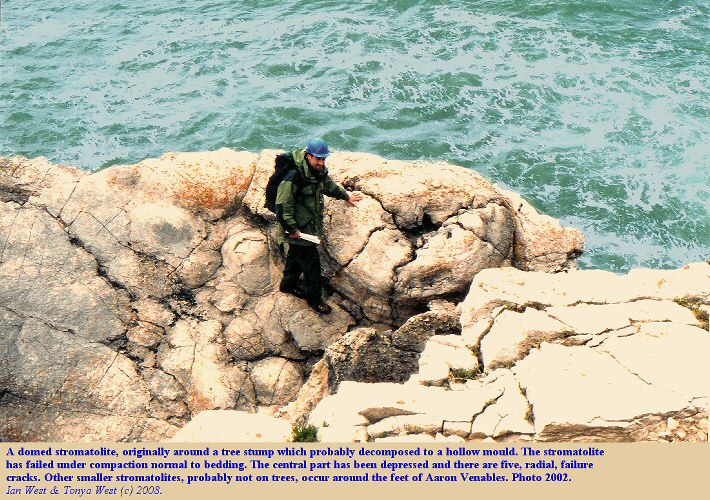
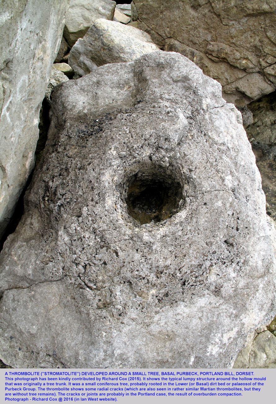
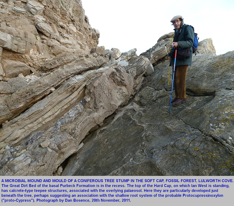
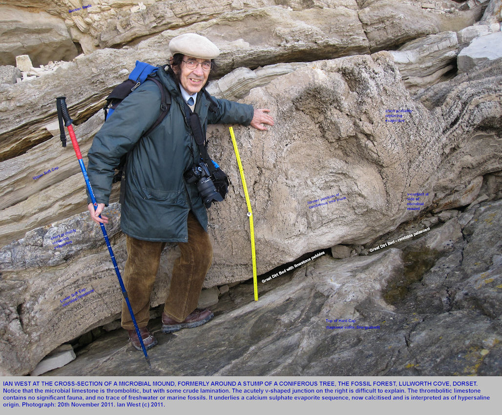
Hypersaline lagoon effectively "pickled"; the remains of trees, which had by now lost their bark. The stumps and fallen logs were then coated in cyanobacterial limestone in conditions rather like (but not identical with) those of Shark Bay, Western Australia. The mounds shown here cover two stumps and a fallen trunk. The internal structure is not well-laminated as in a true stromatolite, but is thrombolitic (lumpy and irregular). Thus, strictly speaking, most of the Purbeck examples of microbial mounds are thrombolites. They are sometimes referred to casually as "stromatolites". Some true, laminated stromatolites are also present in the Soft Cap of the Fossil Forest. These are smaller and they do not coat trees.
I am very grateful to Alan Holiday for pointing out that the Purbeck cylindrical thrombolites are very similar in appearance to the thrombolites of
Lake Thetis in Western Australia
(Grey et al., 1990). It is interesting that these have been modelled mathematically using the Interface Evolution Equation (KPZ equation). The Purbeck thromobolites had the complicating factor of tree boles as nuclei.
For more information see: Proof of Life.
("An important piece of the origin-of-life-on-Earth puzzle has been discovered in a collaboration between researchers in mathematics and the earth sciences... Murray Batchelor (right), a Professor in the Mathematical Sciences Institute and the Research School of Physical Sciences and Engineering, and Dr Robert Burne, a Visiting Fellow in the Faculty of Science�s Department of Earth and Marine Sciences, have applied the mathematical tools of theoretical physics to show how slimy mats of microbes could have formed the unique conical shapes of certain stromatolites on the seabed over 3,450 million years ago.)

THE LOWER SOFT CAP continued:
Thrombolites - Microbial Domes and Vertical Microbial Cylinders (and Lake Thetis analogues)
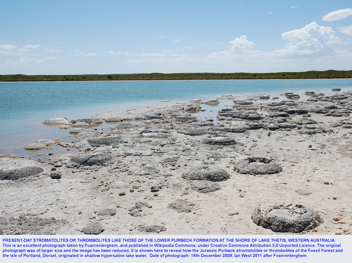
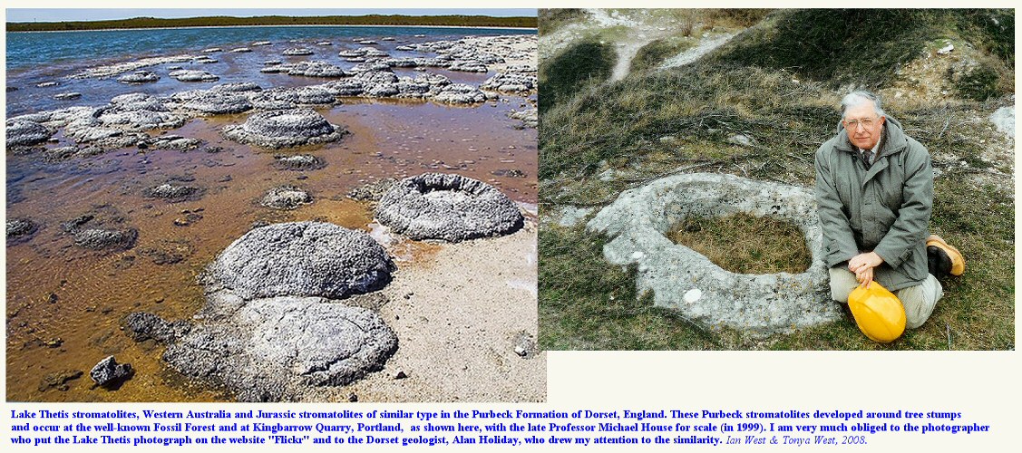
Lake Thetis in Western Australia has an environment in which thrombolites like those of the Purbeck Formation develop at the present day. They do not seem, however, to be around tree stumps, as far as I am aware.
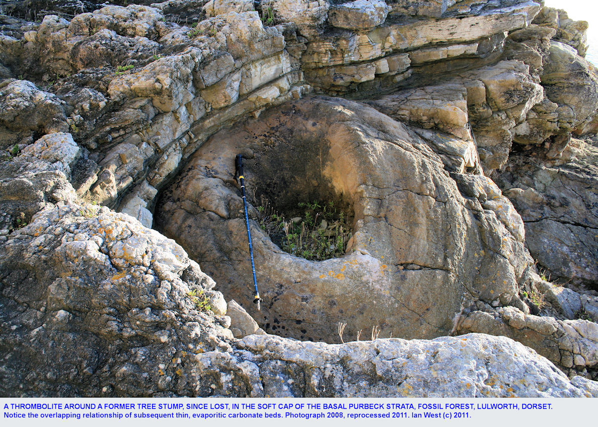
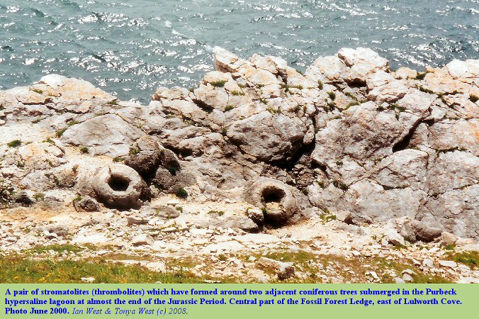
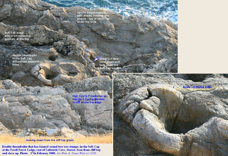
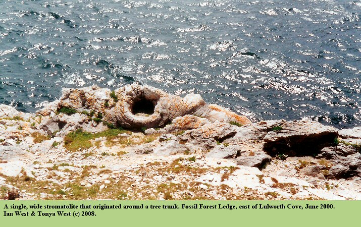
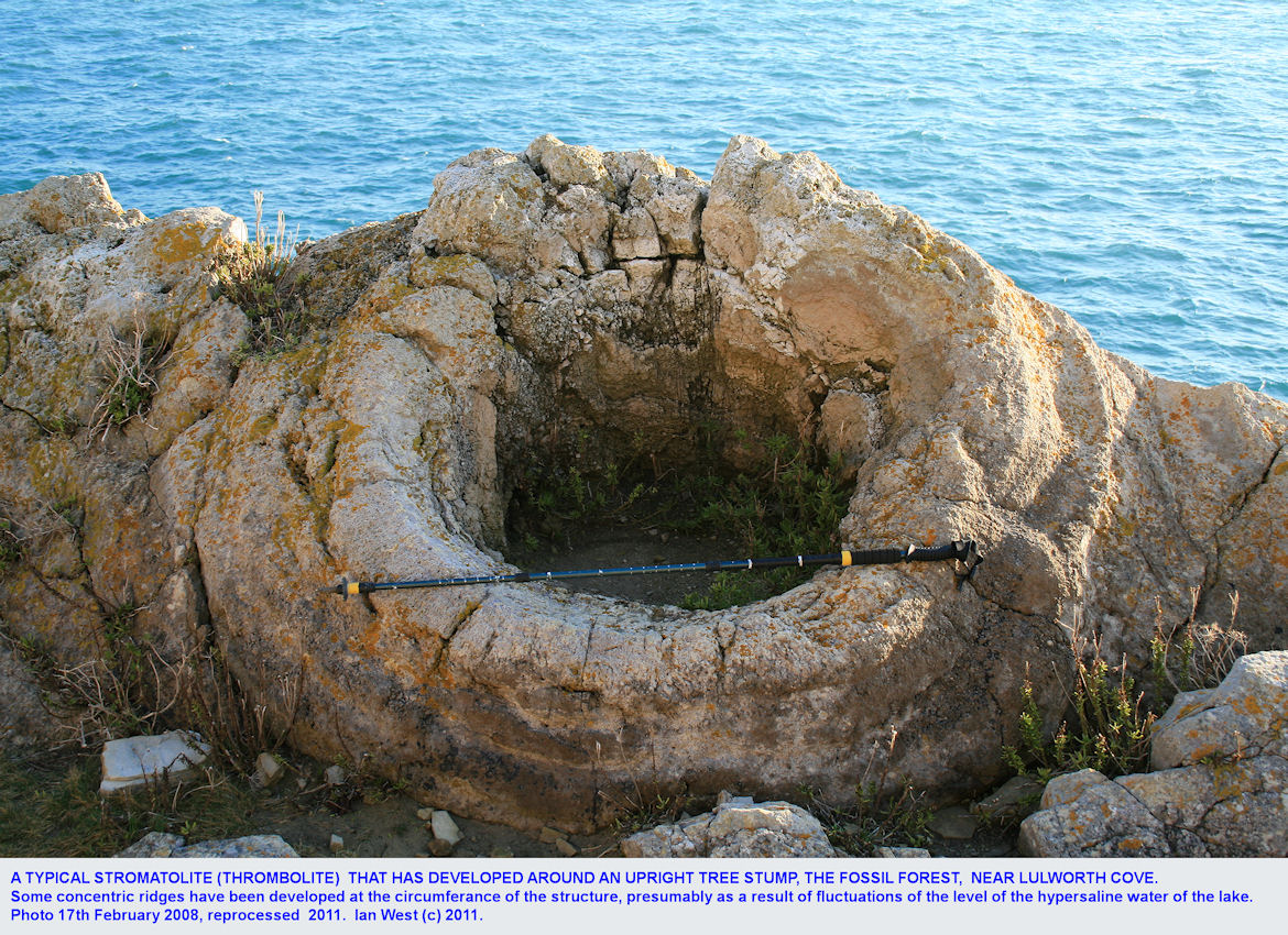
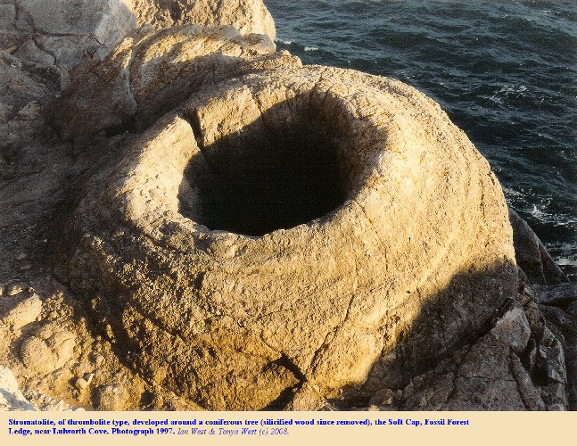
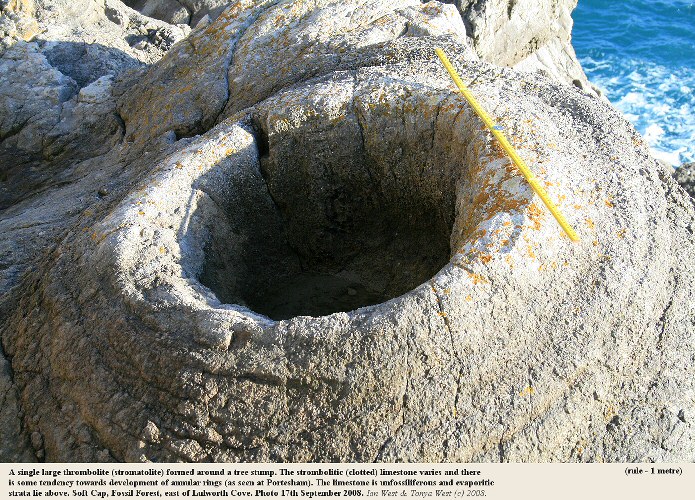
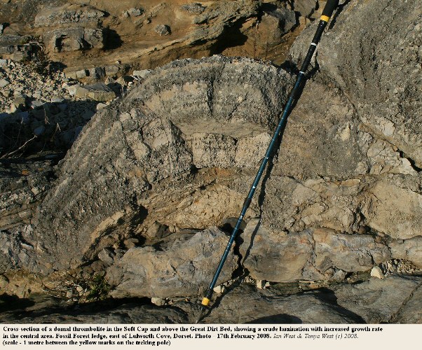
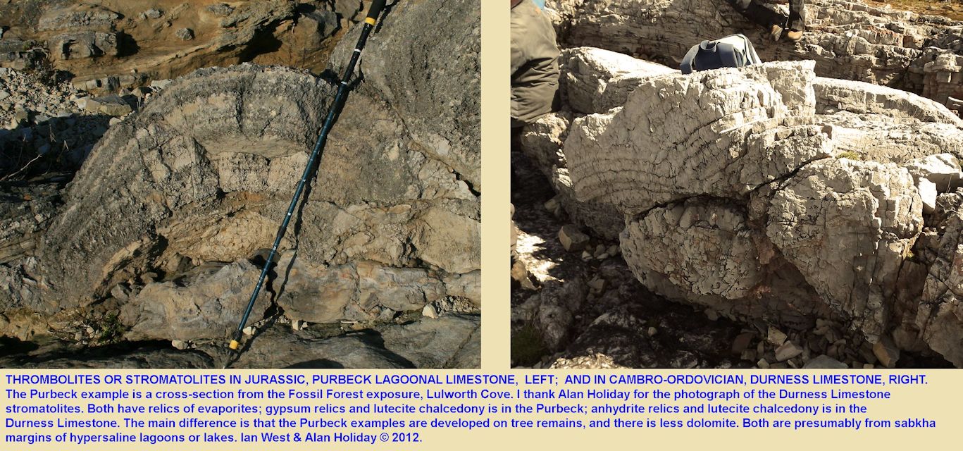
Notice the general similarity between the Purbeck thrombolites and the Durness Limestone stromatolites in cross section. Both microbial structures are closely associated with evaporites. Pseudomorphs after gypsum and the lutecite variety of chalcedony are abundant in the basal Purbeck Group with these structures. Similarly the Durness stromatolites occur in strata which contain, at least in parts, relics of evaporites in the form of anhydrite (also present in the basal Purbeck) and lutecite chalcedony (Young, 1977).
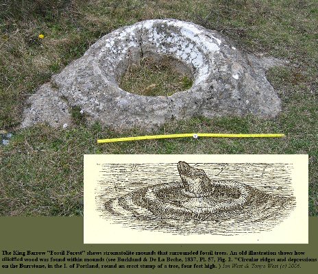
Very similar Purbeck dirt beds, fossil trees and thrombolites occur on the Isle of Portland.

LOWER SOFT CAP -
Further West - Durdle Door
For details regarding the equivalent strata to the west of Lulworth Cove go to the
Durdle Door Webpage. Here is seen the western limit not of the Soft Cap, as such, but of the forest with trees on the Dorset mainland. Note that this is upper fossil forest, and trees of the lower fossil forest occur commonly north of Weymouth, but these are in the Hard Cap, not in the Soft cap.
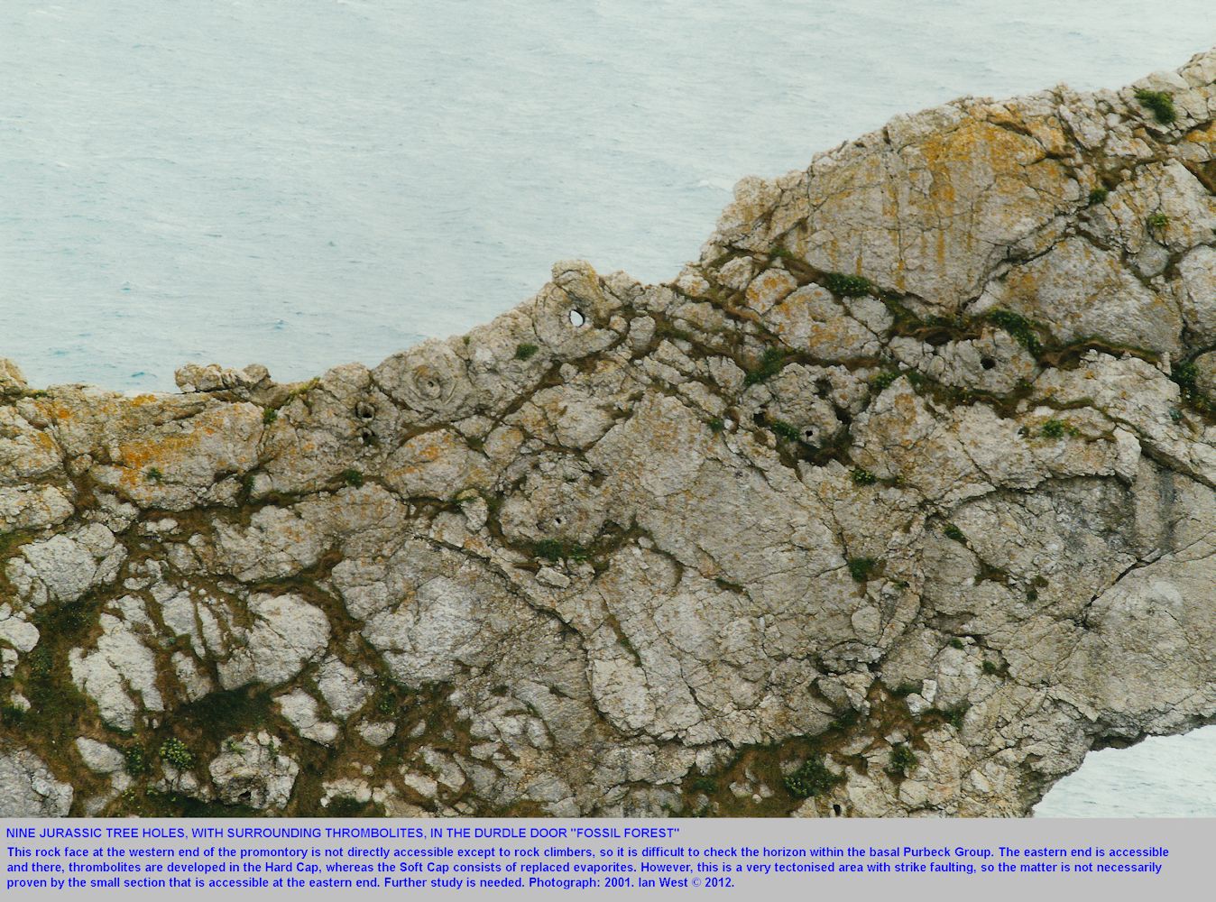
At Durdle Door the tree moulds are of small size, in several cases only about 0.3m or less in diameter. This is a less well-developed part of the forest, probably because the Great Dirt Bed was not uplifted so high above lagoon level. Small diameter tree moulds are reminiscent of the lower fossil forest on the Isle of Portland, i.e. that of Hard Cap (above the less-well developed Lower Dirt Bed).
.
.

LOWER SOFT CAP continued:
Microbial Domes or Thrombolites around Trees - Cross Sections

THE LOWER SOFT CAP continued:
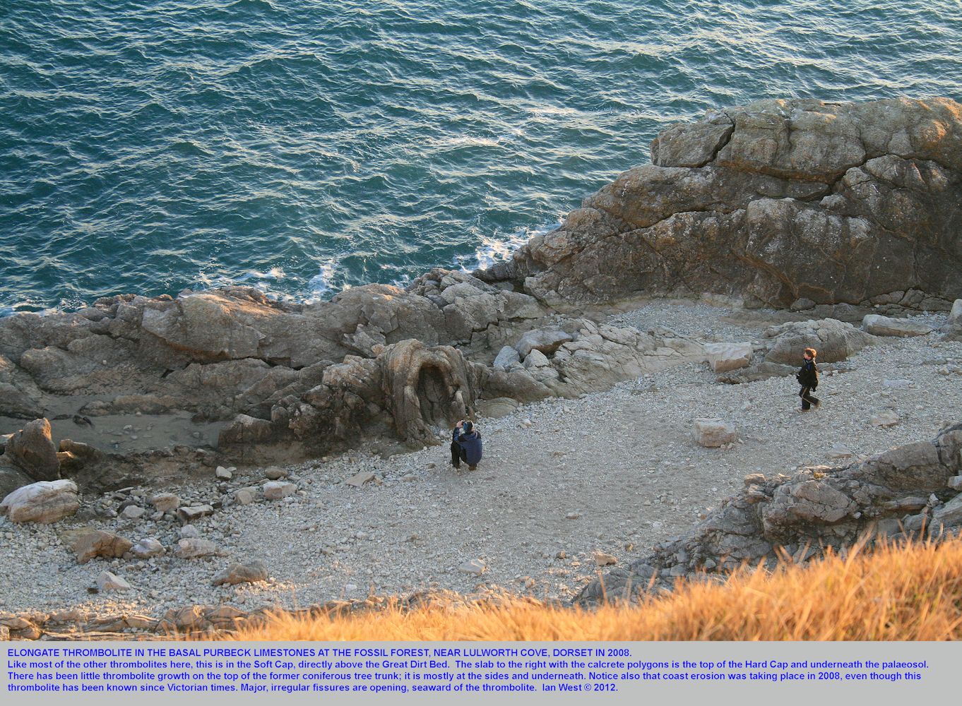
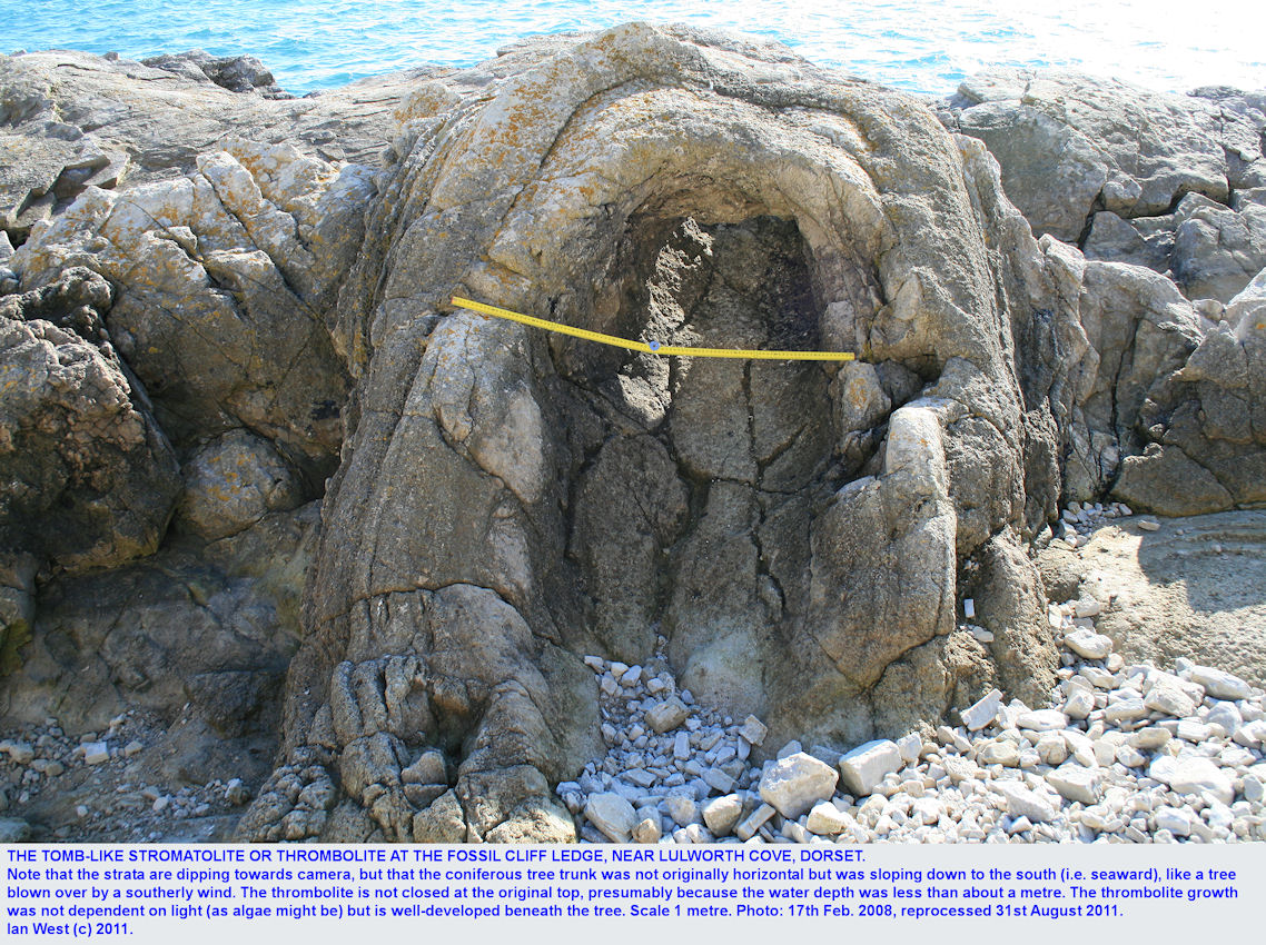
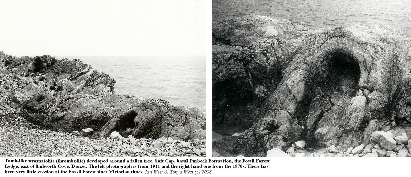
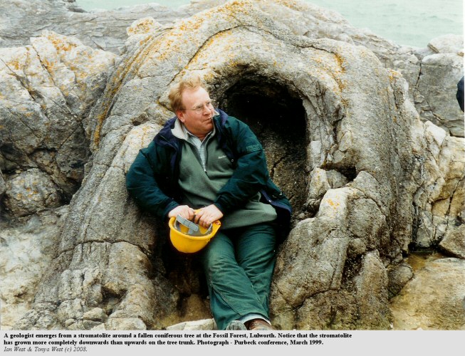
Thrombolites - Elongate on Fallen Trees (bedding parallel)
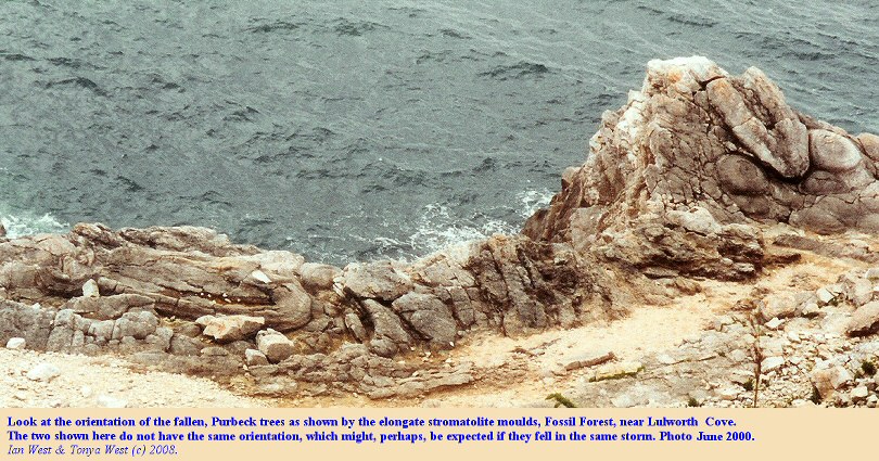
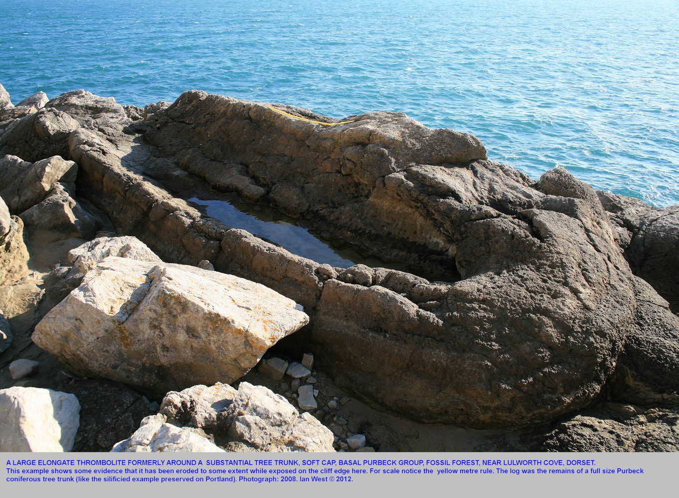
The fallen, almost flat-lying, trees have elongate thrombolites developed around the location of the trunk. The orientation of these is not parallel. Thus the tree trunks do not seem to have been blown down in the same direction in the same storm.

THE LOWER SOFT CAP continued:
Thrombolites - elongate (bedding parallel) in cross section
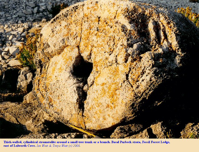
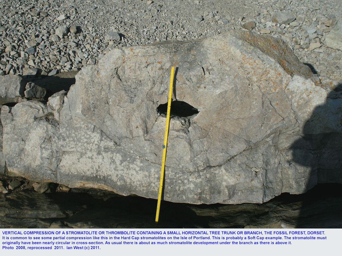
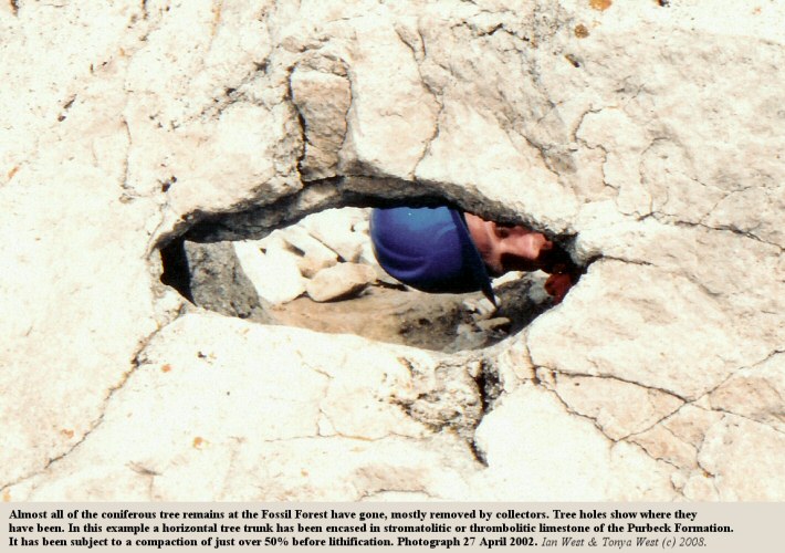
Notice that horizontal or subhorizontal trunks or branches are often compacted by about a quarter to a half (the two photographs above are of the same specimen at different years). The thrombolite around shows about the same amount of compaction. This extent of compaction is compatible with an overburden of probably not more than 10 or 20m. Thus firm cementation took place quite early.
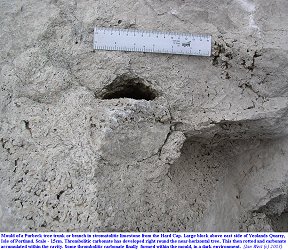
More common on the Isle of Portland is partial and later filling of tree moulds. This is sometimes seen in Hard Cap examples. The filling is at least in part of thrombolite type. This suggests very early decomposition of the wood and early, partial fill.

THROMBOLITES continued:
Analogous Thrombolites in the Lower Fossil Forest at Portesham Rocket Quarry
Go to:
Portesham Rocket Quarry webpage, to see analogous thrombolites that have formed in the Hard Cap (lower than the Soft Cap thrombolites of the Fossil Forest). A notable example is an elongate thrombolite with rings on the periphery. This was once known as the "Fossil Elephant" and is still a notable feature of Portesham Quarry, north of Weymouth.
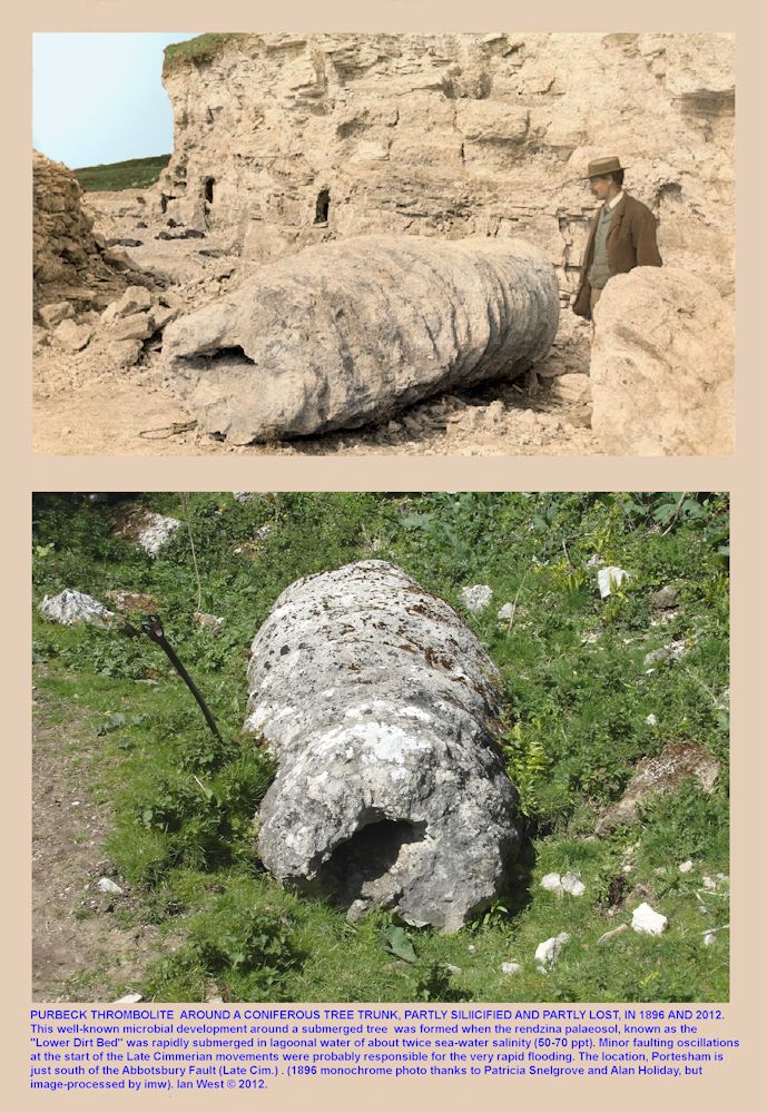
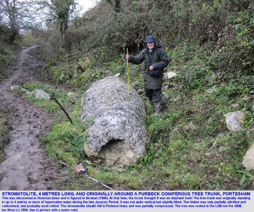
Thrombolitic [i.e. not laminated as in the case of stromatolitic] limestone occurs around a mould of a coniferous tree. There is no doubt that this was a tree because Strahan (1898) has recorded silicified wood within it. In addition a silicified trunk has been found nearby at the time of quarrying. Silicified trunks and moulds occur commonly on the Isle of Portland and at the Fossil Forest Lulworth, although they are best developed there above the Great Dirt Bed, and not so well-developed at the Lower Dirt Bed level.
The thrombolitic coating is thickened in a series of encircling rings occurring at intervals of about 15 cm. The regularity and orientation of these suggests that the tree was standing vertically in water at the time of their formation. A depth of about 4�6 m. is implied by the length of the algal sheath.
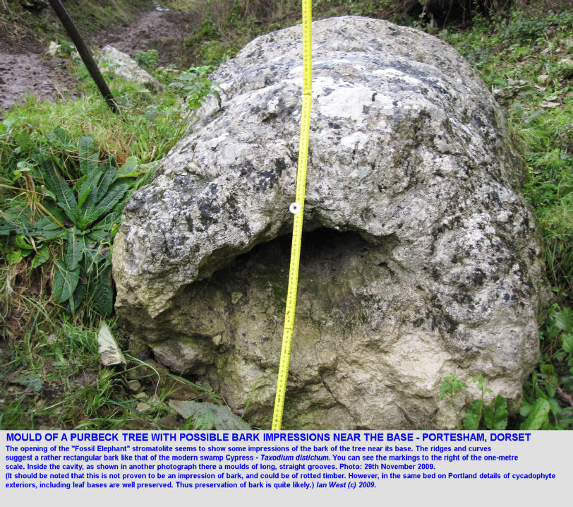
The basal part of the now-missing fossil tree has left an impression in the thrombolitic ("stromatolitic") limestone. This could be just an impression or rotted timber, but it appears more likely that it is the mould of part of the bark of the tree. If this was a bark mould, then the bark seems to resemble the bark of a swamp Cypress tree, like the modern Taxodium distichum.
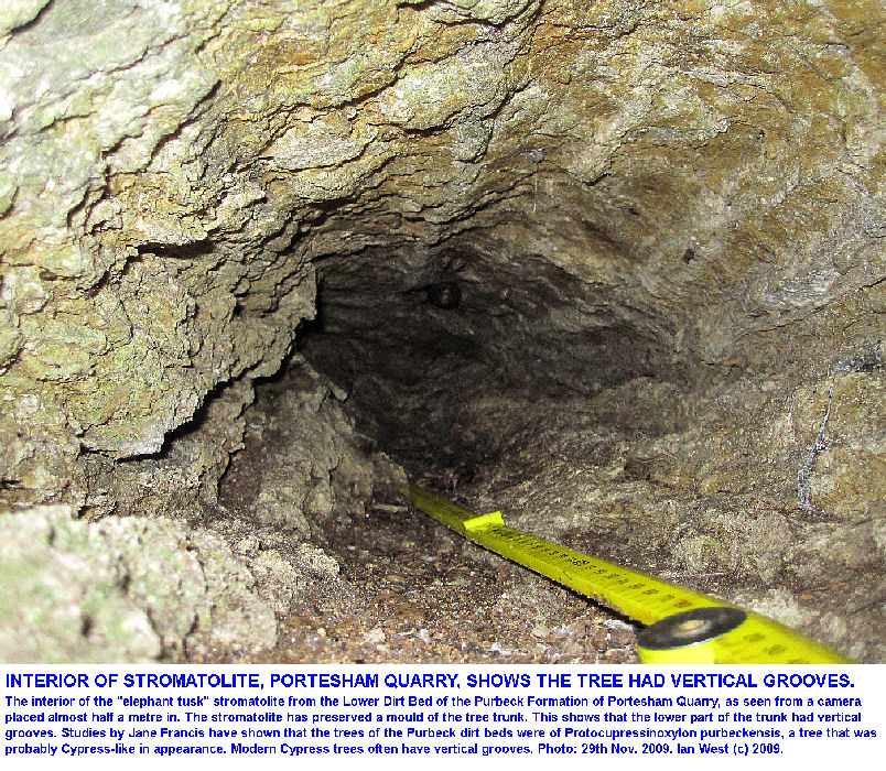
Further in the interior of the mould can be examined. This is shown in the photograph above. It can be seen that the tree trunk had well-defined straight grooves (the twisting of the trunk as shown on some reconstructions of Purbeck trees is just artistic licence by the artist). Straight grooves are common on various modern trees, including Cypress trees. Purbeck fossil trees have been described as Cupressinoxlyon ("proto - Cypress wood") by Professor Jane Francis. It is not known whether this particular tree was of Cupressinoxylon type. Araucaria-type debris is known from the Portesham Charophyte chert a little higher in the succession, and it seems likely that both Cypress-type and Araucaria-type trees were present in Purbeck environments. Whether anything resembling the Swamp Cypress existed there is not known. There was a swamp with horsetails (remains in the Portesham Charophyte Chert), and there was a freshwater lake at times. There are still so much unknown about Purbeck environments.

THE LOWER SOFT CAP continued:
Origin of the Thrombolites
The association of the Purbeck thrombolites with traces of evaporites and the general association with evaporitic strata above (the main Purbeck anhydrite bed) suggests that they originated in a hypersaline lake or lagoon. There are no freshwater gastropods associated and the salinity was generally too high for much fauna at all (although there are some worm tubes). See the discussion about facies at the Fossil Forest. No thrombolites or stromatolites are known in the Purbeck Formation in association with the freshwater facies which are common higher in the Formation (Cherty Freshwater Member etc). They do occur in association with another higher sequence of evaporites, the Soft Cockle Gypsum (probably anhydrite underground). These thrombolites are more isolated in an argillaceous sequence. Although the Victorian geologists did not understand the thrombolites, and thought that they were some form of "tufa", since the 1960s they have been known to be of hypersaline origin (see papers of
West (1963,1964,1975 etc).
As shown above, the major comparison is with the remarkable thrombolites of Lake Thetis in Western Australia. This is a hypersaline lake environment that provides a superb modern analogue. There is little doubt that is the model for the environment, although the modern example at Lake Thetis is on a small scale compared to the late Jurassic development of the Purbeck Formation, discussed here.
Minor Comparison
Very small stromatolites growing at the present day on an old steel drum that has sunk into a soft sabkha with hypersaline brines at Umm Said, Qatar. A hard or raised surface for attachment seems favourable for stromatolite growth. Similarly the tree stumps submerged in the Purbeck hypersaline lake have provided attachment areas on which stromatolites or thrombolites developed.
(For a charophyte mystery concerning the Soft Cap see the charophyte section of the Purbeck Facies and Palaeoenvironments Webpage.)

STROMATOLITES (true stromatolites - laminated)
Microbial Mat Type of Stromatolites
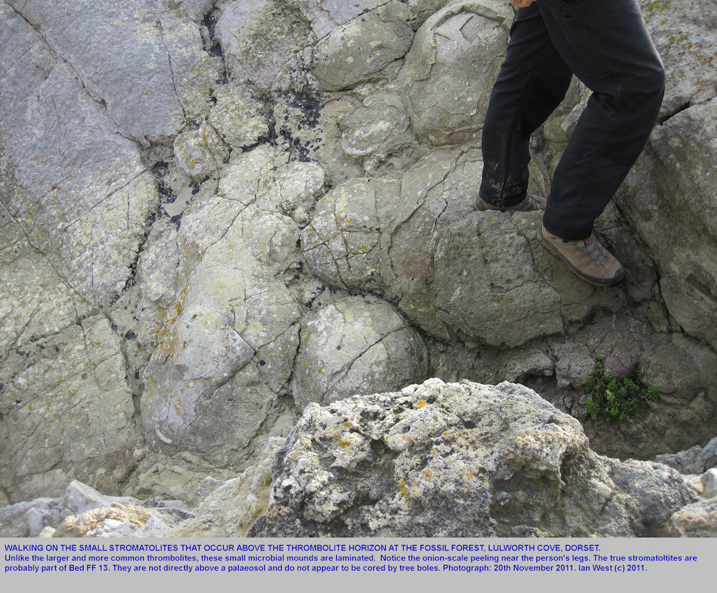
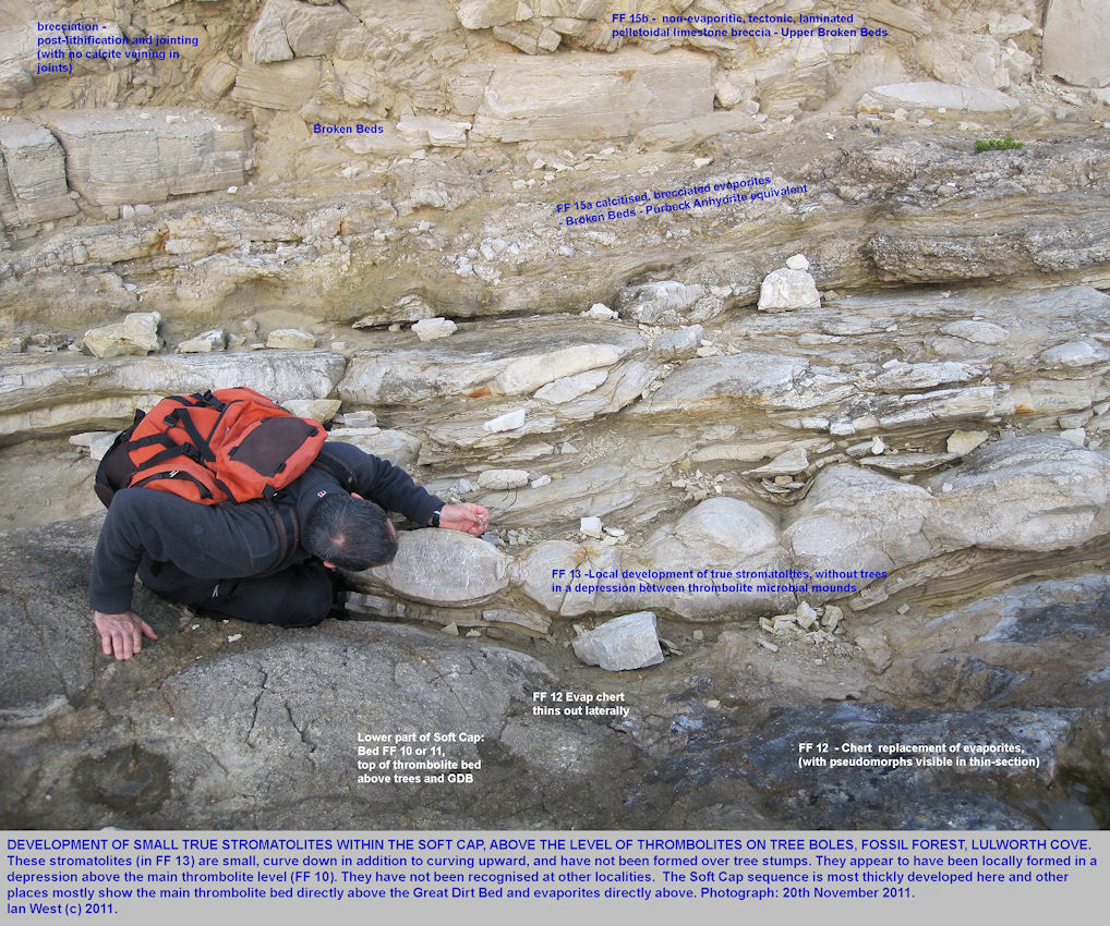
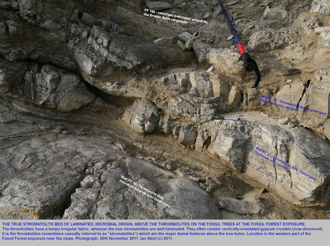
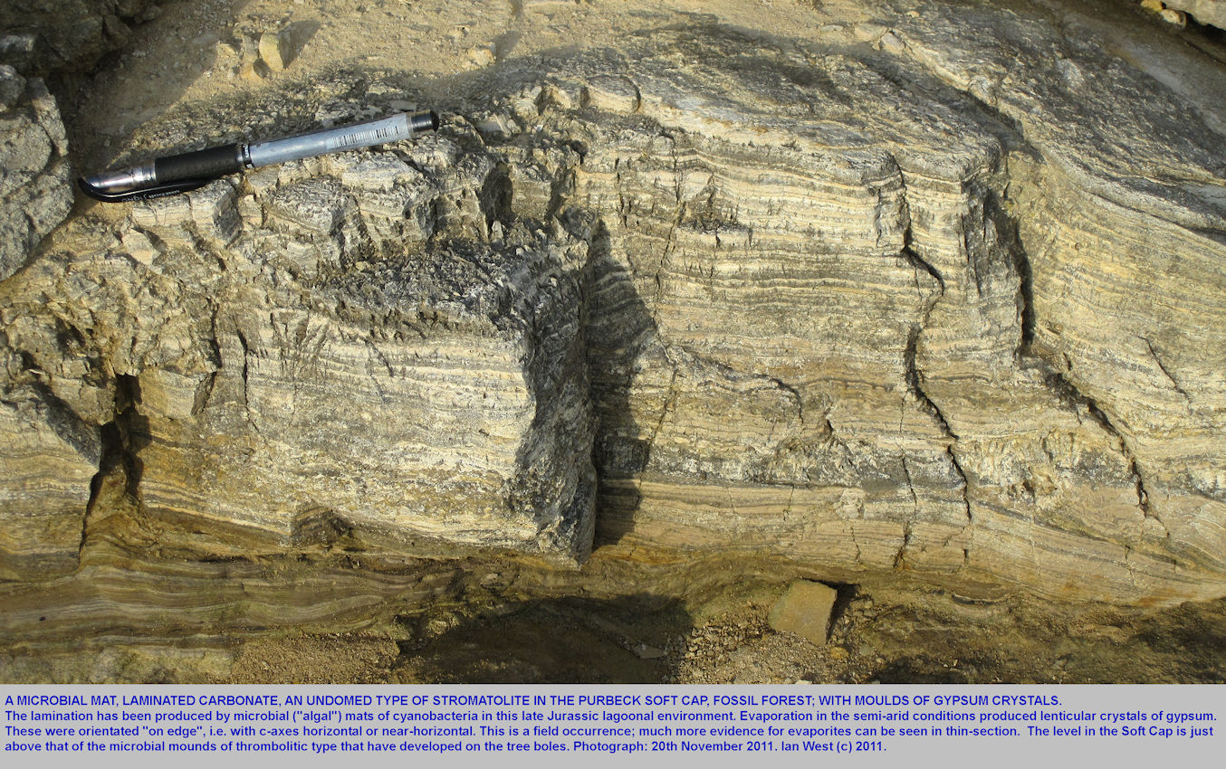
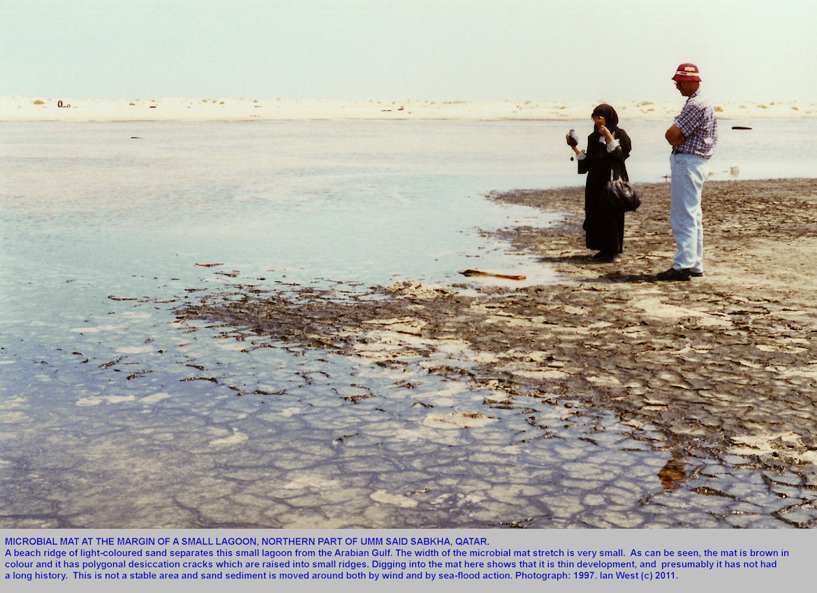
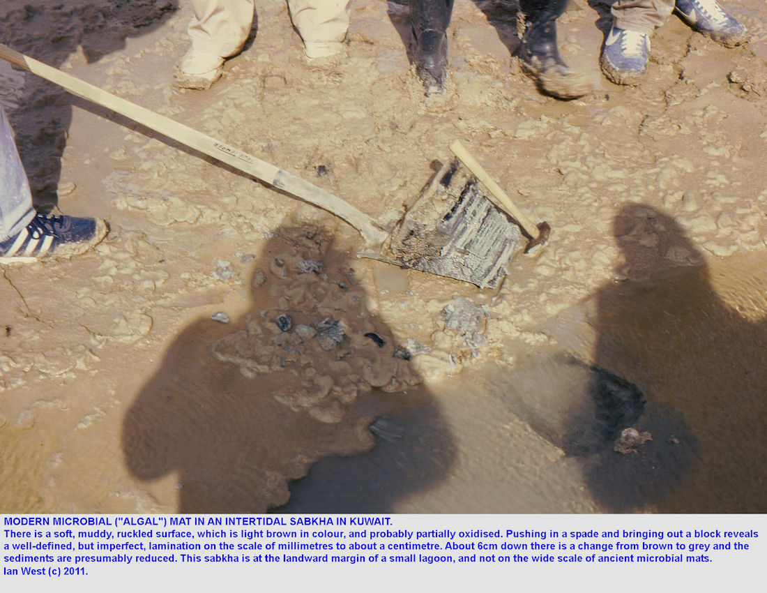
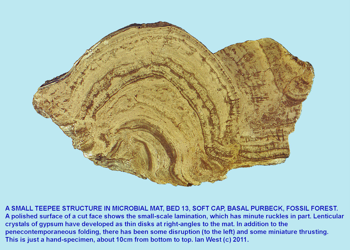
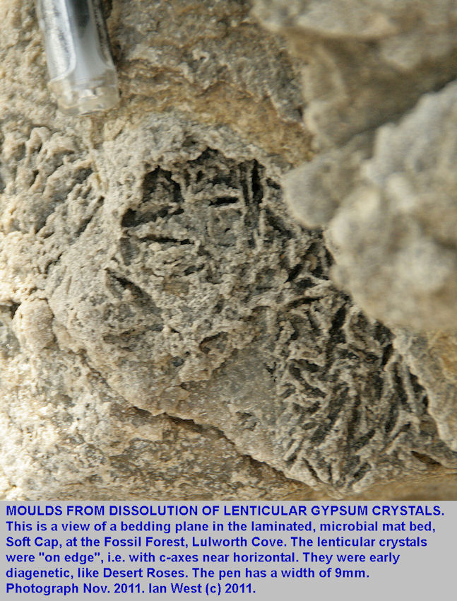
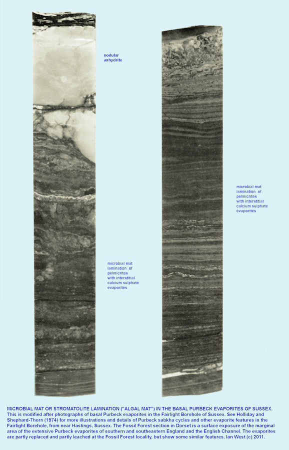
Although the Fossil Forest Ledge which exposes the basal Purbeck strata has long been known for its microbial mounds, the relationship of thrombolite and true stromatolites has not been clearly expressed. The mounds over trees, the most well-known features have been referred in past years in general terms as "stromatolites" (e.g. West, 1975) because of general, overall morphological similarity to the stromatolites of Shark Bay, Western Australia. In fact, they are generally thrombolites with a lumpy and irregular fabric, with only crude lamination. It is actually above this level in Bed FF 13 of West (1975) that true, well-laminated stromatolites occur. They are smaller than the metre-large microbial mounds over the trees and often only about 30cm or so in diameter. They are best seen at the eastern end of the Fossil Forest Ledge. They often contain lenticular gypsum crystals that are "on edge", i.e. with the plane of flattening vertical and the c-axis near-horizontal. There is other close association with evaporites. The main Basal Purbeck evaporite horizon, the "Broken Beds" with brecciated and calcitised evaporites is just above. This is the fringe, coastal equivalent of the much thick Purbeck Anhydrite of the English Channel Inversion, the Isle of Wight area, and the extensive Weald Basin. It is worked economically for gypsum at Brightling and Mountfield in Sussex. There is no question that the true stromatolites of the basal Purbeck originated in very hypersaline conditions (in West's, 1975, Facies C), even more so that the thrombolites (in West's, 1975, Facies B) with salinities near 124 parts per thousand (at the boundary of gypsum precipitation).

THE PURBECK GYPSUM AND ANHYDRITE EVAPORITES
THE EVAPORITIC, UPPER SOFT CAP:
Evaporites - Gypsum, Anhydrite, Flowage and Calcitisation.
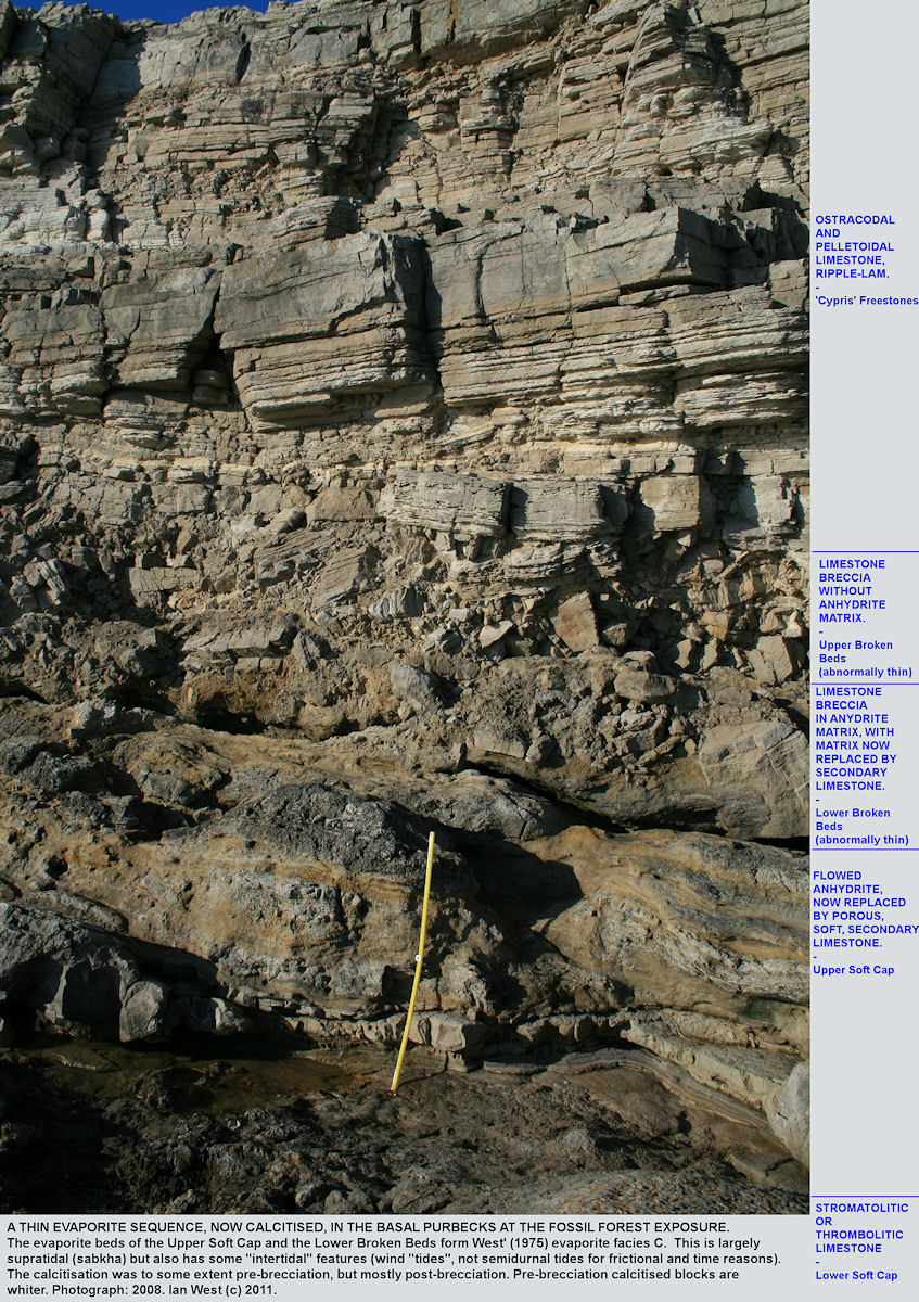
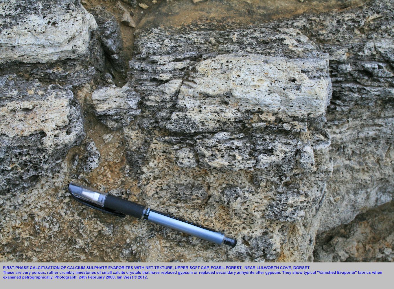
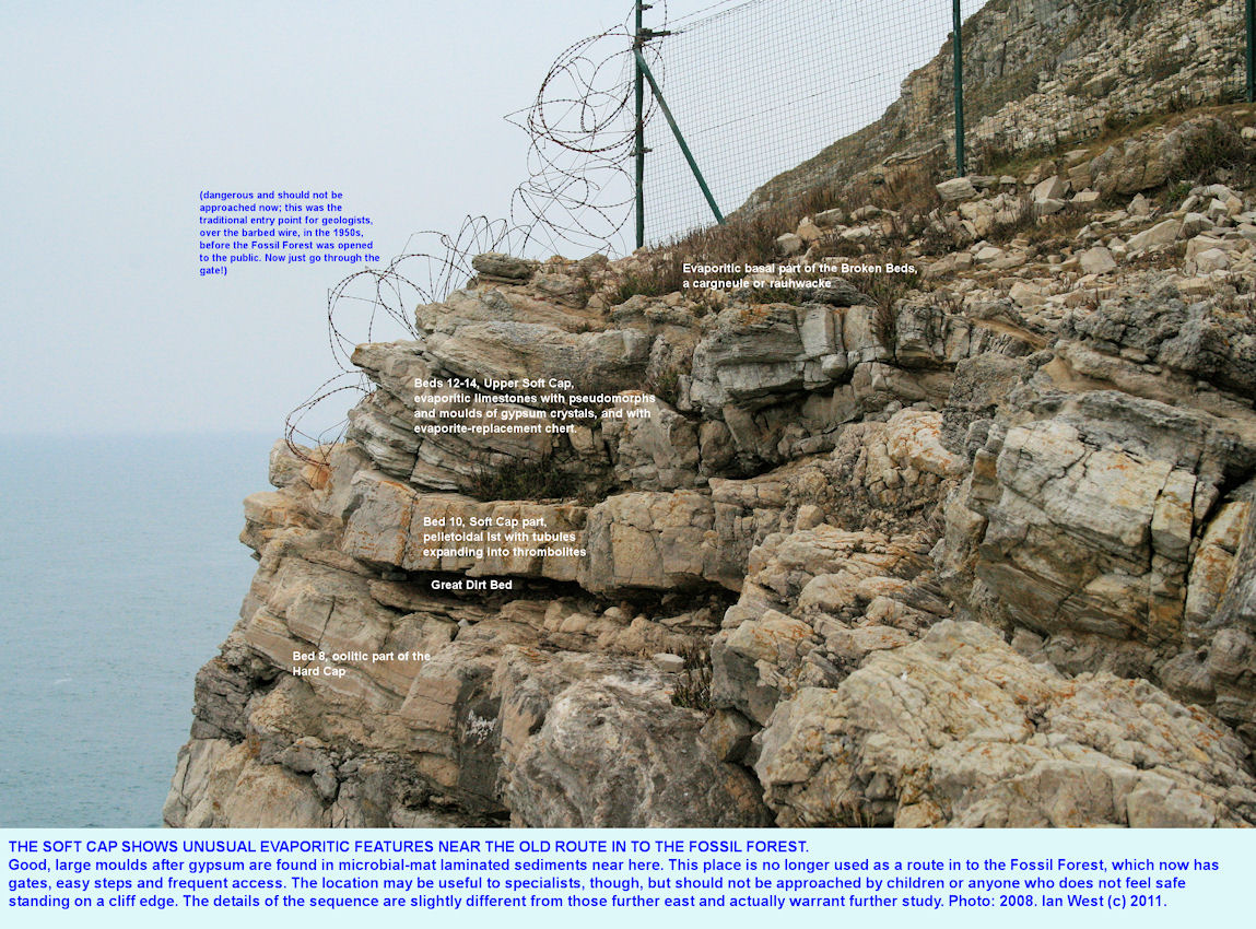
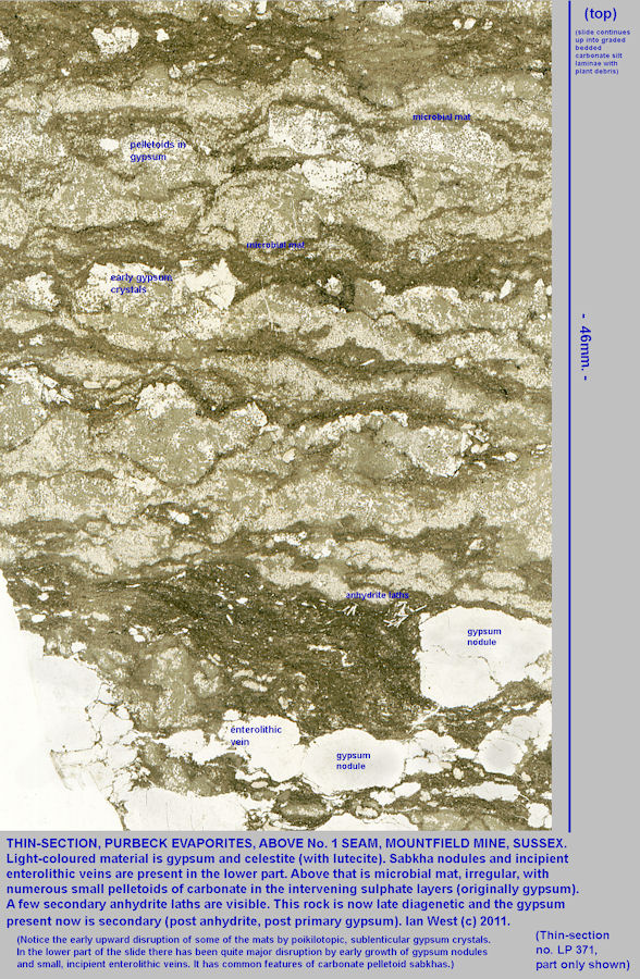
Evaporites are very obvious in the upper part of the Soft Cap, particularly in thin-section. Some large gypsum moulds, on-edge in orientation (i.e. with c-axes horizontal) can be seen in a laminated limestone near the barbed wire at the cliff edge at the western limit of the Fossil Forest. The bed can be followed out of the Fossil Forest ledge towards Potters Hole, and further search can be made in the cliffs there. However, note that this is a dangerous area above vertical cliffs of Portland Stone.
Gypsum is readily replaced by calcite and by silica. Halite is rather easily dissolved. Its former abundance here is liable to be underestimated. The best pseudomorphs actually occur in the Cypris Freestone Member, above the Broken Beds. It is very likely though, that the gypsum crystal relics were associated with some halite, as in modern environments, such as northern Egypt and elsewhere.
No evidence is known, at present though of any thick beds of halite in the Purbeck Formation, such as occur in the Trias of Devon. Beds of anhydrite have been reported in boreholes, but beds of halite have not. Halite crystals occur at the level of the
dinosaur footprints in Lower Purbeck strata of the Isle of Portland. The horizon, the Hard Cockle Member is higher than the Caps and Broken Beds at the Fossil Forest.
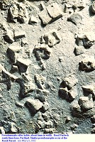
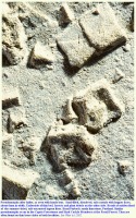
The lagoon floor and particularly its western margins here dried out from time to time. The last relics of brine evaporated to produce a white crust of halite crystals. These crystals displaced the underlying carbonate mud. Late in the summer there were phases when the dried-up lagoon flooded again, perhaps as a result of the first major rains or because winds from the east backed up the lagoon waters and blew them over this marginal area. The flooding quickly dissolved the salt and filled the moulds of the crystals with a mixture of carbonate sand and some quartz sand. Thus were formed the pseudomorphs shown in the photograph. Insects and fine plant debris has been washed over flats and is preserved because it settled on the top, the other side, of the sandy lamina. Some pseudomorphs at the Fossil Forest have a fill of faecal pellets rather than quartz and carbonate sand.
(See other sections of this webpage for the diagenetic sequence involving change from gypsum to anhydrite, and with brecciation and calcitisation taking place. This is not fully explained in this part, but is shown in diagenesis diagrams of Ian West.)
With a little imagination, we can to some extent reconstruct this environment. Here is a small branch of the great lagoon beginning to dry out as seen from a hill on the Wytch Farm High (an east-west axis which was uplifted in late Jurassic/early Cretaceous times because of the late Kimmerian movements). The view is southwestward. The main lagoon was actually very large and extended well over the horizon and for more than 200 km. The salt crust dissolves in the winter rains. Some Iguanodons have left trails of footprints across the salt flats.
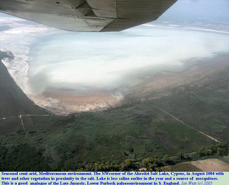
Comparison, is made again with a modern salt lake at Akrotiri, Cyprus, drying only in summer.

UPPER SOFT CAP
More Details - Thrombolite - Evaporite Relationships
The relationship between the evaporites of the Upper Soft Cap and the thrombolites beneath is of interest. This is a topic which requires further study, and the initial interpretation is not proven, and might not necessarily be correct.
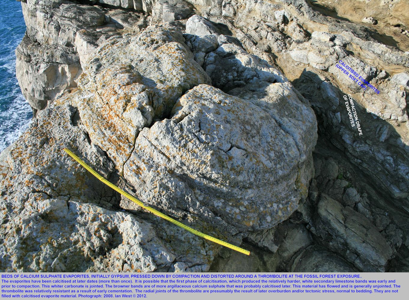
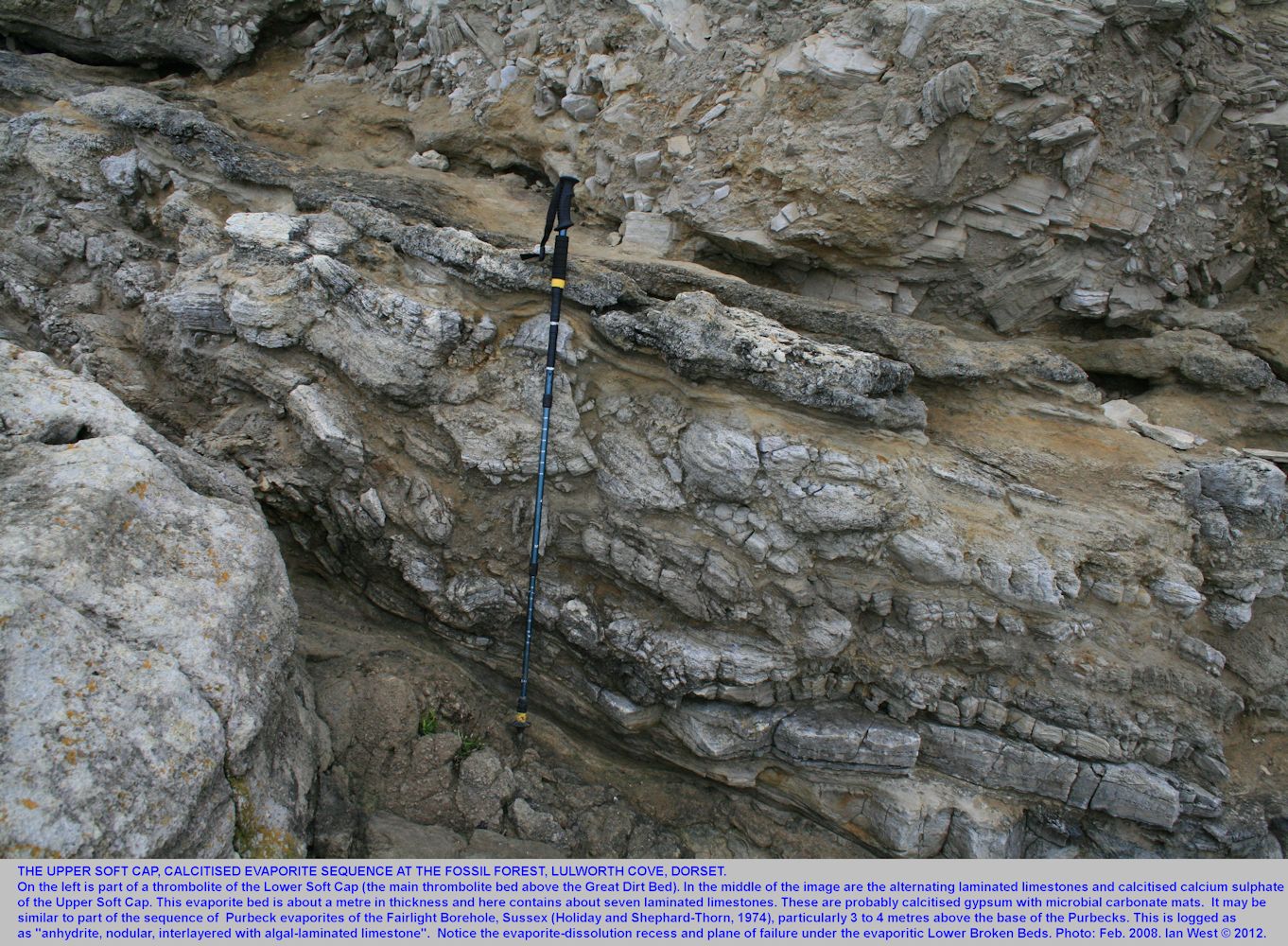
At the Fossil Forest exposure an interesting relationship can be seen between the calcitised evaporites (calcium sulphate, gypsum to anhydrite) and a thrombolite. The evaporites seem to have been distorted around the thrombolite.

BROKEN BEDS - THE CARBONATE-EVAPORITE CARGNEULE (BRECCIA)
General
See also:
Broken Beds at Lulworth Cove.
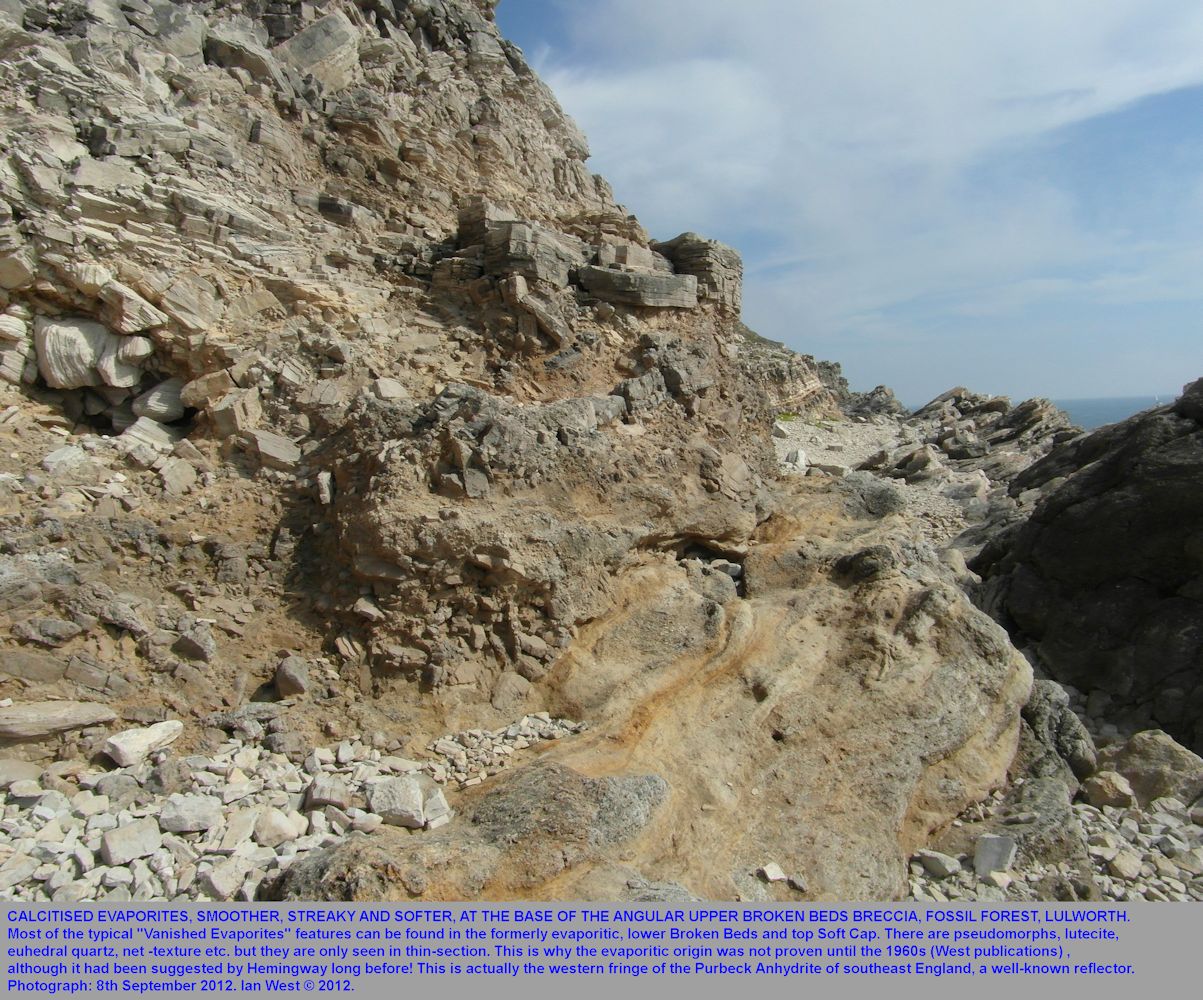
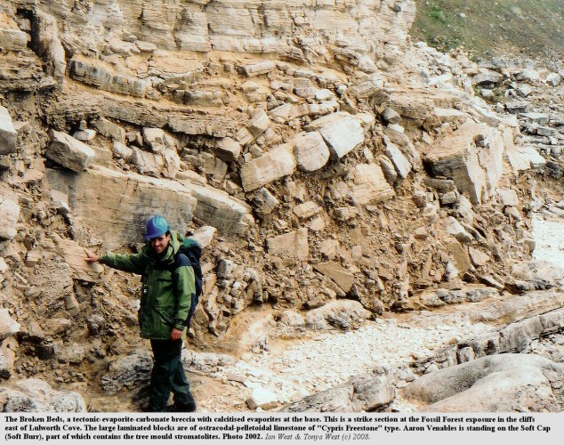
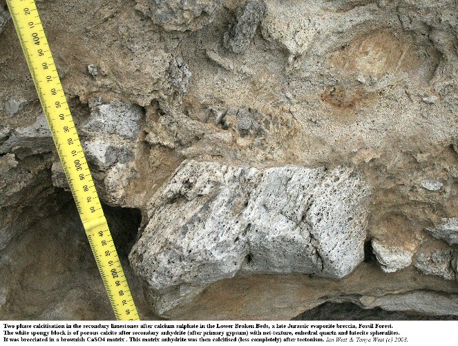
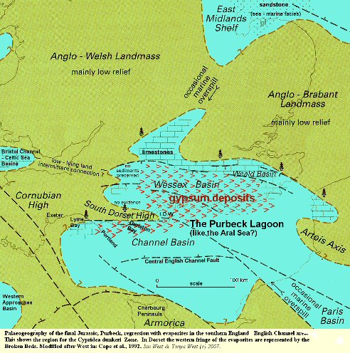
The "Broken Beds" is an old traditional name for a peculiar limestone breccia which puzzled many geologists before it was studied microscopically and geochemically. It extends eastwards from here to Durlston Bay, Swanage, where it is thickest and westward to Durldle Door where it is very thin.
This breccia has a simple explanation, although it is complicated in detail. It is actually a rauhwacke or cargneule of carbonate-evaporite type. It does not look at first sight like the cargneules of the Pyrenees or Alps but this is because it is not in Permo-Triassic red bed facies. Like them, though, it contains euhedral quartz crystals but they are mostly microscopic and not an obvious field indicator. In places it is strontium-rich and it contains celestite at Durlston Head (with calciostrontianite). Small quantities of celestite occurs beneath it in the Soft Cap at Stair Hole. Celestite is also present in the Caps at Worbarrow Tout.
Much of the lower part of the breccia and the upper part of the underlying Soft Cap consists of clasts and matrix of very porous limestone, often soft and sandy in appearance (but certainly not with quartz sand!). This is calcitised anhydrite, an unusual type of limestone produced when calcium sulphate is changed to calcium carbonate and any remaining sulphate dissolved .
This lower part of the breccia (and the bed immediately beneath) originally consisted of beds of gypsum, deposited in a hypersaline lagoon. These evaporites of calcium sulphate occur in boreholes in the Isle of Wight and southeast England at this horizon as anhydrite (calcium sulphate without water of crystallisation). They come close to the surface near Mountfield and Brightling in the Weald of Sussex where they are changed by groundwater to secondary gypsum (calcium sulphate with water of crystallisation) and are mined to make plaster of Paris and plaster-board. There are special reasons (perhaps you can think of some) why here, at the Fossil Forest the calcium sulphate has been replaced by limestone.
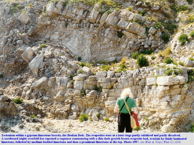
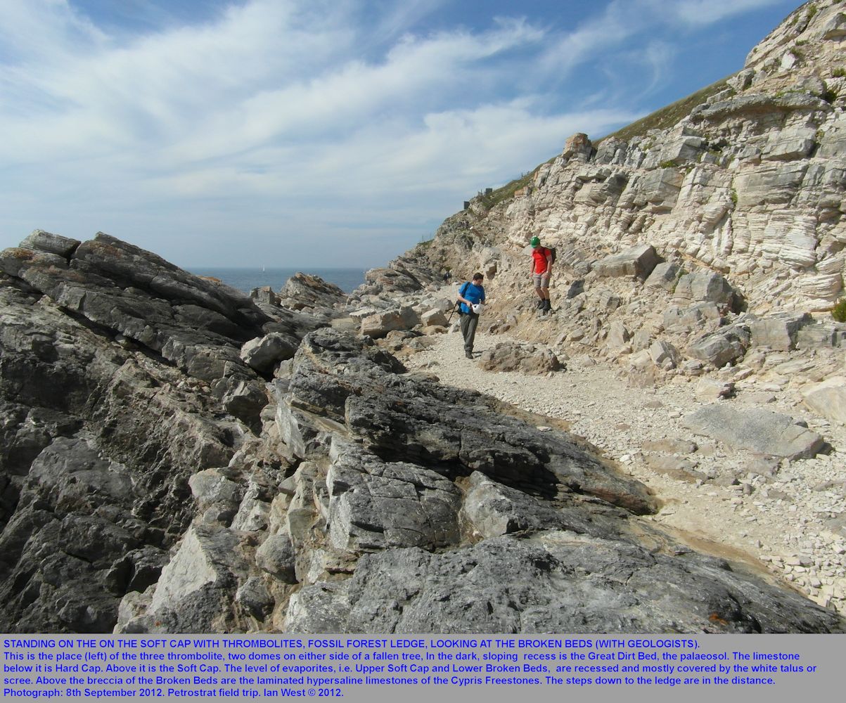
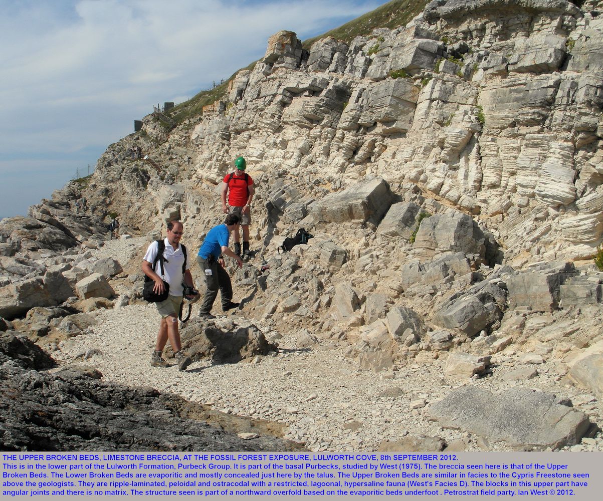
The upper and thicker part of the breccia consists of angular blocks of pelletoidal limestone with numerous small shells of ostracods (the Cypris Freestone facies). The strata have been laterally displaced northward, folded with small overfolds and fragmented into a breccia by tectonic action. The ductile evaporites provided a plane of weakness and the overlying brittle limestone has become involved in the movement. The date of the tectonism could have been Alpine (Tertiary - compressive) or Late Kimmerian (Cretaceous - extensional). Association with extensional faulting in the Isle of Purbeck points towards a Late Kimmerian date.

STRATIGRAPHY:
Broken Beds - Cargneule, Tectonic Evaporite Breccia - Sedimentology

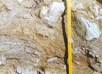
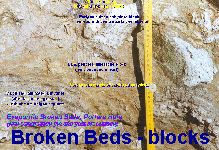
The images here show the evaporitic part of the Broken Beds has calcitised anhydrite both as blocks and as matrix.
Under the microscope here there is abundant lutecite chalcedony, a common feature of evaporites, and there are also pseudomorphs after anhydrite. Some microscopic euhedral quartz occurs.
This anhydrite was a replacement, under burial, of primary gypsum and excellent pseudomorphs of the original lenticular gypsum crystals are preserved in chert nodules which are present in this lower evaporite part of the breccia. In places there are some macroscopically visible moulds left by lenticular crystals of gypsum with the planes of flattening vertical. (These are in the Soft Cap near the outer cliff edge at the extreme eastern end of the Fossil Forest section). A little celestite (in nodules of about a cm across) , which is an insoluble diagenetic product and residue of evaporites, occurs in places in the Soft Cap of the Lulworth region (at Stair Hole - again in a place not recommended for safety reasons!). It is much better to see this where it is well-developed in the Broken Beds at Durlston Head, Swanage.
An interesting aspect of the Broken Beds is that the chert here is, as mentioned above, a replacement of primary gypsum. Further east, near Swanage, it is a replacement of anhydrite. A possible explanation for this is that the chert formed at about the same time during early burial when the calcium sulphate here was still gypsum (West, 1964). Further east anhydritisation probably commenced at this time because the area was away from the shelf (Lulworth area) and into the basin (Swanage area). Such a process has been described in the Miocene of southern Poland (Kasprzyk and Orti, 1997) and has been attributed to the probable occurrence of higher salinity pore fluids in the basin centre.
The evaporites of the Broken Beds (and the Soft Cap beneath) originated in the hypersaline lagoon that "pickled" the dead Purbeck trees before they could rot completely. Silicification of the initially carbonaceous submerged forest was probably largely the result of high pH conditions in lagoon water at times (silica is very soluble at high pH and the tree stumps would have provided locally lower pH conditions suitable for precipitation. The silicified tree remains weather to a pale colour but are actually more carbonaceous and, to some extent, more sulphurous than they look. They can be black when sawn through)
The upper part is a breccia of angular joint-bounded limestone blocks without any substantial relics of evaporites. Notice the absence of matrix in this part. Much of this consists of ripple-laminated ostracodal pelsparites and is similar to the "Cypris" Freestones Member above. The fauna suggests an origin in moderately hypersaline lagoon water, perhaps about twice the salinity of seawater (no accurate estimate is possible because of the summer to winter variation salinity variations in the seasonal Purbeck climate).
The brecciation was not simple collapse over evaporite, although some collapse may have occurred. It is mostly tectonic with small folds which have east-west axes and vergence towards the north. There are two possible dates for the tectonic brecciation at this plane of weakness produced by the evaporites. Tectonism occurred in the mid-Cretaceous (Late Cimmerian or Kimmerian) and in the Tertiary (Alpine). It is has not yet been firmly proven as to which phase was responsible and different authors have had different theories. The the reason for the northward movement of the overlying strata (as shown by the small folds) is also disputable.
Although the Broken Beds are a type of cargneules or rauhwackes, like those frequently associated with thrusting in the Alps and Pyrenees and elsewhere, they are different in certain respects. This particular breccia is not dolomitised and does not have associated red marl.
.
The Broken Beds are monomict cargneules(West, 1964; 1975; Warrak, 1974), at least in their lower part. Calcitisation at this particular locality is probably by meteoric water (Quest, 1985) although hydrocarbons were involved further east. Some collapse may have occurred in addition to tectonism but it seems to have been on a limited scale. Thus the breccia is not referred to as a collapse breccia.

Broken Beds and Soft Cap Evaporite
Petrography - Pseudomorphs after Lenticular Crystals of Gypsum
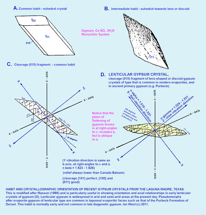
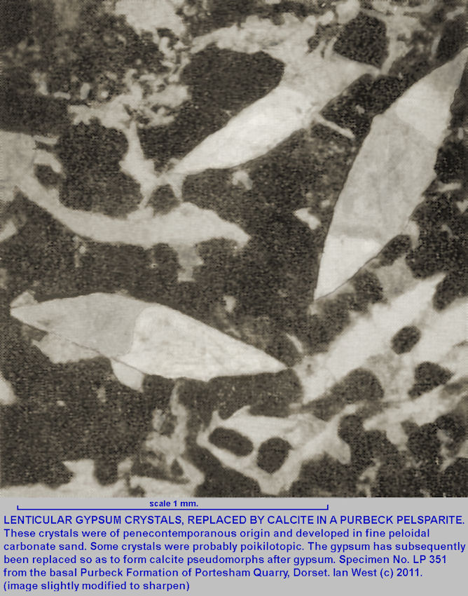
Early or penecontemporaneous crystals of gypsum are very commonly lenticular in form. Later, diagenetic gypsum is rarely so. The early lenticular gypsum is often replaced and present at lutecite pseudomorphs after gypsum, calcite pseudomorphs after gypsum or celestite pseudomorphs after gypsum. This a major part of the common evidence for "Vanished Evaporites". Such pseudomorphs are abundant in the Lower Purbeck Formation of Dorset, but are not normally visible in the field. Thin-section petrography is needed.
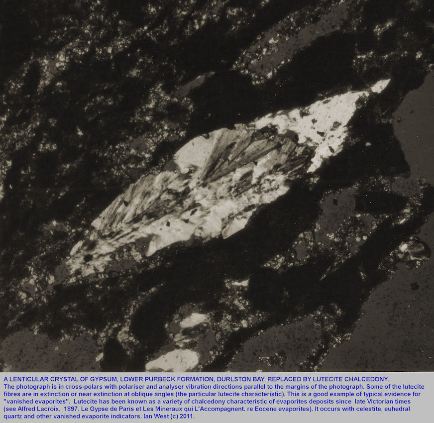
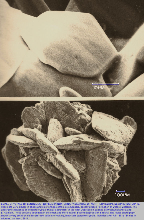
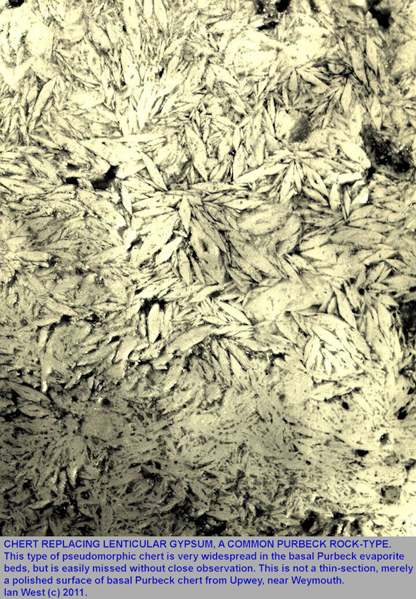
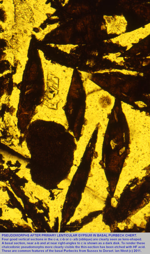
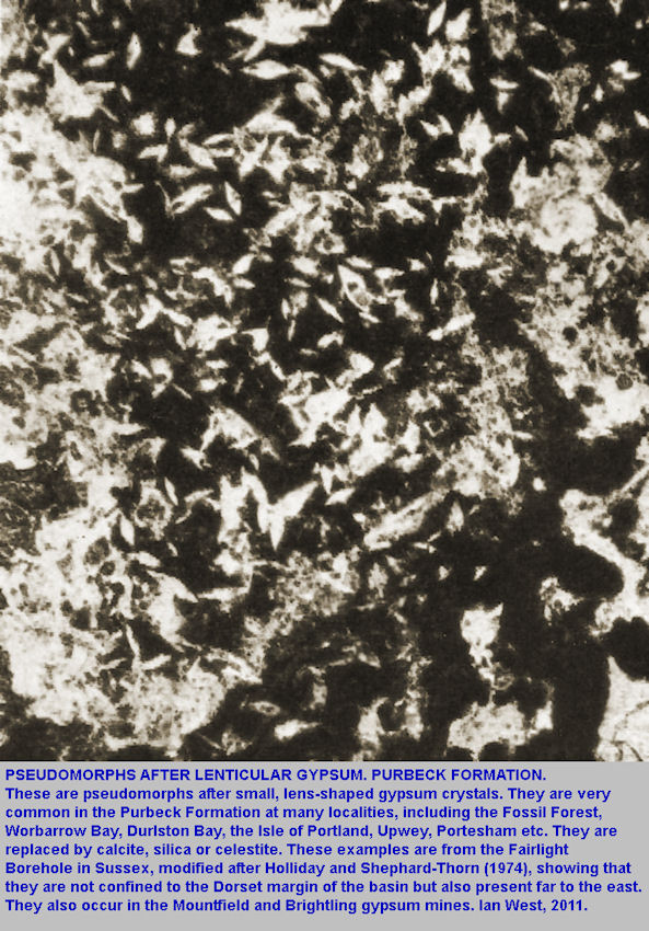
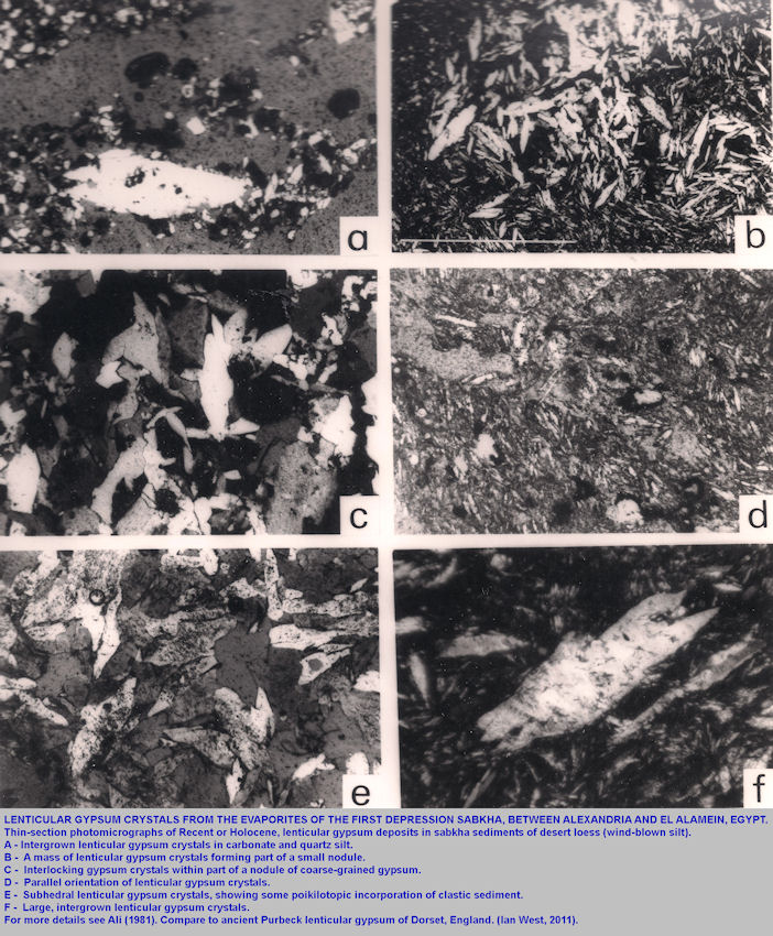
The most notable feature of the early or primary Purbeck calcium sulphate is that it was in the form of lenticular gypsum, as is abundant at the present day in the sabkhas of Northern Egypt (see for example Ali (1981). Pseudomorphs of calcite, chalcedony (particularly lutecite) celestite after such gypsum are very common. In most cases they are too small to see without a microscope so they are ofen misssed by field geologists. Some illustrations are shown above. The pseudomorphs after lenticular gypsum occur at most localities in Dorset where the Lower Purbeck Formation is exposed, and this includes the Fossil Forest Ledge. They are to be found in the lower part of the Broken Beds and in the Soft Cap. They occur again in some abundance around the levels of the Soft Cockle gypsum at Worbarrow Bay and Durlston Bay, higher in the Lower Purbeck. They are rarely found above the Mammal Bed (base of the Middle Purbecks) because of the well-known change to a rather wetter climate.
The Purbeck evaporite are dominantly calcium sulphate and the Stage 1 (of West's (1964) diagenetic scheme was broadly similar to that of the Eocene gypsum of Paris. This French gypsum is notable for lenticular gypsum crystals and they have been very well described in the the classic work of
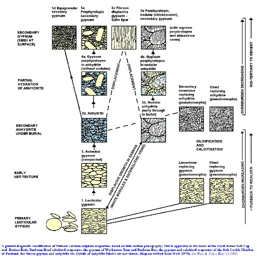
Alred Lacroix (1897) on La Gypse de Paris et Les Mineraux qui l'Accompagnent. It is interesting the French gypsum has survived largely unchanged for about 40 million years. The Purbeck gypsum, about 100 million years older, has undergone diagenesis from primary gypsum to secondary anhydrite, and, at the surface, back to gypsum again but of secondary type (largely anhedral and with negligible porosity.
The sequence of diagenetic stages West's (1964) is fairly obvious (although there differing views on the details of the anhydrite stage). However, it is still not known at what date the Purbeck lenticular gypsum was converted under burial to anhydrite. Late Wealden (about Barremian) would be a reasonable guess.
The crystallography of the primary lenticular gypsum was probably similar to that in the modern deposits. An interpretation by Masson (1955) of the details of the habit and crystallography of Laguna Madre (Texas) lenticular gypsum is given above.

Upper Broken Beds
Brecciation
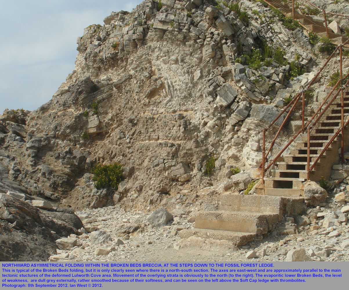
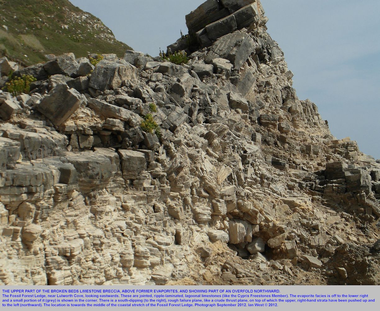
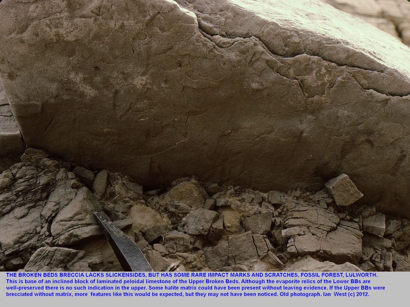
The brecciation of the Upper Broken Beds (upper part of the Broken Beds without obvious evaporites) is clearly tectonically driven with movement towards the north. There are, as shown in photographs in this webpage, clearly defined overfolds in a northward direction. There is a general lack though of calcite veins on joints and slickensides are not normally seen, in spite of a search for them. However, as shown in the associated photograph, there are impact marks and some short but broad scratches.

STRATIGRAPHY:
Cypris Freestones Member
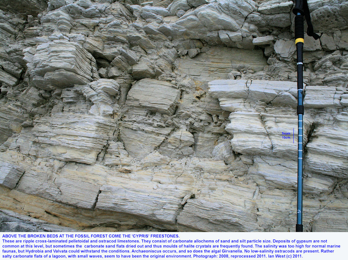
The 'Cypris' Freestone Member consists of very laminated buff, blocky limestone above the breccia of the Broken Beds. They are thus above the ledge of the Fossil Forest and in the back cliff, but not far up and quite accessible. Not all of these limestone are rich in ostracods, but some parts are. Look with a handlens for the small, bean-shaped ostracods (crustaceans).
In more technical terms this facies has been discussed by West (1975). The following notes are partly from this
Facies D - Limestones with Ostracods - 'Cypris' Freestones
The name has originated because these limestones are full of ostracods, referred to in early Victorian days as 'Cypris'. In fact they are very featuresless ostracods and difficult to identify. An important aspect is the low salinity ostracods, such as Cypridea (with beaks) and its relatives are generally absent in the 'Cypris' Freestones, because of the prevailing high palaeosalinity. The name "Freestone" applies because at some localities, mainly Upwey, some of this limestone has proved hard enough for building purposes, and can be cut in various directions (i.e. free-stone).
The facies D, discussed here largely corresponds to the the 'Cypris' Freestones, but not exactly. The upper part of the "Broken Beds" is of this facies, but the "Broken Beds" have been defined by the brecciation (tectonic and evaporite), not by the facies.
This facies consists of ripple-laminated limestones of pelletoids and ostracods. It contrasts strikingly with the underlying facies in its abundance of ostracods and relative lack of replaced gypsum. Normal marine faunas, such as those containing oysters and Corbula etc. do not occur, and neither (normally) do freshwater faunas with pondsnails such as Viviparus, Physa etc. The molluscs present are small euryhaline gastropds, Hydrobia and Valvata; these are not abundant.
The dominant rock types are ostracodal biosparites, intrasparites and pelletoidal limestones. Calcareous shales occur and in the western part of the Dorset outcrop there are some quiet-water oolite (i.e. lagoonal). The most common evidence of evaporites consists of occasional casts of small halite crystals, although these have been noted particularly near the base of the Hard Cockle Member, next above.

STRATIGRAPHY:
Hard Cockle Member

BROKEN BEDS continued:
Fish Remains in the Broken Beds
A small fish, Ichthyokentema purbeckensis, of a generally marine type but possibly adapted to hypersaline conditions has been found in the upper (moderately hypersaline) part of the Broken Beds (Griffith and Patterson, 1963) at the Fossil Forest locality and elsewhere. It seems to occur in the the hypersaline facies of the upper Broken Beds of West (1975).
This fish was only 6 to 7 cm in length and related to the marine fish genus Pholidophorus. The bones were found to be very abundant, several hundred specimens having been collected. Specific information on the horizon has been given by Griffith and Patterson: " At Lulworth there is a 0.15m (6 inches) band of yellow-brown, sandy limestone, darker in colour than the surrounding purer limestone, lying at about 1.91m (6 feet, 3 inches) below the top of the Broken Beds. 0.20m (8 inches) below this band there is a similar band, 3 to 5 inches thick. The fish were found in the 1.06m (3 feet, 6 inches) of limestone directly below this band. The specimens were collected from a single large block, about 3.05m (10 feet) long and 1.22m (4 feet) thick, lying immediately above the "fossil forest" where it is exposed in the cliff a quarter of a mile east of the mouth of Lulworth Cove. The bones were distributed through 1.06m (3 feet, 6 inches) of sediment and were common everywhere, though more abundant in and near the clay partings which occur irregularly in the rock. The fish remains are all disarticulated, only the neurocrania, mandibles and pectoral girdles being preserved reasonably
intact. Thought the bones lie scattered throughout the rock, they are perfectly preserved, and show no sign of rolling or abrasion. There are some signs that the bones have been water sorted, for while no specimen shows scattered remains of a single skeleton, it is common to find two or three nerurocrania lying close together with no other bones in their vicinity. The vast majority of the bones are of Ichthyokentema purbeckensis: we have parts of at least 50 neurocrania of this species. A few fragments of other fish are present.. Associated with the fish are fragmentary plant remains and abundant ostracods of the two species "Cypris" purbeckensis Forbes and Fabanella bononiensis (Jones) (equals Candona bononiensis), with the former more abundant.
These particular "griesly fish" did not, in fact, swim through the tree branches (fish remains are rare in the Soft Cap) but lived a little later in the moderately hypersaline lagoon. And unlike those of the Bishop of Dunkeld flooded forest they did not of course, shriek and yell so as to "fordeafit the heiring with their schouts"!

Cherty Freshwater Limestone Blocks
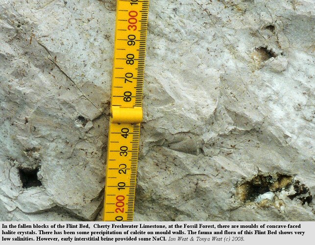
Fallen blocks of white micrite are conspicuous features of the Fossil Forest Ledge, especially in the central part. These are quite distinctive because they are not laminated but they do contain chert. They contain freshwater gastropods and sometimes charophyte remains. These blocks are from the Flint Bed of the Cherty Freshwater Limestone Member of the Middle Purbeck Formation.
They are interesting because the fauna and flora of the beds is of a very low salinity type. However, they usually contain moulds of halite crystals and, in some cases, silica pseudomorphs after halite. These are the relics of salt crystals that developed in the sediment soon after sedimentation. They show that the early interstitial brine contained NaCl in solution in spite of the "freshwater" conditions implied by the fauna.

LOCATION:
Mupe Bay
If time permits you can continue your field trip to Mupe Bay and Bacon Hole which is in the Ranges, not far to the east. Here you can see ammonites in the Portland Stone, a good sequence through the Purbeck Formation and oil sand in the Wealden.

ACKNOWLEDGEMENTS
I am particularly grateful to Professor Jane Francis for discussion on the Purbeck Formation. I much appreciate the comments of many visitors to the locality and the opportunity to consider with them various details of the Purbeck succession. It was very helpful to discuss evaporites with the late Professor Douglas Shearman and the late Professor Robin Bathurst. I much appreciate the help of Alan Holiday in drawing attention to the Lake Thetis analogue of the Purbeck thrombolites. Paul Ensom has kindly drawn attention to his discoveries of fossil trees at other Purbeck horizons. I very much appreciate the help of the Portland Stone expert, Dr. Geoff Townson, with regard to Shark Bay photographs and other matters. Regarding other sources, the submerged forest illustration is modified from Davey and Morcombe (1972) and the night reconstruction is partly after Dutton (1980). Dr. David Godfrey kindly provieded the Coorong photograph.

Bibliographies
See the Geological Bibliography of Lulworth Cove.
See also the Geological Bibliography of the Purbeck Formation.

PURBECK FOSSIL FOREST WEBSITES, PART 1 AND PART 2.
This is the end of:
THE FOSSIL FOREST: PART 1: GEOLOGY OF THE LEDGE.
To continue with Purbeck Fossil Trees - go to:
THE FOSSIL FOREST: PART 2: PURBECK FOSSIL TREES.
.

ACKNOWLEDGEMENTS
I am very grateful to the Dean of the Faculty of Natural and Environmental Science, to the Head of the School and the Staff of the School of Ocean and Earth Science for supporting the running of this website. I thank iSolutions for runnng the website from their server. The Channel Coastal Observatory, and in particular Dr. Travis Mason has been very helpful with regard to aerial photographs. I much appreciate the helpful discussion with various people on field trips in the past back to the late 1950s. I think Dr. Geoff Townson for kindly providing photographs of the Shark Bay stromatolites. I very much appreciate discussion in the field with the specialist on microbial mounds, Professor Dan Bosence. I particularly appreciate the boost to my career that was given by the late Professor Bathurst in the 1960s, as a result of a sedimentological field trip that I was leading here. My wife and family have provided support and assistance in various ways. I particularly thank Alan Holiday for having realised the similarity between the Purbeck thrombolites and the thrombolites of Lake Thetis. Alan has also noticed the comparison with Durness Limestone stromatolites, photographed them and kindly sent me a copy with is used in an illustration above. I thank Richard Cox for an excellent photograph of a thrombolite around a hollow mould of a coniferous tree at Portland Bill.

Click here for the full LIST OF WEBPAGES

Copyright
© 2016 Ian West, Catherine West, Tonya Loades and Joanna Bentley. All rights reserved. This is a purely academic website and images and text may not be copied for publication or for use on other webpages or for any commercial activity. A reasonable number of images and text may be used for non-commercial academic purposes, including field trip handouts, lectures, student projects, dissertations etc, providing source is acknowledged.
Disclaimer:
Geological fieldwork involves some level of risk, which can be reduced by knowledge, experience and appropriate safety precautions. Persons undertaking field work should assess the risk, as far as possible, in accordance with weather, conditions on the day and the type of persons involved. In providing field guides on the Internet no person is advised here to undertake geological field work in any way that might involve them in unreasonable risk from cliffs, ledges, rocks, sea or other causes. Not all places need be visited and the descriptions and photographs here can be used as an alternative to visiting. Individuals and leaders should take appropriate safety precautions, and in bad conditions be prepared to cancel part or all of the field trip if necessary. Permission should be sought for entry into private land and no damage should take place. Attention should be paid to weather warnings, local warnings and danger signs. No liability for death, injury, damage to, or loss of property in connection with a field trip is accepted by providing these websites of geological information. Discussion of geological and geomorphological features, coast erosion, coastal retreat, storm surges etc are given here for academic and educational purposes only. They are not intended for assessment of risk to property or to life. No liability is accepted if this website is used beyond its academic purposes in attempting to determine measures of risk to life or property.


Webpage - written and produced by:
Ian West, M.Sc. Ph.D. F.G.S.
.
at his private address, Romsey, Hampshire, kindly supported by Southampton University,and web-hosted by courtesy of iSolutions of Southampton University. The website does not necessarily represent the views of Southampton University. The website is written privately from home in Romsey, unfunded and with no staff other than the author, but generously and freely published by Southampton University. Field trips shown in photographs do not necessarily have any connection with Southampton University and may have been private or have been run by various organisations.
.
 .
.


