Aquitaine
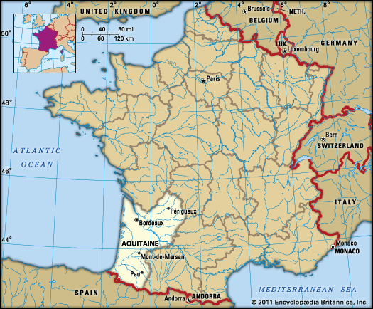
Aquitaine, former région of France. As a région, it encompassed the southwestern départements of Dordogne, Gironde, Landes, Lot-et-Garonne, and Pyrénées-Atlantiques. In 2016 the Aquitaine région was joined with the régions of Poitou-Charentes and Limousin to form the new administrative entity of Nouvelle-Aquitaine. The present-day région of Nouvelle-Aquitaine roughly matches the western half of the historical region of Aquitaine.
Geography
Except for the Pyrenees Mountains, which rise in the south, lowlands predominate in Aquitaine. The highest point in the region is the peak of Midi d’Ossau at 9,465 feet (2,885 metres). Most of the land, however, lies below 1,600 feet (500 metres), and a significant percentage is forested. Chief rivers include the Adour, Dordogne, and Garonne; the last flows northwest through Bordeaux and then joins the waters of the Dordogne to become the Gironde estuary. Annual precipitation exceeds 30 inches (800 mm) in the northeast and increases in the south toward the Pyrenees. An oceanic climate prevails.
Although the average population density is relatively low and much of Aquitaine retains a rural character, the number of people living there has risen steadily since the 1960s. This growth is increasingly due to immigration, as birth rates have fallen and the population ages. Aquitaine is most densely inhabited in Bordeaux and its immediate surroundings, while population growth is strongest in the city’s outlying areas.
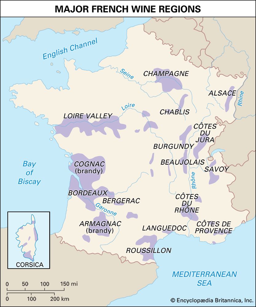
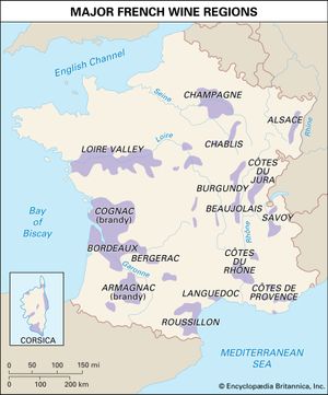
Traditionally, agricultural activity in Aquitaine was associated with polyculture (the raising of fish and aquatic plants), but modernization led to far greater specialization in aquaculture. Farm production is dominated by corn (maize) and fruits, particularly grapes, which are used to produce the famous wines of the Bordeaux region (e.g., Médoc, Sauternes, Saint-Emilion, and Pomerol). Vegetable crops are also important. Walnuts are extensively cultivated in Dordogne, and Lot-et-Garonne is one of France’s main tobacco-growing areas. Périgord is world-famous for its highly prized black truffles. Some livestock is raised in Aquitaine, mainly for meat. A significant number of farms raise ducks and geese for the production of foie gras.
Aquitaine is not a heavily industrialized area, although industry has expanded to include the manufacture of automobile components, equipment for the aerospace industry, food and beverages, and pharmaceutical products. Such activity is concentrated principally in and around Bordeaux and in smaller urban centres such as Bayonne. In the Orthez-Pau area, small quantities of crude oil have long been extracted, while Lacq became well known for its production of natural gas and its related chemical industry. However, very little gas is now exploited. Other energy-related industries include a nuclear power station at Blayais.
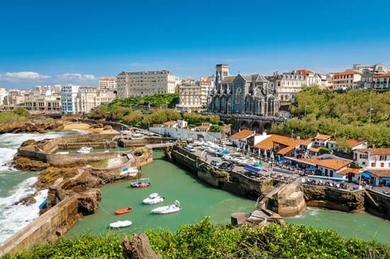
Tourism is widespread, particularly along the coasts. The Basque coast in Pyrénées-Atlantique experienced a major development of leisure activity, centred on the towns of Saint-Jean-de-Luz and, especially, Biarritz. A number of small winter-sports resorts have been developed in the Pyrenees. In Dordogne many visitors travel to the valley of Vézère, one of the earliest known cradles of human habitation. Caves at Les Eyzies-de-Tayac and Lascaux contain some of the world’s best prehistoric drawings and paintings. Dordogne also has about 1,000 châteaus and a number of picturesque medieval towns.
Bordeaux is the main transportation hub, with a maritime port, regional airport, and high-speed train service (train à grande vitesse; TGV) to Paris. A network of motorways also radiates from Bordeaux.
History
In Julius Caesar’s description of Gaul, “Aquitania” was an area extending from the Pyrenees to the Garonne River. The Roman emperor Augustus (reigned 27 bce–14 ce) made it a Roman administrative district, and its borders were extended as far north as the Loire River and east to the Massif Central.
A Visigothic province in the 5th century, Aquitaine came under Frankish rule in the 6th century, retaining a measure of provincial identity exploited by local rulers. Long resistant, Aquitaine was finally subdued in the 8th century by Charlemagne, who bestowed it (less Gascony) as a kingdom upon his son Louis (the future emperor Louis I). It remained a kingdom under Louis’s son Pippin I and grandson Pippin II. Its chief towns were Toulouse, Limoges, and Poitiers. Devastation by the Normans in the 9th century resulted in political and social upheavals during the course of which various feudal domains were established.
The title of duke of Aquitaine, which had already been used by various little-known persons in the 7th century, was assumed at the end of the 9th century by William I (the Pious), count of Auvergne and the founder of the abbey of Cluny. In the first half of the 10th century the counts of Auvergne, of Toulouse, and of Poitiers each claimed this ducal title, but it was eventually secured by another William I, count of Poitiers (William III of Aquitaine). The powerful house of the counts of Poitiers retained Aquitaine during the 10th and 11th centuries, endeavouring from time to time to restore to the name its former significance by extending the boundaries of the duchy to include Gascony and Toulouse.
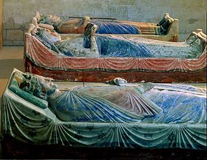
Then, on the death without heirs of the last duke, William X (William VIII of Poitiers), in 1137, his daughter Eleanor united Aquitaine to the kingdom of France by her marriage with Louis VII. When Louis divorced her, however, Eleanor of Aquitaine married in 1152 the count of Anjou, Henry Plantagenet, who two years later became king of England as Henry II. The duchy thus passed to her new husband, who, having suppressed a revolt there, gave it to his son, Richard the Lion-Heart (later Richard I of England), who spent most of his life in Aquitaine, often subduing rebellious vassals. When Richard died in 1199, the duchy reverted to Eleanor, and on her death five years later it was united to the English crown and henceforward followed the fortunes of the English possessions in France.
Aquitaine, as it existed under the English kings, stretched (as of old) from the Loire to the Pyrenees, but its extent was curtailed on the southeast by the wide lands of the counts of Toulouse. The name Guyenne (or Guienne), a corruption of Aquitaine, seems to have come into use about the 10th century, and the subsequent history of Aquitaine merged at times with that of Gascony and Guyenne. These regions were completely reunited to France by the end of the Hundred Years’ War, in the mid-15th century.
During the French Revolution, Aquitaine became one of many provinces reorganized into smaller départements. In 2016 the région of Aquitaine was merged with Poitou-Charentes and Limousin as part of a national plan to increase bureaucratic efficiency.

