Troy
- Greek:
- Troia
- Also called:
- Ilios or Ilion
- Latin:
- Troia , Troja, or Ilium
- Major Events:
- Trojan War
- Troy, Siege of
- Key People:
- Heinrich Schliemann
- Carl Blegen
- Related Places:
- Turkey
- Anatolia
- ancient Middle East
- Troas
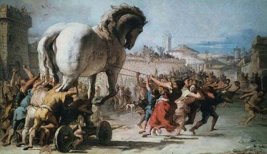
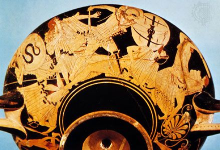
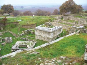
Troy, ancient city in northwestern Anatolia that holds an enduring place in both literature and archaeology. It occupied a key position on trade routes between Europe and Asia. The legend of the Trojan War, fought between the Greeks and the people of Troy, is the most notable theme from ancient Greek literature and forms the basis of Homer’s Iliad. Although the actual nature and size of the historical settlement remain matters of scholarly debate, the ruins of Troy at Hisarlık, Turkey, are a key archaeological site whose many layers illustrate the gradual development of civilization in northwestern Asia Minor. The extensive and complex ruins are open to visitors, and there is a museum on the site. There is much potential for future excavations. The ruins of Troy were enrolled as a UNESCO World Heritage site in 1998.
Geography
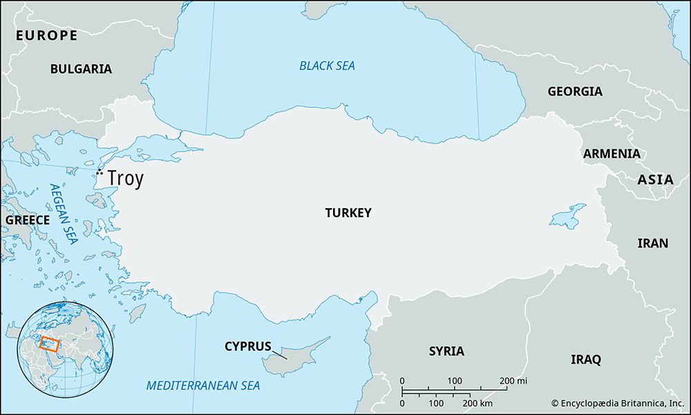
Ancient Troy commanded a strategic point at the southern entrance to the Dardanelles (Hellespont), a narrow strait linking the Black Sea with the Aegean Sea via the Sea of Marmara. The city also commanded a land route that ran north along the west Anatolian coast and crossed the narrowest point of the Dardanelles to the European shore. In theory, Troy would have been able to use its site astride these two lines of communication to exact tolls from trading vessels and other travelers using them; the actual extent to which this took place, however, remains unclear.
The Troad (Greek: Troias; “Land of Troy”) is the district formed by the northwestern projection of Asia Minor into the Aegean Sea. The present-day ruins of Troy itself occupy the western end of a low descending ridge in the extreme northwest corner of the Troad. Less than 4 miles (6 km) to the west, across the plain of the Scamander River (Küçükmenderes Çayı), is the Aegean Sea, and toward the north are the narrows of the Dardanelles.
Archaeology
The search for Troy at Hisarlık
The approximate location of Troy was well known from references in works by ancient Greek and Latin authors, including Homer, Herodotus, and Strabo. But the exact site of the city remained unidentified until modern times. A large mound, known locally as Hisarlık, had long been understood to hold the ruins of a city named Ilion or Ilium that had flourished in Hellenistic and Roman times. In 1822 Charles Maclaren suggested that this was the site of Homeric Troy, but for the next 50 years his suggestion received little attention from Classical scholars, most of whom regarded the Trojan legend as a mere fictional creation based on myth, not history. Those who did believe in the existence of a real Troy thought it to be at Bunarbashi (Pınarbaşı), a short distance south of Hisarlık. It took Frank Calvert, a scholarly amateur archaeologist, until 1860 to begin exploratory work on Hisarlık. It was he who persuaded the German archaeologist Heinrich Schliemann to work at Hisarlık, though Schliemann soon took full credit for adopting Maclaren’s identification and demonstrating to the world that it was correct. (Not until the late 20th century was the full extent of Calvert’s role widely known.) In seven major and two minor campaigns between 1870 and 1890, Schliemann conducted excavations on a large scale mainly in the central area of the Hisarlık mound, where he exposed the remains of a walled citadel. After Schliemann’s death in 1890, the excavations were continued (1893–94) by his colleague Wilhelm Dörpfeld and later (1932–38) by an expedition from the University of Cincinnati headed by Carl W. Blegen. After a lapse of some 50 years, excavations resumed (1988–2005) under the leadership of University of Tübingen archaeologist Manfred Korfmann and continued after his death.
Questions of Troy’s physical size, population, and stature as a trade entrepôt and regional power became subjects of intense scholarly dispute following the resumption of excavations at Hisarlık in the late 1980s. Although Homeric Troy was described as a wealthy and populous city, by this time some scholars had come to accept the probability of a lesser Troy—a relatively minor settlement, perhaps a princely seat. Beginning in 1988, Korfmann’s team investigated the terrain surrounding the citadel site in search of wider settlement. Korfmann’s findings at Hisarlık, drawn from geomagnetic surveying and isolated excavations, led him to conclude in favour of a greater Troy—that is, a settlement of some size and prosperity. His presentation of this perspective in a 2001 exhibition, accompanied by a controversial model reconstruction of the city, sparked especially intense scholarly debate over the city’s true nature.
Findings
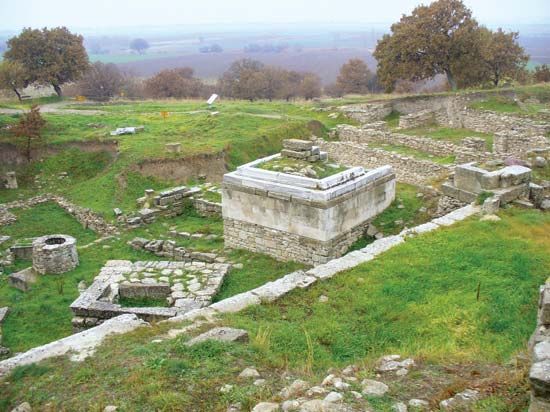
Before excavations began, the mound rose to a height of 105 feet (32 metres) above the plain. It contained a vast accumulation of debris that was made up of many clearly distinguishable layers. Schliemann and Dörpfeld identified a sequence of nine principal strata, representing nine periods during which houses were built, occupied, and ultimately destroyed. At the end of each period when a settlement was destroyed (usually by fire or earthquake or both), the survivors, rather than clear the wreckage down to the floors, merely leveled it out and then built new houses upon it.
The nine major periods of ancient Troy are labeled I to IX, starting from the bottom with the oldest settlement, Troy I. In periods I to VII Troy was a fortified stronghold that served as the capital of the Troad and the residence of a king, his family, officials, advisers, retinue, and slaves. Most of the local population, however, were farmers who lived in unfortified villages nearby and took refuge in the citadel in times of danger. Troy I to V corresponds roughly to the Early Bronze Age (c. 3000 to 1900 bce). The citadel of Troy I was small, not more than 300 feet (90 metres) in diameter. It was enclosed by a massive wall with gateways and flanking towers and contained perhaps 20 rectangular houses. Troy II was twice as large and had higher, sloping stone walls protecting an acropolis on which stood the king’s palace and other princely residences, which were built of brick in a megaron plan. This city came to an end through fire, and Schliemann mistakenly identified it with Homer’s Troy. In the “burnt layer’s” debris were found a trove of gold jewelry and ornaments and gold, silver, copper, bronze, and ceramic vessels that Schliemann named “Priam’s treasure.” The burning of Troy II seems to have been followed by an economic decline; each of the citadels of Troy III, IV, and V was fortified and somewhat larger than its predecessor, but the houses inside the walls were much smaller and more closely packed than in Troy II.
Troy VI and VII may be assigned to the Middle and Late Bronze Age (c. 1900 to 1100 bce). Troy at this time had new and vigorous settlers who introduced domesticated horses to the Aegean area. They further enlarged the city and erected a magnificent circuit of cut limestone walls that were 15 feet (4.5 metres) thick at the base, rose to a height of more than 17 feet (5 metres), and had brick ramparts and watchtowers. Inside the citadel, which was now about 650 feet (200 metres) long and 450 feet (140 metres) wide, great houses were laid out on ascending, concentric terraces. Troy VI was destroyed by a violent earthquake a little after 1300 bce. Dörpfeld had identified this stage as Homeric Troy, but its apparent destruction by an earthquake does not agree with the realistic account of the sack of Troy in Greek tradition. Moreover, the city’s date, as indicated by imported Mycenaean pottery found in the earthquake debris, is too early for the Trojan War.
The survivors of the earthquake quickly rebuilt the town, thus inaugurating the short-lived Troy VIIa. The ruins were leveled and covered over by new buildings, which were set close together and filled all available space inside the fortress. Almost every house was provided with one or several huge storage jars that were sunk deep into the ground, with only their mouths above the level of the floor. Troy VIIa probably lasted little more than a generation. The crowding together of houses and the special measures to store up food supplies suggest that preparations had been made to withstand a siege. The town was destroyed in a devastating fire, and remnants of human bones found in some houses and streets strengthen the impression that the town was captured, looted, and burnt by enemies. Based on the evidence of imported Mycenaean pottery, the end of Troy VIIa can be dated to between 1260 and 1240 bce. The Cincinnati expedition under Blegen concluded that Troy VIIa was very likely the capital of King Priam described in Homer’s Iliad, which was destroyed by the Greek armies of Agamemnon.
The partly rebuilt Troy VIIb shows evidence of new settlers with a lower level of material culture, who vanished altogether by 1100 bce. For about the next four centuries the site was virtually abandoned. About 700 bce Greek settlers began to occupy the Troad. Troy was reoccupied and given the Hellenized name of Ilion; this Greek settlement is known as Troy VIII. The Romans sacked Ilion in 85 bce, but it was partially restored by the Roman general Sulla that same year. This Romanized town, known as Troy IX, received fine public buildings from the emperor Augustus and his immediate successors, who traced their ancestry back to the Trojan Aeneas. After the founding of Constantinople (324 ce), Ilion faded into obscurity.


