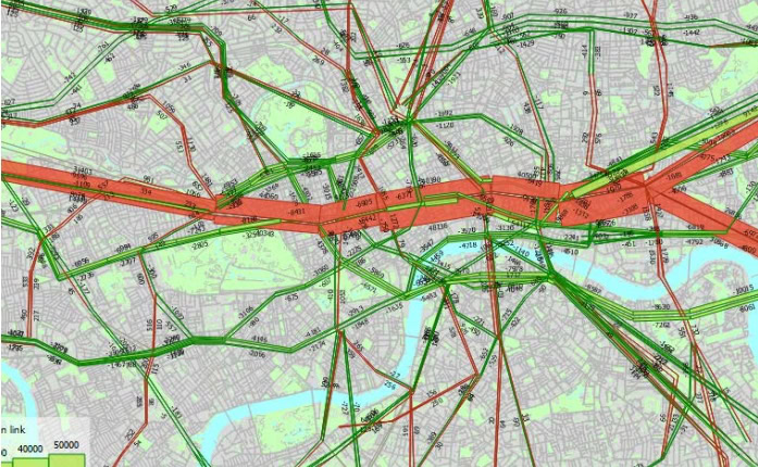
What is OpenPaths?
OpenPaths Answers Your Transport Planning “What If?” Questions and Opens Paths To More Efficient, Resilient, and Sustainable Mobility.
OpenPaths incorporates both multimodal transport network modeling and modern travel demand forecasting capabilities to deliver the most comprehensive transport modeling platform for strategic and operational transport planning.
Generational shifts to travel behavior, mobility service, and technology challenge every decision. You need the capabilities to build a model that represents your city or region, including multimodal networks, travel demand, and operational data, to successfully inform 21st century planning initiatives–faster and more accurately than ever before.
Model
Build a model based on key inputs such as population data, demand data, and network data.
Forecast
Predict and simulate the impact of demographic, infrastructure, and transport policy changes to plan ahead.
Analyze
Set up and run user-defined analyses and generate rich outputs based on a variety of metrics including accessibility, efficiency, and equity.
OpenPaths Advanced
All the essential capabilities for multimodal transport modeling and classic travel demand modeling.
Edition includes: OpenPaths CUBE
OpenPaths EMME
OpenPaths CityPhi
OpenPaths Ultimate
Everything in OpenPaths Advanced, PLUS
– Advanced demand modeling including ABM, data fusion, and automated model calibration
– Traffic simulation and DTA for the ultimate mobility simulation toolset.
OpenPaths CUBE
OpenPaths EMME
OpenPaths AGENT
OpenPaths DYNAMEQ
OpenPaths CityPhi
*Prices vary per region. For more options, see licensing and subscriptions section.
The Right Capabilities, for the Right Job, Right When You Need Them
Transportation professionals around the world, including metropolitan planning organizations (MPOs), departments of transportation (DOTs), transit agencies, toll road operators, mobility service providers, and transport advisory consultants rely on the OpenPaths mobility simulation software to understand the urban, metropolitan, regional, and national movement of people.
By providing an evidence base to evaluate mobility infrastructure, policy, and multimodal transport system planning and design, the OpenPaths suite of transport modeling applications allows users to:
- Apply virtually any travel demand model structure without the high costs of changing software.
- Reduce the time/effort to develop a new travel model, no matter the model structure (trip-based, tour-based, activity-based).
- Easily adapt or upgrade existing models with included and comprehensive support for ABM and advanced travel demand modeling.
- Leverage all your mobility data sources in the modeling process, including big data.
- Use machine learning (ML) to eliminate costly trial-and-error approaches to model calibration and improve response time for more agile modeling.
- Support operational traffic planning applications more consistently with simulation-based dynamic traffic assignment.
- OpenPaths AGENT
-
OpenPaths AGENT
Modern Travel Demand Modeling
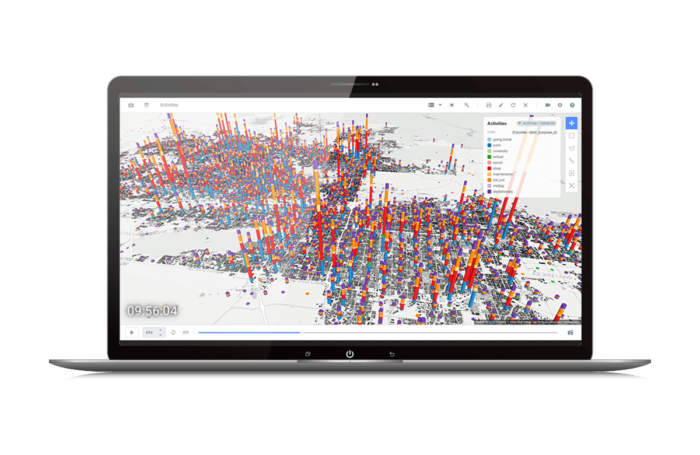
OpenPaths AGENT is game-changing travel demand modeling software used to forecast mobility decisions at any level of detail, from zones to individual people. From changing demographics, or residential and work locations, to daily trip patterns including time, location, and mode choice, OpenPaths AGENT captures realistic representations of mobility to address 21st-century transport planning challenges. And with machine learning built-in, OpenPaths AGENT takes advantage of new mobility data sources to achieve improved model calibration at reduced time and cost.
Advance Your Travel Demand Model
- Assemble virtually any travel demand model including activity-based (ABM), tour-based, and classic trip-based modeling.
- Upgrade your demand model with improved usability and performance without the high costs of recoding or changing platforms.
- A visual interface, live model validation, and a powerful expression system help you work with travel demand models faster.
- All the capabilities needed for modern travel demand modeling, including population synthesis and comprehensive choice modeling features for both aggregate and disaggregate/microsimulated demand modeing, are at your fingertips.
Leverage All Your Mobility Data
- Machine learning removes the need for tedious and unpredictable trial-and-error model calibration, saving time and costs.
- Automated model calibration procedures simultaneously adjust demand model coefficients against data targets from multiple data sources, allowing better validation.
- Leverage all your mobility data sources to directly improve your travel demand model, incorporating traffic, transit, and origin-destination counts as well as big data in addition to or instead of household travel survey (HHTS) data.
OpenPaths AGENT is only available in the OpenPaths Ultimate edition.
- OpenPaths EMME
-
OpenPaths EMME
Multimodal Transportation Planning
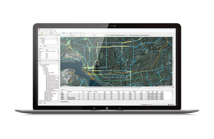
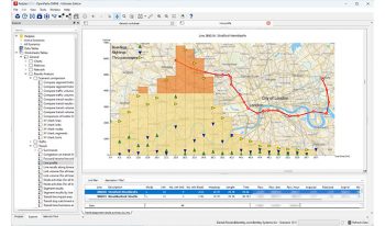
OpenPaths EMME is a complete transportation forecasting application for planning the urban, regional, and national movement of people. OpenPaths EMME is used to create digital transport models for travel demand forecasting, traffic planning, transit service planning, and related needs to provide an evidence base for transport strategy and policy decision-making. By modeling the people, places, processes, and options involved in travel, transport planners can evaluate transport system performance on any number of virtual scenarios prior to implementation.
Leading Transport Modeling
- Traffic, public transit, and multimodal network and demand modeling procedures trusted by leading transport agencies.
- Uniquely flexible models may be tailored to support local applications or new model procedures.
- Work efficiently with out-of-the-box support for crowded transit, fare integration, tolling, junction delay, active transport, and service planning applications.
- Integrates natively with OpenPaths AGENT for advanced demand modeling. (OpenPaths AGENT is only available in the OpenPaths Ultimate edition)
Accelerate Productivity
- Extensive maps, charts, reports, and scenario comparisons provide data transparency and help turn results into insights.
- Code-free and code-friendly. Easily configure model procedures with a visual control flow system that anyone on the team can use, or customize procedures and manage model-as-code with comprehensive Python APIs for developers.
- Manage all your mobility data, including multimodal networks, travel demand, surveys, demographics, and travel results, including households, persons, trips, and tours.
- Create 3D animations across time or between planning scenarios to understand regional mobility patterns at scale.
- OpenPaths CUBE
-
OpenPaths CUBE
Multimodal Transportation Planning
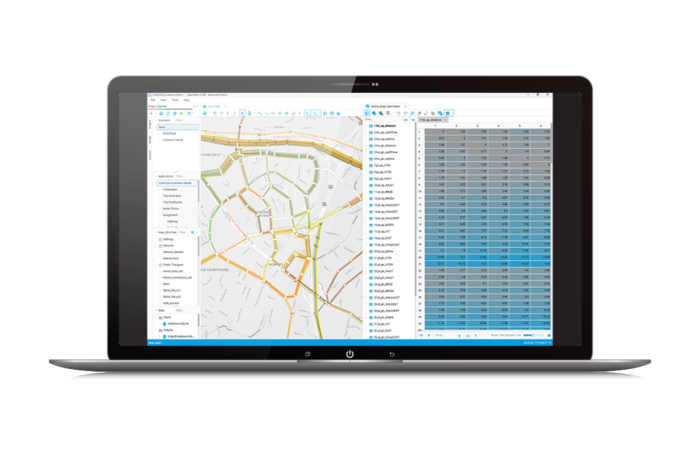
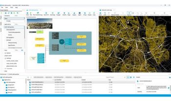
OpenPaths CUBE Is multimodal transport planning software that is used to develop and apply predictive multimodal transportation models to simulate how changes in infrastructure, operations, technology, and demographics will impact movement and accessibility of a given area. OpenPaths CUBE lets you analyze the effects of new projects and policies on a city’s transportation network and its population. OpenPaths CUBE provides a desktop interface to link a model, data, and geographic information system (GIS), easing the development and application of your models.
Make Informed Decisions
- Visualize, test, and compare multiple scenarios with a complete library of multimodal transport modeling procedures.
- Integrates natively with OpenPaths AGENT for advanced demand modeling. (OpenPaths AGENT is only available in the OpenPaths Ultimate edition)
- Easily manage changes in input data with comprehensive scenario management features.
- Advise on the suitability of planning and design decisions to support business cases.
Accelerate Project Delivery
- Access libraries of transport modeling functions to save time when developing models.
- Use an intuitive flow-charting interface to organize model processes and quickly complete modeling tasks.
- Benefit from Python APIs and flexible integration with third-party applications.
- Reduce rework and errors, and streamline processes with powerful spatial technology.
- OpenPaths DYNAMEQ
-
OpenPaths DYNAMEQ
Traffic Simulation and Dynamic Traffic Assignment (DTA)
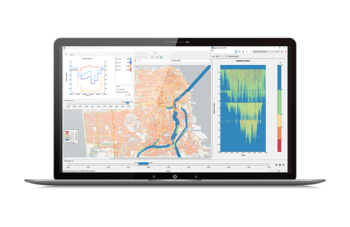
OpenPaths DYNAMEQ is a traffic simulation and dynamic traffic assignment (DTA) software for transport planning and traffic management studies of virtually any size. Whether you are implementing freeway or urban congestion pricing, planning major infrastructure rehabilitation, or undertaking road improvements, transit planning or neighborhood redevelopments, OpenPaths DYNAMEQ allows you to accurately assess the related traffic and mobility impacts.
Traffic simulation that lets you see the whole picture
- Simulates vehicles with car-following, lane changing, and gap acceptance models to produce realistic traffic behavior.
- High-performance animations provide a 3D, 360° visualization and analysis environment.
- Production-quality video allows you to storyboard and share intuitive animations.
Rapidly develop models of any size
- Get started quickly with importers for a range of popular transportation software and data formats.
- Streamline model development with comprehensive network data validation and cleaning capabilities that make it easy to identify and resolve issues.
- Develop future scenarios by synthesizing traffic signals and turning movement parameters that are adapted to future travel demand.
Calibrate your models with confidence
- Spend less time calibrating and more time testing scenarios with fast run times and fewer calibration parameters.
- Achieve higher calibration metrics than ever before with a proven simulation-based demand adjustment capability.
- Generate reliable and reproducible results even for high-demand future-year scenarios.
OpenPaths DYNAMEQ is only available in the OpenPaths Ultimate edition.
- OpenPaths CityPhi
-
OpenPaths CityPhi
Mobility Animation Studio
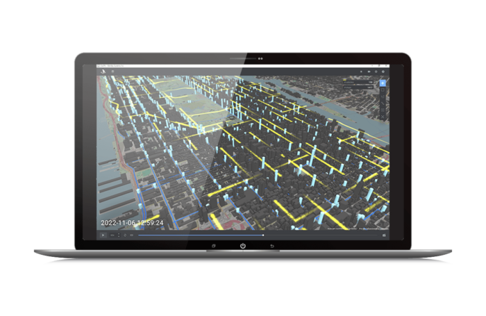
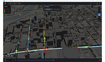
OpenPaths CityPhi provides an API to produce captivating data visualizations, interactive animations, and insightful analytics about mobility and location by turning data about the movement of people and things, their location, and their changing social, economic, and physical characteristics into dynamic scenes. With OpenPaths CityPhi you can create applications that let users explore time, space, and motion with interactive animations that stay responsive at scale.
A Digital Lens on Mobility
- Create compelling visual representations of mobility data, including trajectories, paths, points, or any kind of time-based location or movement data.
- Animate, explore, color, filter, label, and query mobility data to uncover relationships and develop a clearer understanding.
- Import and work with mobility data including General Transit Feed Specification (GTFS), fare card data, GPS and cell phone records, social media activity, travel surveys, land use models, and agent-based simulation results.
- Save production-quality videos with scripted camera keyframe animations.
Mobility Development Kit
- Develop analytics and visual treatments, and load your own data with native OpenPaths CityPhi Python libraries.
- Create the right scene with fifteen visual layers and dozens of parameters to configure and play back through time.
- Incorporate OpenPaths CityPhi into modern Python data science workflows using Jupyter Notebook with a reactive UI.

OpenPaths AGENT
Modern Travel Demand Modeling
OpenPaths AGENT is game-changing travel demand modeling software used to forecast mobility decisions at any level of detail, from zones to individual people. From changing demographics, or residential and work locations, to daily trip patterns including time, location, and mode choice, OpenPaths AGENT captures realistic representations of mobility to address 21st-century transport planning challenges. And with machine learning built-in, OpenPaths AGENT takes advantage of new mobility data sources to achieve improved model calibration at reduced time and cost.
Advance Your Travel Demand Model
- Assemble virtually any travel demand model including activity-based (ABM), tour-based, and classic trip-based modeling.
- Upgrade your demand model with improved usability and performance without the high costs of recoding or changing platforms.
- A visual interface, live model validation, and a powerful expression system help you work with travel demand models faster.
- All the capabilities needed for modern travel demand modeling, including population synthesis and comprehensive choice modeling features for both aggregate and disaggregate/microsimulated demand modeing, are at your fingertips.
Leverage All Your Mobility Data
- Machine learning removes the need for tedious and unpredictable trial-and-error model calibration, saving time and costs.
- Automated model calibration procedures simultaneously adjust demand model coefficients against data targets from multiple data sources, allowing better validation.
- Leverage all your mobility data sources to directly improve your travel demand model, incorporating traffic, transit, and origin-destination counts as well as big data in addition to or instead of household travel survey (HHTS) data.
OpenPaths AGENT is only available in the OpenPaths Ultimate edition.

OpenPaths EMME
Multimodal Transportation Planning
OpenPaths EMME is a complete transportation forecasting application for planning the urban, regional, and national movement of people. OpenPaths EMME is used to create digital transport models for travel demand forecasting, traffic planning, transit service planning, and related needs to provide an evidence base for transport strategy and policy decision-making. By modeling the people, places, processes, and options involved in travel, transport planners can evaluate transport system performance on any number of virtual scenarios prior to implementation.
Leading Transport Modeling
- Traffic, public transit, and multimodal network and demand modeling procedures trusted by leading transport agencies.
- Uniquely flexible models may be tailored to support local applications or new model procedures.
- Work efficiently with out-of-the-box support for crowded transit, fare integration, tolling, junction delay, active transport, and service planning applications.
- Integrates natively with OpenPaths AGENT for advanced demand modeling. (OpenPaths AGENT is only available in the OpenPaths Ultimate edition)
Accelerate Productivity
- Extensive maps, charts, reports, and scenario comparisons provide data transparency and help turn results into insights.
- Code-free and code-friendly. Easily configure model procedures with a visual control flow system that anyone on the team can use, or customize procedures and manage model-as-code with comprehensive Python APIs for developers.
- Manage all your mobility data, including multimodal networks, travel demand, surveys, demographics, and travel results, including households, persons, trips, and tours.
- Create 3D animations across time or between planning scenarios to understand regional mobility patterns at scale.

OpenPaths CUBE
Multimodal Transportation Planning
OpenPaths CUBE Is multimodal transport planning software that is used to develop and apply predictive multimodal transportation models to simulate how changes in infrastructure, operations, technology, and demographics will impact movement and accessibility of a given area. OpenPaths CUBE lets you analyze the effects of new projects and policies on a city’s transportation network and its population. OpenPaths CUBE provides a desktop interface to link a model, data, and geographic information system (GIS), easing the development and application of your models.
Make Informed Decisions
- Visualize, test, and compare multiple scenarios with a complete library of multimodal transport modeling procedures.
- Integrates natively with OpenPaths AGENT for advanced demand modeling. (OpenPaths AGENT is only available in the OpenPaths Ultimate edition)
- Easily manage changes in input data with comprehensive scenario management features.
- Advise on the suitability of planning and design decisions to support business cases.
Accelerate Project Delivery
- Access libraries of transport modeling functions to save time when developing models.
- Use an intuitive flow-charting interface to organize model processes and quickly complete modeling tasks.
- Benefit from Python APIs and flexible integration with third-party applications.
- Reduce rework and errors, and streamline processes with powerful spatial technology.

OpenPaths DYNAMEQ
Traffic Simulation and Dynamic Traffic Assignment (DTA)
OpenPaths DYNAMEQ is a traffic simulation and dynamic traffic assignment (DTA) software for transport planning and traffic management studies of virtually any size. Whether you are implementing freeway or urban congestion pricing, planning major infrastructure rehabilitation, or undertaking road improvements, transit planning or neighborhood redevelopments, OpenPaths DYNAMEQ allows you to accurately assess the related traffic and mobility impacts.
Traffic simulation that lets you see the whole picture
- Simulates vehicles with car-following, lane changing, and gap acceptance models to produce realistic traffic behavior.
- High-performance animations provide a 3D, 360° visualization and analysis environment.
- Production-quality video allows you to storyboard and share intuitive animations.
Rapidly develop models of any size
- Get started quickly with importers for a range of popular transportation software and data formats.
- Streamline model development with comprehensive network data validation and cleaning capabilities that make it easy to identify and resolve issues.
- Develop future scenarios by synthesizing traffic signals and turning movement parameters that are adapted to future travel demand.
Calibrate your models with confidence
- Spend less time calibrating and more time testing scenarios with fast run times and fewer calibration parameters.
- Achieve higher calibration metrics than ever before with a proven simulation-based demand adjustment capability.
- Generate reliable and reproducible results even for high-demand future-year scenarios.
OpenPaths DYNAMEQ is only available in the OpenPaths Ultimate edition.

OpenPaths CityPhi
Mobility Animation Studio
OpenPaths CityPhi provides an API to produce captivating data visualizations, interactive animations, and insightful analytics about mobility and location by turning data about the movement of people and things, their location, and their changing social, economic, and physical characteristics into dynamic scenes. With OpenPaths CityPhi you can create applications that let users explore time, space, and motion with interactive animations that stay responsive at scale.
A Digital Lens on Mobility
- Create compelling visual representations of mobility data, including trajectories, paths, points, or any kind of time-based location or movement data.
- Animate, explore, color, filter, label, and query mobility data to uncover relationships and develop a clearer understanding.
- Import and work with mobility data including General Transit Feed Specification (GTFS), fare card data, GPS and cell phone records, social media activity, travel surveys, land use models, and agent-based simulation results.
- Save production-quality videos with scripted camera keyframe animations.
Mobility Development Kit
- Develop analytics and visual treatments, and load your own data with native OpenPaths CityPhi Python libraries.
- Create the right scene with fifteen visual layers and dozens of parameters to configure and play back through time.
- Incorporate OpenPaths CityPhi into modern Python data science workflows using Jupyter Notebook with a reactive UI.
What OpenPaths Users Are Saying


Featured User Stories
Transport for London
Transport for London Delivers the Elizabeth Line
OpenPaths EMME helped improve commuter experience, bringing an additional 1.5 million people within 45 minutes of Central London.
CitiME Consultancy LLC
CitiME Develops Travel Demand Model in Cairo
To improve public transportation, CitiME uses OpenPaths CUBE for predictive multimodal modeling.
City of Edmonton
City of Edmonton Develops Citywide Traffic Simulation
Using OpenPaths™ DYNAMEQ® , City Planners Developed a Roadmap to Model Edmonton’s Roadways for Smarter Future Planning.
FAQs
The individual OpenPaths applications are no longer licensed separately. OpenPaths licenses are available in two editions: OpenPaths Advanced which includes OpenPaths EMME, OpenPaths CUBE, and OPenPaths CityPhi, and OpenPaths Ultimate which includes everything in the Advanced edition plus OpenPaths AGENT and OpenPaths DYNAMEQ.
You can seamlessly upgrade from OpenPaths Advanced to OpenPaths Ultimate for an incremental fee and without losing your existing investment. Contact us to discuss OpenPaths licensing options.
Or, if you are ready to go, simply run through the OpenPaths installer, and change your product level to OpenPaths Ultimate. Additional term licensing fees may apply. There is no need to reinstall applications.
We recommend the following system requirements for OpenPaths applications.
Operating System
64-bit Microsoft Windows 11, 10, Server 2022, Server 2019, or Server 2016.
Minimum disk space
Installation of all OpenPaths applications requires 8GB of disk space:
- OpenPaths EMME – 3.5GB
- OpenPaths CUBE – 2.5 GB
- OpenPaths DYNAMEQ – 1 GB
- OpenPaths CityPhi – 1GB
RAM
Minimum 16GB RAM recommended
Graphics
Use of 3D rendering and animation features require OpenGL 4.0 support
Reference Systems
OpenPaths applications offer high-performance scientific, graphics, and interactive computing capabilities. Certain features benefit from high-performance computing (CPUs) and dedicated graphics processors (GPUs). Requirements vary by application. Reference systems below provide illustrative guidelines:
Base system example
- Intel Core i5 or i7 CPU, 2.3 GHz or greater base clock
- 6 cores/12 threads or more
- 16 GB RAM or more
- NVIDIA RTX 3050, AMD Radeon, Intel Xe, or Intel integrated graphics (non-graphic workloads)
Intermediate systems
- Intel Core i7 or i9 CPU, 3 GHz or greater base clock
- 8 cores/16 threads or more
- 32GB of RAM or more
- NVIDIA RTX 3060, AMD Radeon RX 6600XT, Intel Arc A770, or integrated graphics (non-graphic workloads)
Advanced systems
- Intel Xeon CPU, 3GHz or greater base clock
- 12 cores / 24 threads or more
- 128GB RAM or more
- NVIDIA RTX 3070, NVIDIA Quadro RTX, AMD Radeon Pro W6000, or integrated graphics (non-graphic workloads)
Browser
Recent versions of Chrome or Firefox are recommended. Up-to-date versions of Opera and Edge may also work.
Licensing and Subscription options
Choose What is Right for You
One-year license with training
Virtuoso Subscription – A popular choice for small and medium-sized businesses
Get access to software that comes with training – fast! Bentley’s eStore, Virtuosity, offers a convenient way to lease a 12-month license of Bentley software for a low, upfront cost. Every online purchase through Virtuosity comes as a Virtuoso Subscription that includes training and auto-renewals.
With no contract required, it’s easy to get started quickly.
One-time purchase with support
Perpetual License with SELECT
A perpetual license of Bentley software is a one-time purchase, with a yearly maintenance subscription, called SELECT. This includes 24/7/365 technical support, learning resources, and the ability to exchange licenses for other software once a year. With SELECT, you will benefit from:
- License pooling, so you can access your software from multiple computers.
- Access additional Bentley software with Term Licenses, which allow you to pay for what you use without the upfront cost of purchasing a perpetual license.
Annual renewal quotes are delivered directly to your inbox, and our experienced Renewal Representatives are available to answer your questions and guide you through any changes you’d like to make.
Enterprise Organizations
We’ve got your back
For larger organizations with in-depth requirements, we offer plans to provide global pricing and access to our comprehensive portfolio of solutions and success plan services. Contact us about how to get access to software, global best practices, implementation services, training, and technical support to help your organization realize its full potential while addressing your unique needs.
