|
|


|
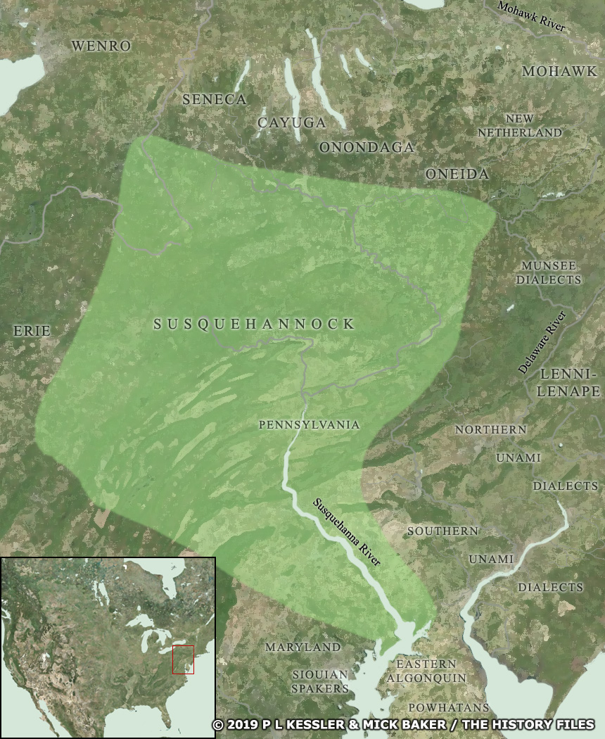
Map of Susquehannock territory AD 1600-1700 |
|
The Susquehannock territories were centred around the river which bore their name, but extended far to the east, towards Lake Erie where they abutted the generally peaceful Erie people and north to the Iroquois nations, who certainly were not peaceful. In time pressure from the Iroquois groups forced them to concentrate to the south of their territory while English colonists continually took bites out of their territories to the east and south. Their last stand as a free, independent group took place around the headwaters of the Susquehanna river, after which they had to head towards Maryland for English protection. A clickable version of this map is available for desktop displays. To select a tribe for further information, click on its name.
Map navigation: |
|
Original text and maps copyright © P L Kessler, Mick Baker, and the History Files. An original feature for the History Files. Go back or return home. |